Log in
All resources
Create a design
19 Free Images of 1640s Maps Of The Netherlands
bibliothèque nationale de france
atlas novus (blaeu)
maps by willem and johannes blaeu
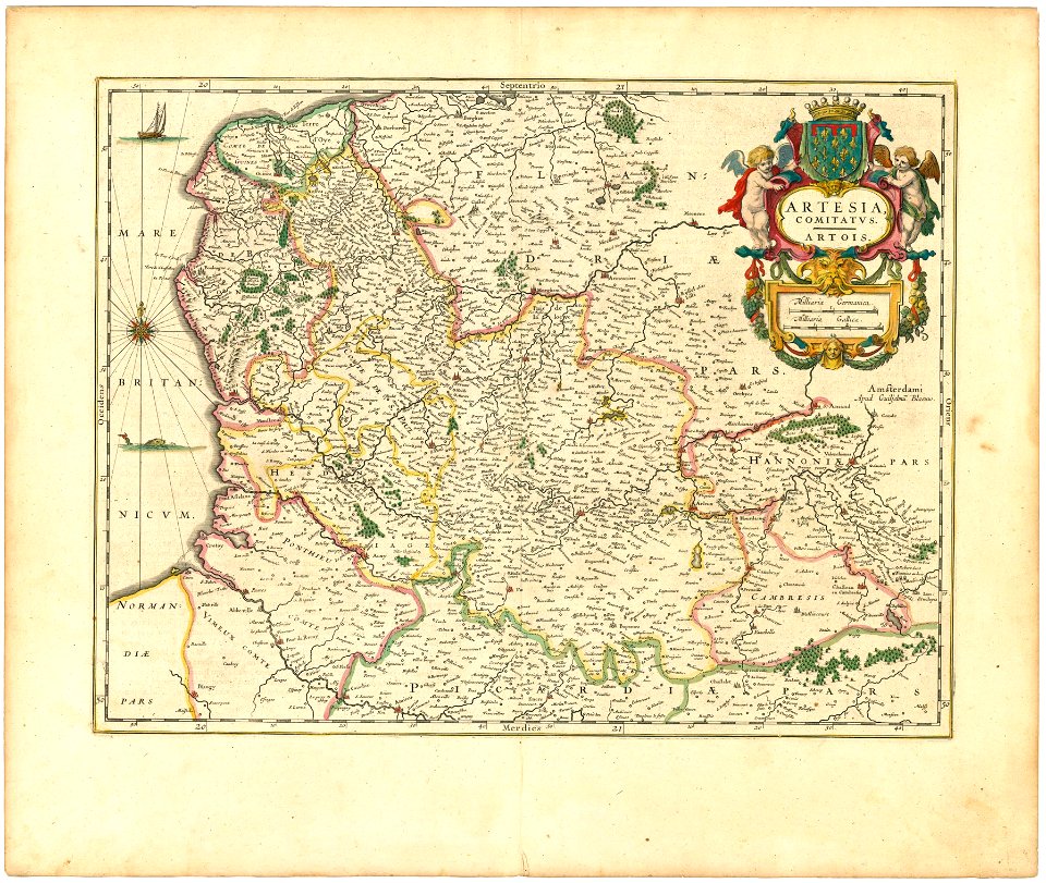
spanish netherlands in the 1640s
coats of arms on maps
old maps of the spanish empire
old maps of regions of france
county of artois
cambrésis
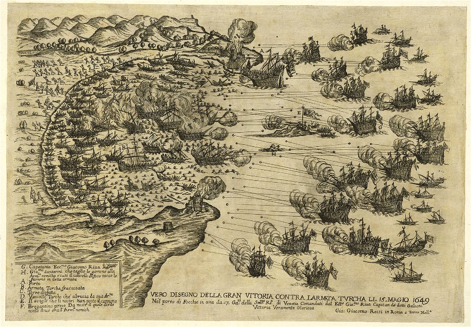
works by giovanni giacomo de rossi
old maps of the spanish empire
old maps of regions of france
works by giovanni giacomo de rossi
sailing ships of the netherlands
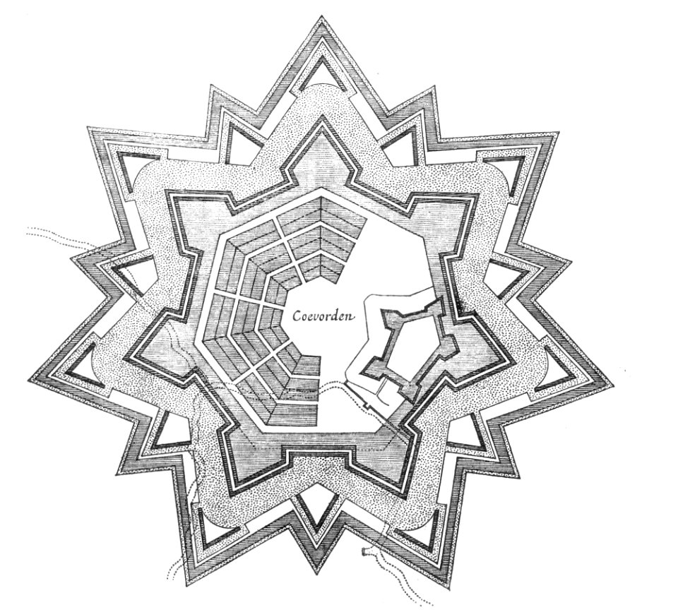
floor plans of fortresses
coevorden
works by giovanni giacomo de rossi
sailing ships of the netherlands
old maps of regions of france
county of artois
1640s maps of the netherlands
coats of arms on maps
old maps of north brabant
1645 maps of belgium
maps of territories in the burgundian circle
17th-century maps of the north sea
bodleian maps collection
leo belgicus
1640s maps of the netherlands
coats of arms on maps
17th-century maps of the strait of magellan
maps by willem and johannes blaeu
paraguay, o prov. de rio de la plata cum regionibus adiacentibus tucuman et sta cruz de la sierra - (blaeu) - btv1b8596658x
1640s maps of south america
1640s maps of the netherlands
maps by nicolaes visscher i
maps by willem and johannes blaeu
1640s maps of belgium
venezuela, cum parte australi novae andalusiae - btv1b53196851w
17th-century maps of venezuela
maps of dordrecht by braun & hogenberg
bibliothèque nationale de france
old maps of nova belgica et anglia nova
maps by willem and johannes blaeu
fossa sanctae mariae quae et eugeniana dicitur vulgo de nieuwe grift - btv1b532255218
maps of venlo by willem and johannes blaeu
dutch 17th-century prints in the rijksmuseum amsterdam
capture of wesel 1629
1 - 19 of 19
/ 1


![[Map of the Netherlands as 'Leo Belgicus' by Nikolaus Visscher, 1648], Nicolaes Visscher](https://cdn.creazilla.com/illustrations/10000445798/map-of-the-netherlands-as-leo-belgicus-by-nikolaus-visscher-1648-nicolaes-visscher-md.jpg)


![Paraguay, o prov. de Rio de La Plata cum regionibus adiacentibus Tucuman et Sta Cruz de la Sierra / [Blaeu], 1640s](https://cdn.creazilla.com/illustrations/10001055781/paraguay-o-prov-de-rio-de-la-plata-cum-regionibus-adiacentibus-tucuman-et-sta-cruz-de-la-sierra-blaeu-1640s-md.jpg)


