Log in
All resources
Create a design
12 Free Artworks of Maps Of Charente Maritime
bibliothèque nationale de france
old maps of charente-maritime
maps by nicolas sanson
gerard valck
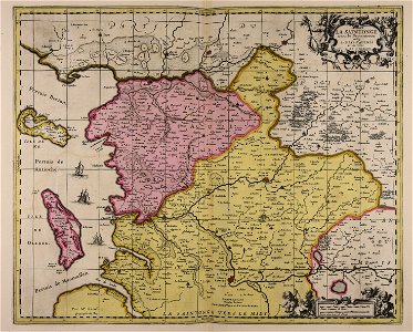
maps by pieter schenk (i)
atlantis magni tomus quartus (biblioteca comunale di trento)
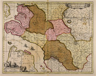
17th-century maps of xaintonge
die zee custe van tland van poictou ende bordeaux tuschen picqueliers ende de riviere van bordeaux alsoe hem tlant aldaer vuijt der zee opdoet ende verthoont - btv1b53156768t
fonds ancely - bibliothèque municipale de toulouse - maps
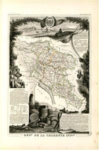
victor levasseur - maps of france
fonds ancely - bibliothèque municipale de toulouse - maps
victor levasseur - maps of france
maps by nicolas sanson
gerard valck
maps by nicolas sanson
gerard valck
old maps of charente-maritime
coats of arms of la rochelle
old maps of charente-maritime
maps by nicolas sanson
17th-century maps of xaintonge
old maps of charente-maritime
maps by willem and johannes blaeu
17th-century maps of xaintonge
maps by willem and johannes blaeu
17th-century maps of xaintonge
maps from gallica
guides joanne
die zee custe van tland van poictou ende bordeaux tuschen picqueliers ende de riviere van bordeaux alsoe hem tlant aldaer vuijt der zee opdoet ende verthoont - btv1b53156768t
bibliothèque nationale de france
die zee custe van tland van poictou ende bordeaux tuschen picqueliers ende de riviere van bordeaux alsoe hem tlant aldaer vuijt der zee opdoet ende verthoont - btv1b53156768t
bibliothèque nationale de france
die zee custe van tland van poictou ende bordeaux tuschen picqueliers ende de riviere van bordeaux alsoe hem tlant aldaer vuijt der zee opdoet ende verthoont - btv1b53156768t
bibliothèque nationale de france
1 - 12 of 12
/ 1