Log in
All resources
Create a design
25 Free Artworks of Maps Of Brest
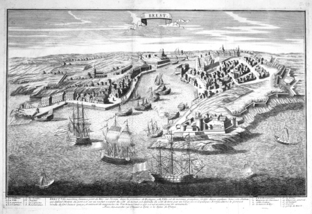
maps of brest, france by antoine aveline
brest (france) in the 1700s
antoine aveline
maps of brest from bibliothèque nationale de france
bibliothèque nationale de france
france
old maps of brest
old maps of brest harbours
maps of the penfeld river
old maps of rade de brest
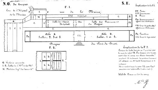
bagne de brest
france
rue de siam (brest
france
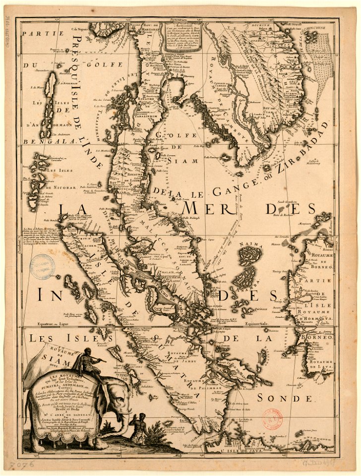
old maps of thailand
maps by coronelli
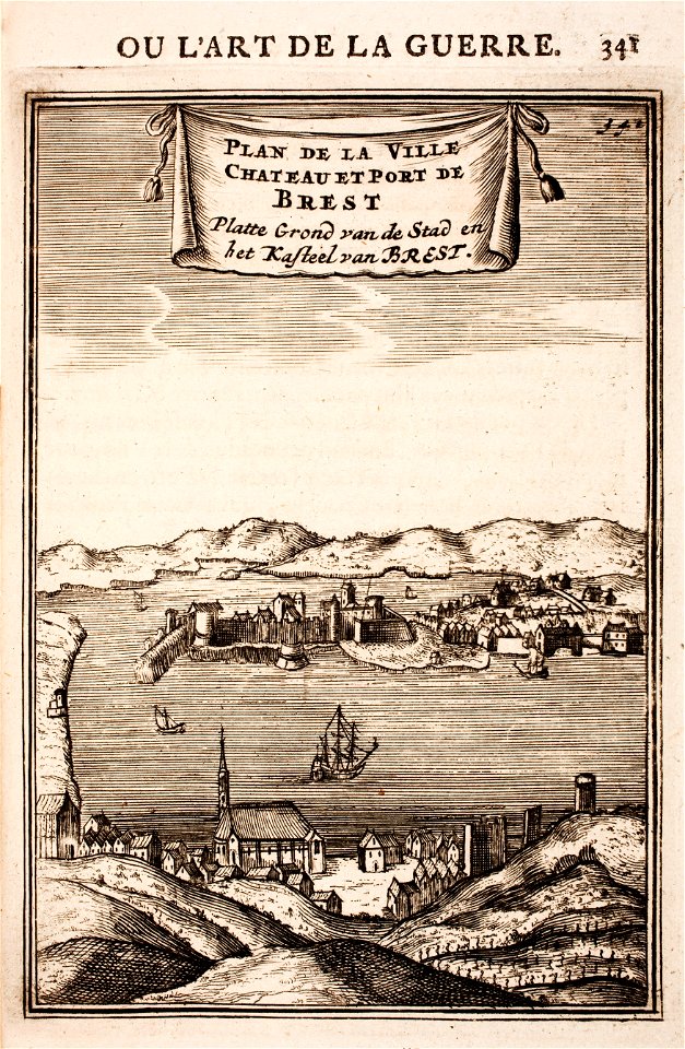
brest (france) in the 17th century
1696 in bretagne
erik dahlbergh
belarus
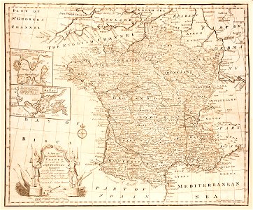
old maps of france
old maps of brest
port of cherbourg
france
maps of brest, france by antoine aveline
17th-century maps of brest
maps of brest from bibliothèque nationale de france
maps from gallica
maps of brest from bibliothèque nationale de france
lithographs of brest, france
maps of brest, france by antoine aveline
brest (france) in the 1700s
maps of brest from bibliothèque nationale de france
brest (france) in the 1700s
dessin du château de brest
old maps of brest harbours
prints from manesson travaux de mars at the peace palace library
old maps of brest from musée de bretagne
old maps of douarnenez
old maps of brest
old maps of rade de brest
cartes de franz schrader
maps of brest from bibliothèque nationale de france
1829 in brest (france)
1858 photographs of brest (france)
august 1858 in france
lucas janszoon waghenaer
bretagne in the 1580s
historical images of bieraście
erik dahlbergh
maps of battles of france
1744 maps
the comprehensive history of england (1876)
english-language maps showing history
carte de partie de lithuanie (west belarus, brest) by nicolas sanson
cartouches by sanson family
volhynian voivodeship (1569–1795)
maps of volhynia
maps by pieter mortier
le neptune francois
1 - 25 of 25
/ 1