Log in
All resources
Create a design
9,064 Free Artworks of Géographie
science
period
physical geography
smithsonian libraries
voyages and travels
geology
physical geography (1899) by davis
a system of modern geography (1810)
géographie générale; physique, politique et économique (1876)
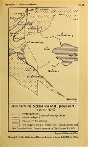
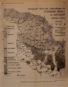
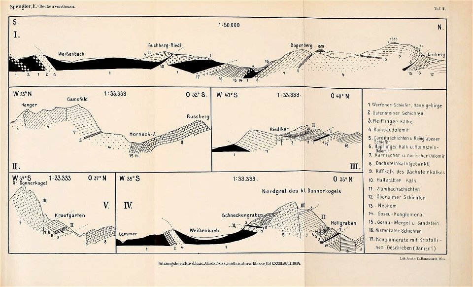
sitzungsberichte abt. 1 mineralogie, krystallographie, botanik, physiologie der pflanzen, zoologie, paläontologie, geologie, physische geographie und reisen bd.123 (1914)
post-impressionism,pont-aven school,symbolism,synthetism,cloisonnism,impressionism,primitivism
post-impressionist paintings
illustration
geography
illustration
geography
maps from the earth and its inhabitants, vol. vi
old maps of kyrgyzstan
maps from the earth and its inhabitants, vol. iv
falkirk
maps from the earth and its inhabitants, vol. vii
population density maps of china
maps from the earth and its inhabitants, vol. vi
old maps of kyrgyzstan
maps from the earth and its inhabitants, vol. iv
maps of lewis, scotland
maps from the earth and its inhabitants, vol. xviii
maps of the conquest of peru
maps from the earth and its inhabitants, vol. xviii
colonialism
maps from the earth and its inhabitants, vol. x
1910s maps of somalia
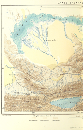
tian shan
alps
physical geography (1899) by davis
monsoon maps of india
1890s maps of north carolina
1899 maps of south carolina
physical geography (1899) by davis
19th-century maps of normandie
a system of modern geography (1810)
1810s maps of the pacific ocean
the earth and its inhabitants, vol. ix: asia, vol. iv
bosphorus
the earth and its inhabitants, vol. ix: asia, vol. iv
nouvelle géographie universelle, vol. xvii
monte cristi province
a system of modern geography (1810)
1810s maps of italy
maps from the earth and its inhabitants, vol. ix
maps of beirut
géographie générale; physique, politique et économique (1876)
19th-century maps of the english channel
géographie générale; physique, politique et économique (1876)
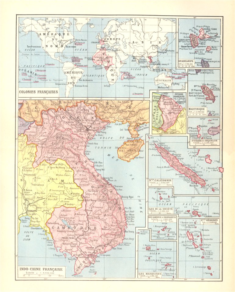
19th-century maps of southeast asia
géographie générale; physique, politique et économique (1876)
1870s maps of the caucasus
a system of modern geography (1810)
1810s maps of france
a system of modern geography (1810)
old maps of the holy land
physical geography (1899) by davis
maps of global mean precipitation
a system of modern geography (1810)
1810s maps of scotland
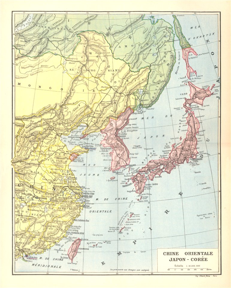
the earth and its inhabitants, vol. ix: asia, vol. iv
historical images of palmyra
géographie générale; physique, politique et économique (1876)
old maps of the amazon river
géographie générale; physique, politique et économique (1876)
1876 maps of asia
géographie générale; physique, politique et économique (1876)
1870s maps of arabia
a system of modern geography (1810)
1810s maps of china
19th-century maps of the malay archipelago
a system of modern geography (1810)
a system of modern geography (1810)
1810s maps of iran
a system of modern geography (1810)
1810s maps of canada
the earth and its inhabitants, vol. ix: asia, vol. iv
géographie générale; physique, politique et économique (1876)
isotherms (contour lines)
19th-century maps of england and wales
a system of modern geography (1810)
illustration
geography
illustration
geography
nouvelle géographie universelle, vol. xiii
engraved illustrations of nature
science
period
science
period
science
period
science
period
science
period
oval portraits of men
orazio antinori
maps from the earth and its inhabitants, vol. iii
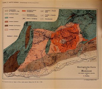
mining in austria
maps from the earth and its inhabitants, vol. vi
charles eugène perron
old maps of south africa
maps of transvaal
maps from the earth and its inhabitants, vol. iv
boston, england
christmas and winter scenes from the british library mechanical curator collection
a system of modern geography (1810)
nouveau cours d'instruction primaire de géographie (1886)
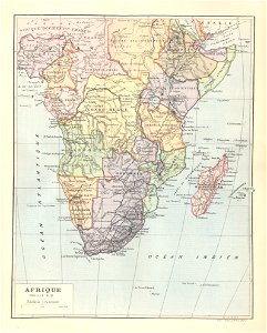
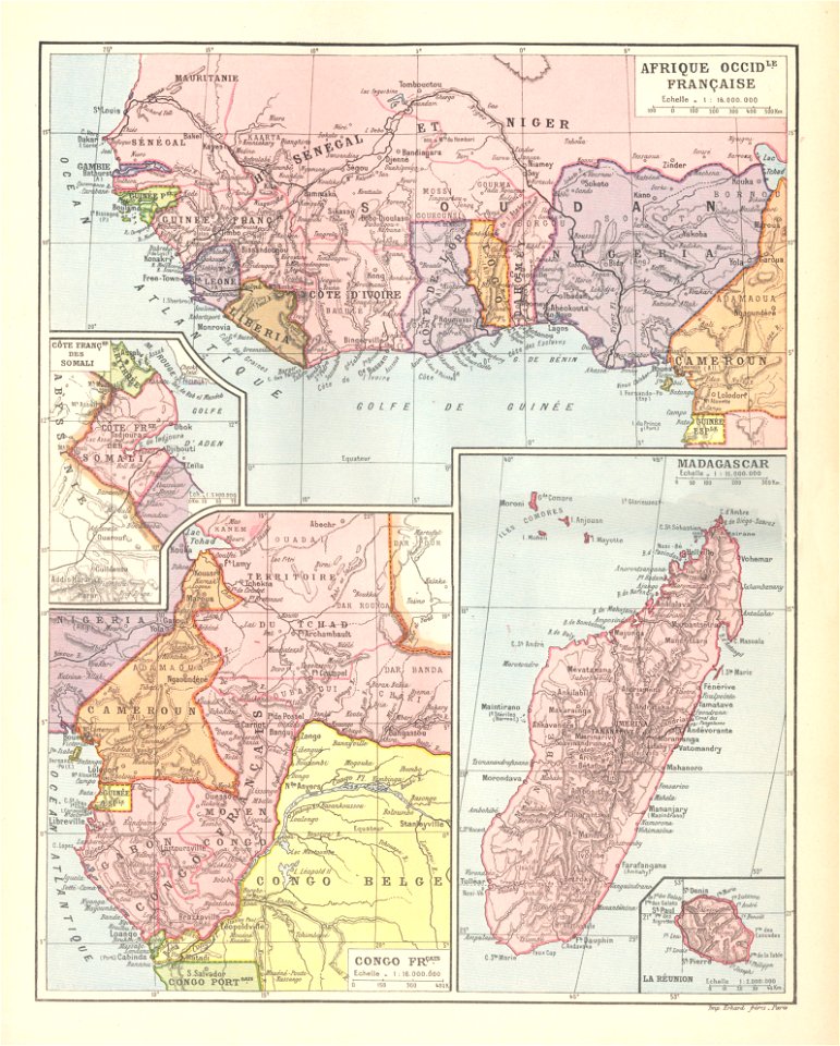
1886 maps of africa
physical geography (1899) by davis
1899 maps of new york (state)
maps from the earth and its inhabitants, vol. xiii
exploration of africa
maps from the earth and its inhabitants, vol. xiv
maps of the sunda strait
maps from the earth and its inhabitants, vol. iv
brentford, england
maps from the earth and its inhabitants, vol. xvii
maps of louisville, kentucky
german renaissance,northern renaissance
danse macabre (holbein)
science
period
science
period
science
period
science
period
local government
bundas in art
t. taylor
lévy, j
fur clothing of native people of congo
description de l'universe
physical geography (1899) by davis
geological block diagrams
science
geology
old maps of somaliland
zeila
landscape paintings by kamal-ol-molk
landscape paintings in iran
science
geology
science
geology
science
geology
science
geology
science
geology
science
geology
science
geology
science
geology
science
geology
science
geology
science
geology
science
geology
science
geology
science
geology
science
geology
cosmographia (münster)
german renaissance
physical geography (1899) by davis
1899 maps of europe
nouveau cours d'instruction primaire de géographie (1886)
maps of tahiti
nouveau cours d'instruction primaire de géographie (1886)
1886 maps of france
physical geography (1899) by davis
maps of the mississippi river
nouveau cours d'instruction primaire de géographie (1886)
1886 maps of europe
physical geography (1899) by davis
isotherms (contour lines)
the earth and its inhabitants, vol. ix: asia, vol. iv
historical images of grand mosque of bursa
physical geography (1899) by davis
weather maps of the united states
physical geography (1899) by davis
1899 maps of south america
nouveau cours d'instruction primaire de géographie (1886)
1886 maps of france
volcano school
people of fiji
description de l'universe
alexandria in art
people with kobzas
ostap veresai
1301 - 1400 of 9,064
Next page
/ 91