Log in
All resources
Create a design
405 Free Artworks of Caribbean
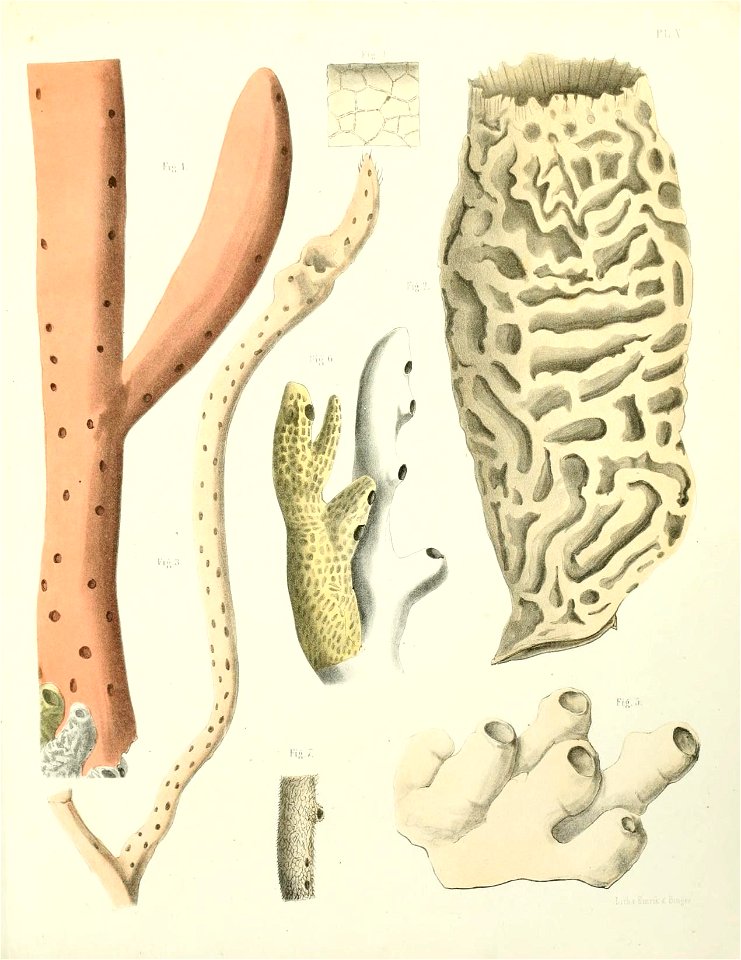
sponge
caribbean sea
american museum of natural history library
59.34(26.35)
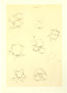
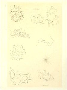
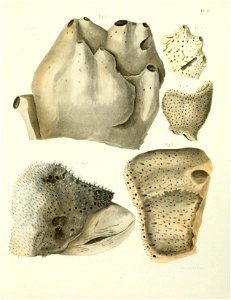
spongiaires de la mer caraïbe 1864.
illustrations xi
cuba
smithsonian libraries
natural history
marine animals
romanticism,orientalism
ronald reagan in 1981
kenneth shoesmith
palms in art
history of saint vincent and the grenadines
garifuna
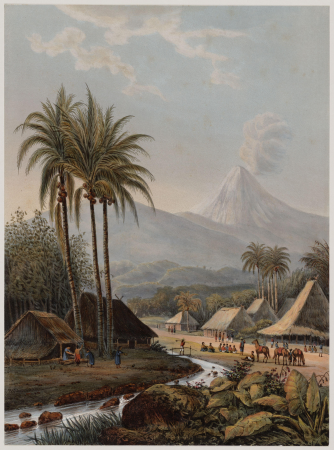
java in the 1870s
romanticism
paintings of the battle of the saintes
thomas mitchell (painter)
people with flags in art
history of the bahamas
helena sturtevant
pirates of the caribbean costumes
baroque
pirates of the caribbean costumes
baroque
jakarta in art
cityscapes
javanese
java
jacques le moyne de morgues
1591
americae 1562 by diego gutiérrez and hieronymus cock
renaissance
18th-century engravings of women
women of barbados
prints by pieter tanjé
baroque
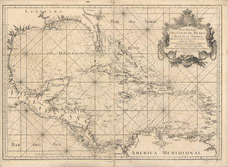
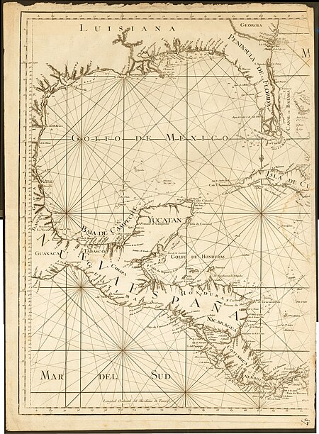
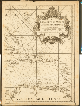
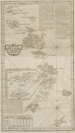
maps of the caribbean by mercator-hondius
maps in the library of congress
1750s maps of central america
sculptures in the rijksmuseum amsterdam
dioramas by gerrit schouten
1780s maps of the caribbean
maps in the british museum
carel frederik bendorp (i)
sint eustatius in art
extinct birds (rothschild book)
amazona martinicana
people of the caribbean
agostino brunias
trinidad and tobago in art
michel-jean cazabon
sketches from the americas by frances c. fairman
british overseas territories
1780s maps of the caribbean
maps by tomas lopez
1780s maps of the caribbean
maps by tomas lopez
romanticism
raden saleh
marine paintings by thomas luny
history of the french navy
history of trinidad and tobago
1595 in military history
juan de la cruz cano y olmedilla
maps by tomas lopez
juan de la cruz cano y olmedilla
maps by tomas lopez
brehms tierleben (arthropod)
illustrations
1720s maps of the caribbean
maps by pieter mortier
18th-century maps of central america
1760s maps of the caribbean
history of saint vincent and the grenadines
garifuna
people of the caribbean
pierre bodard
william bromley (engraver)
c. blackberd
historical images of saint pierre (martinique)
daguerreotypes of france
sint eustatius in the 1780s
new netherland
maps of ciudad colonial
caribbean sea in art
paintings by fritz melbye
romanticism
maps in the library of congress
1780s maps of the caribbean
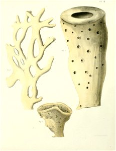
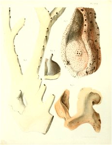
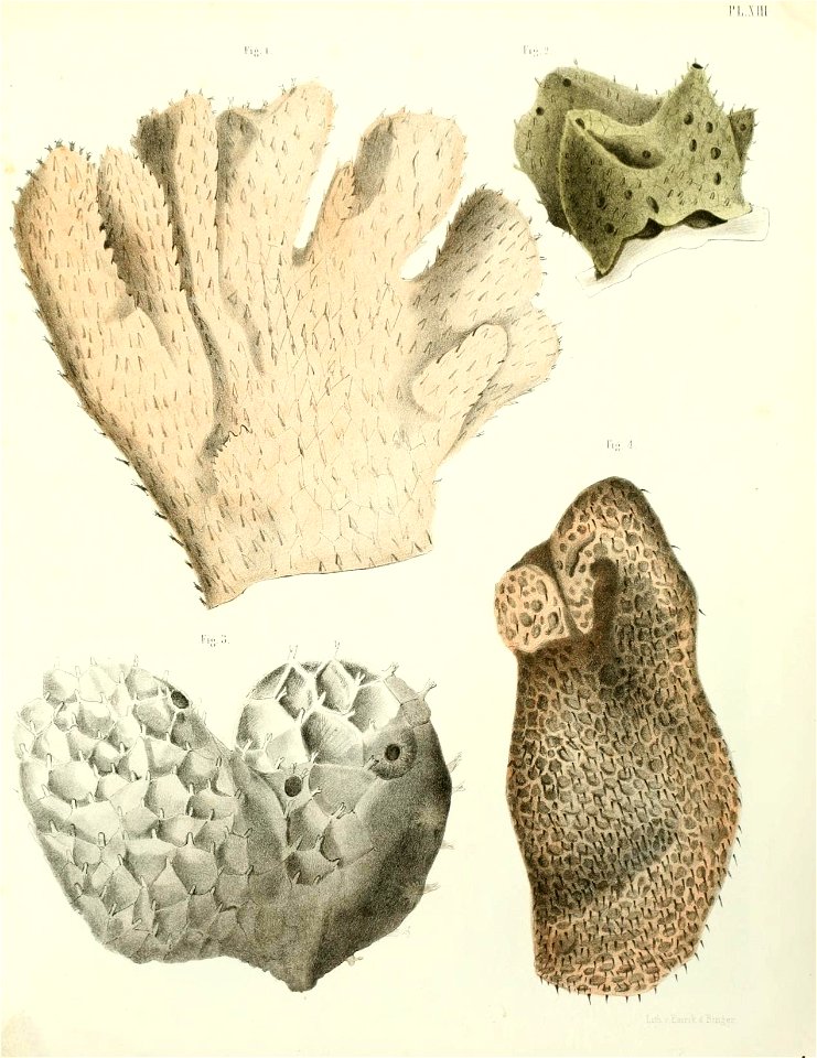
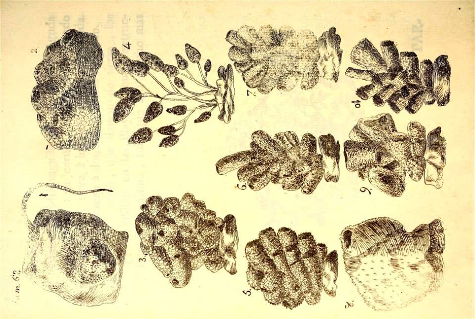
caribbean sea
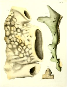
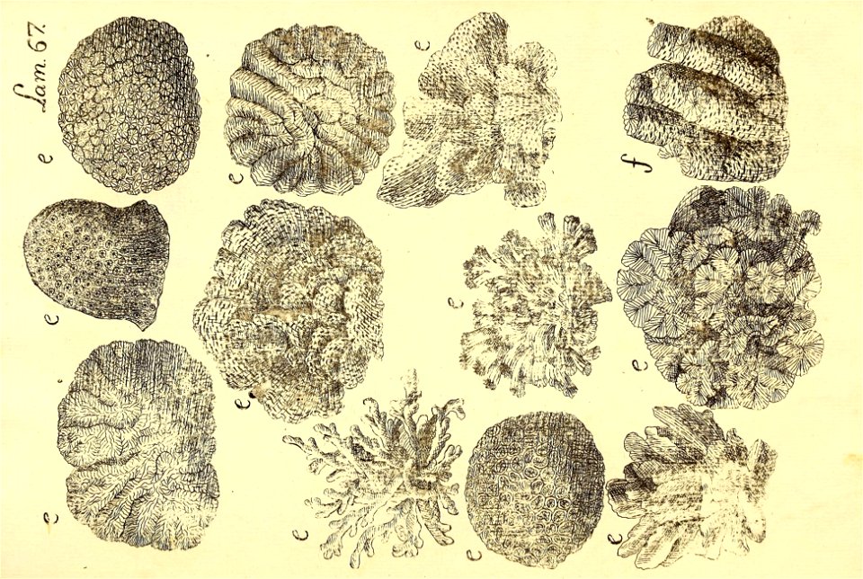
sponge
caribbean sea
sponge
caribbean sea
sponge
floods in indonesia
romanticism
art of suriname in the rijksmuseum amsterdam
dioramas by gerrit schouten
charlotte martner
martinique in art
art of suriname in the rijksmuseum amsterdam
dioramas by gerrit schouten
1754 maps of the bahamas
1754 maps of florida
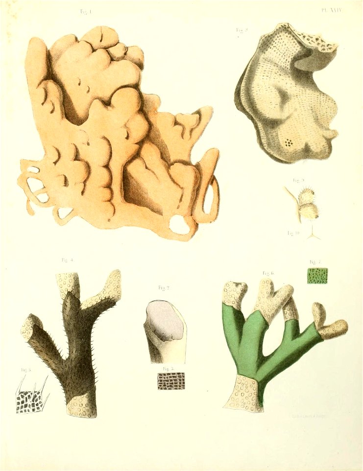
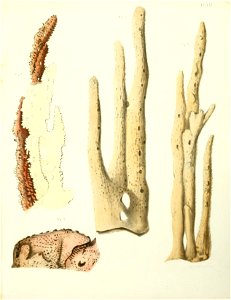
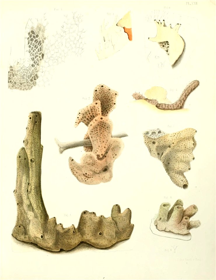
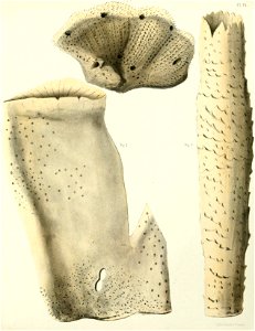
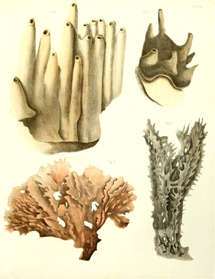
caribbean sea
sponge
caribbean sea
sponge
caribbean sea
sponge
ronald reagan in the oval office
neoclassicism
woodes rogers and his family (bhc2973)
realism
paintings by fritz melbye
romanticism
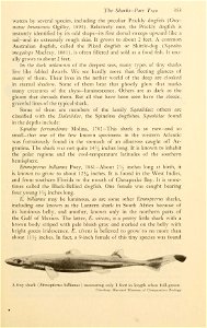
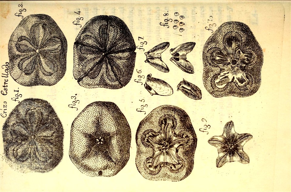
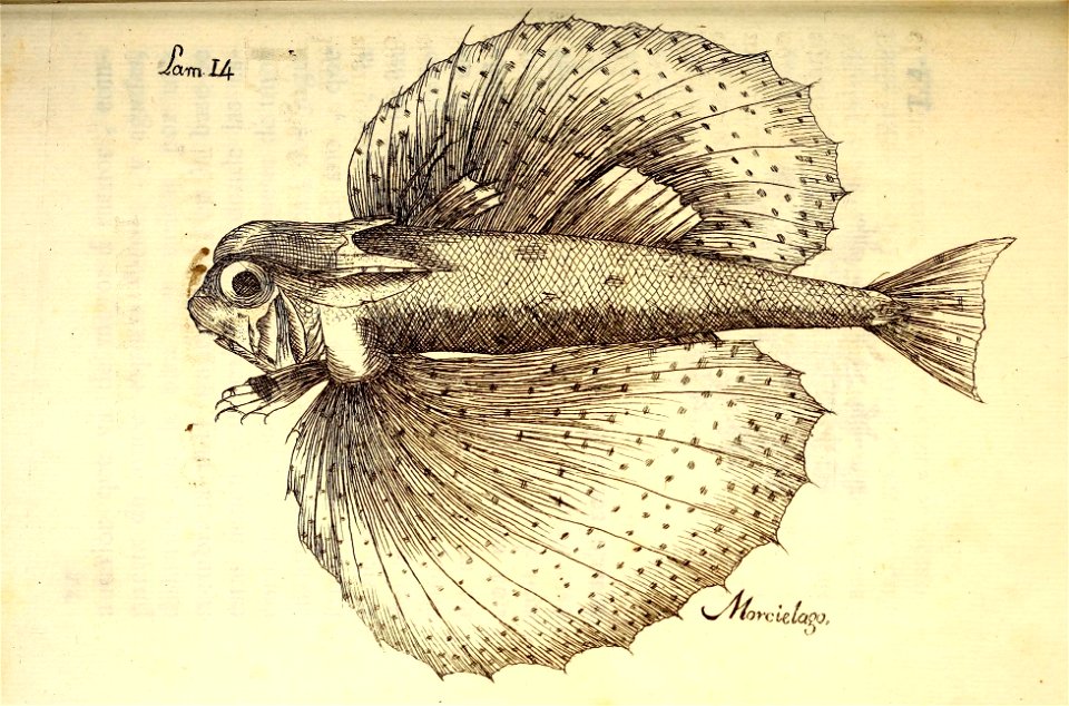
chondrichthyes
shark
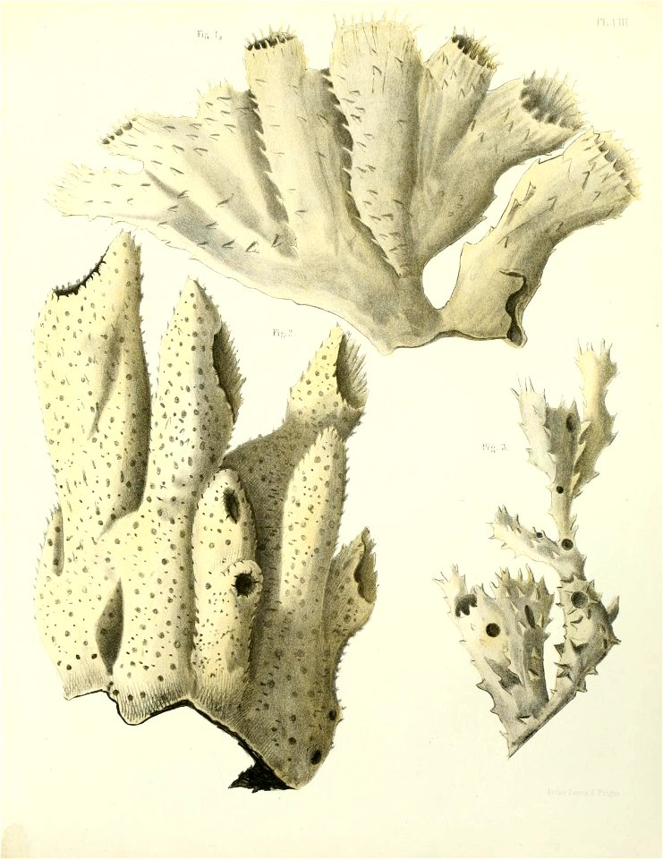
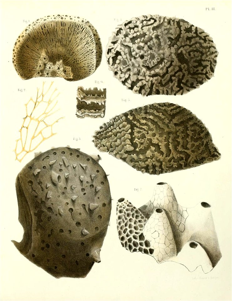
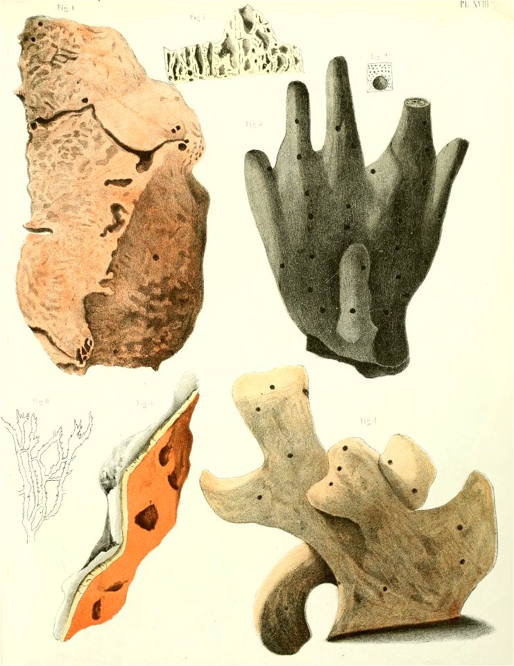
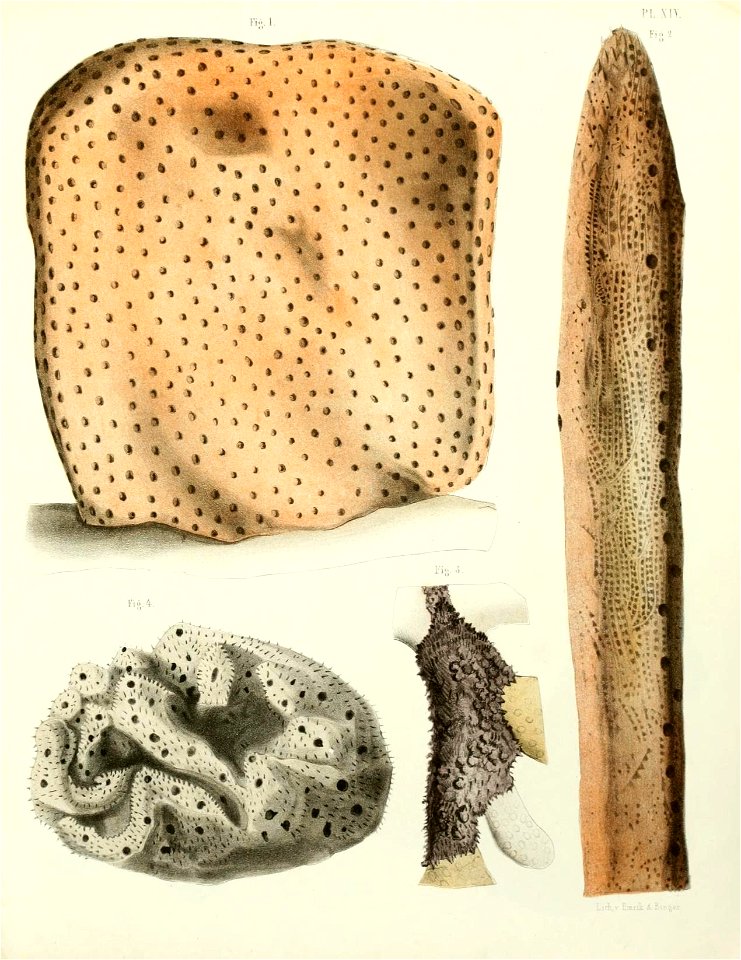
caribbean sea
sponge
bird
dove
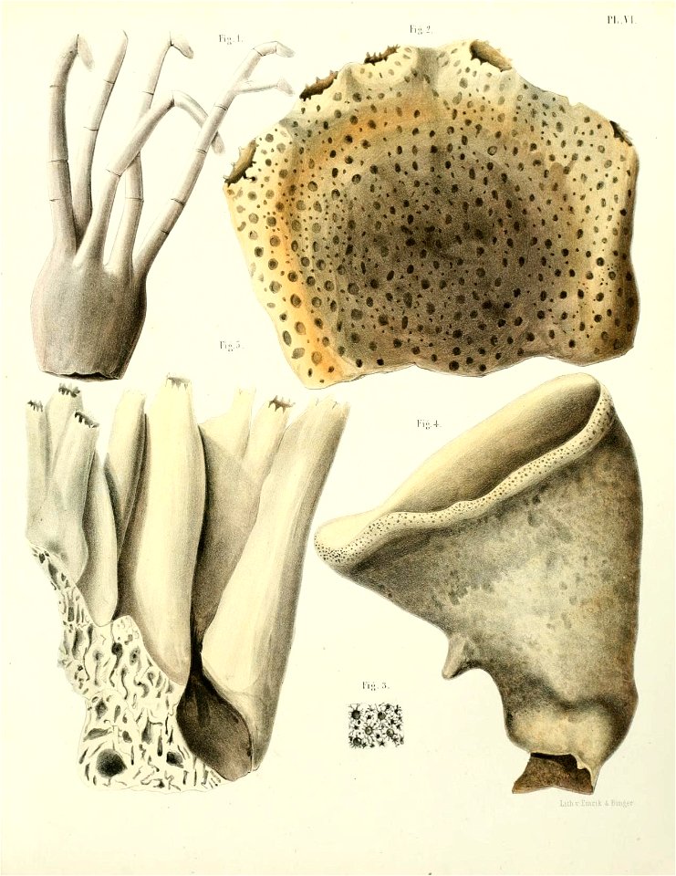
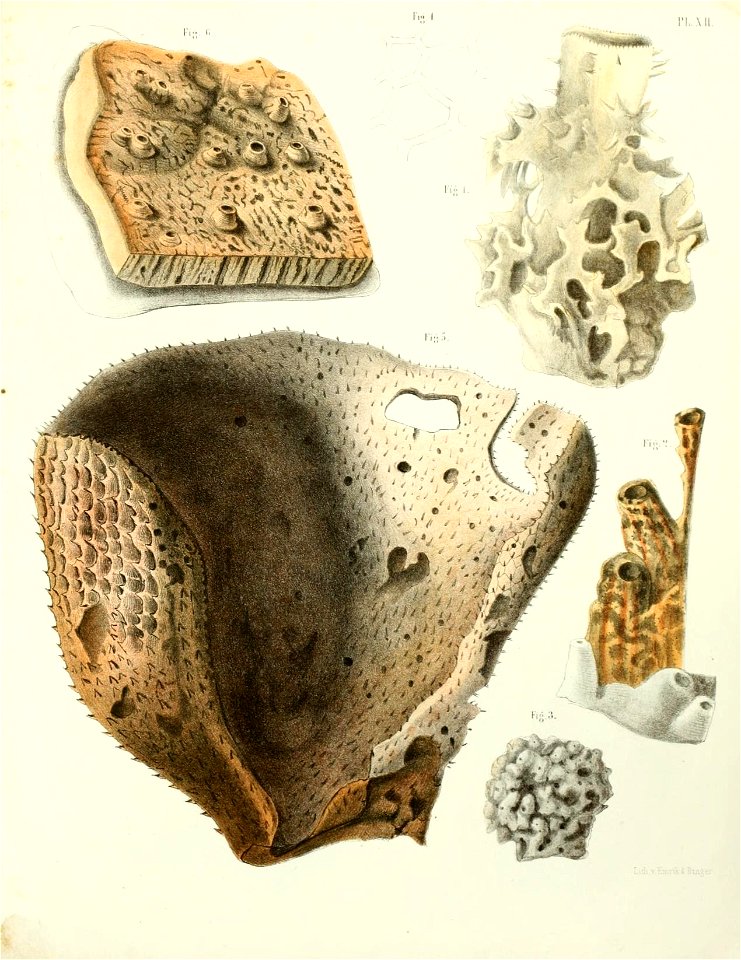
caribbean sea
sponge
caribbean sea
sponge
caribbean sea
sponge
caribbean sea
sponge
caribbean sea
sponge
caribbean sea
sponge
history of saint vincent and the grenadines
garifuna
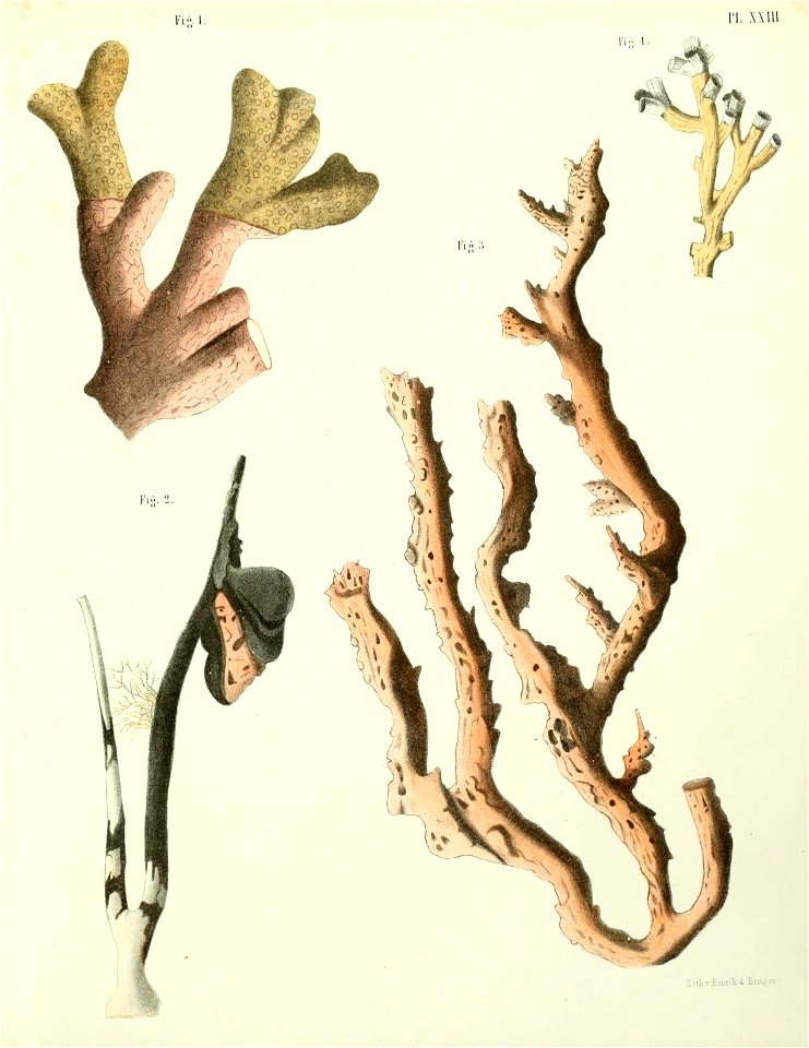
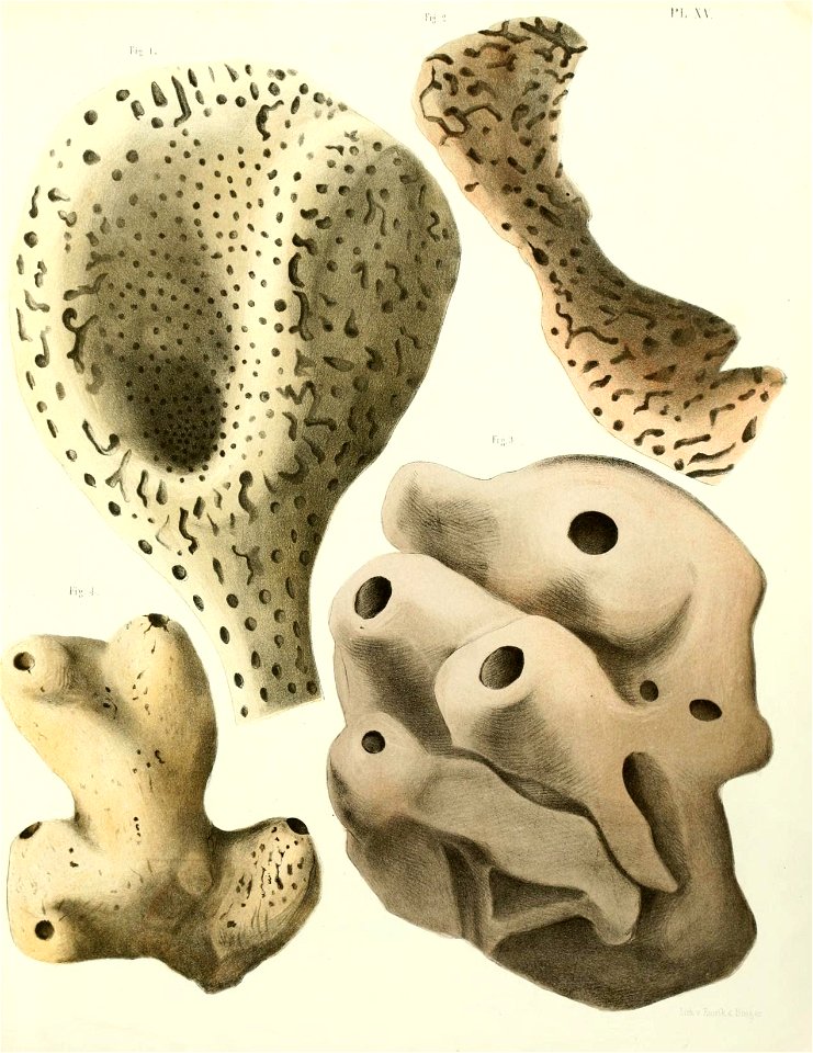
caribbean sea
sponge
caribbean sea
sponge
caribbean sea
sponge
caribbean sea
sponge
caribbean sea
sponge
caribbean sea
sponge
sculptures in the rijksmuseum amsterdam
dioramas by gerrit schouten
slave trade in the musée d'aquitaine
marius-pierre le masurier
sea life
sponge
sea life
sponge
caribbean sea
sponge
etchings in the rijksmuseum amsterdam
willem crul
a map of the british empire in america with the french and spanish settlements adjacent thereto
1730s maps of the caribbean
post-impressionism,pont-aven school,symbolism,synthetism,cloisonnism,impressionism,primitivism
portrait photographs
caribbean sea
sponge
caribbean sea
sponge
pierre-julien gilbert
ships named minerve
maps of the turks and caicos islands
1782 maps of the caribbean
landscapes of the caribbean
george robertson (artist)
caribbean maps in leiden university library
files uploaded at wiki techstorm 2019
caribbean maps in leiden university library
files uploaded at wiki techstorm 2019
copper engravings by benjamin cole
a general history of the pyrates
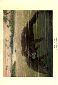
manatee
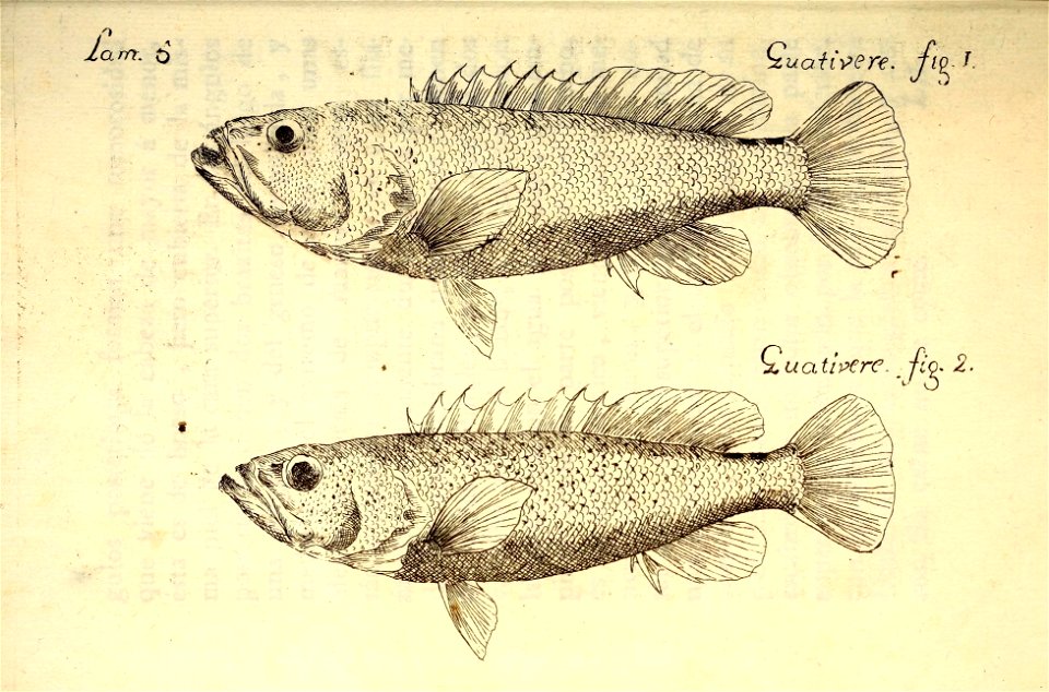
zoology
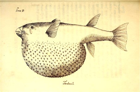
natural history
cuba
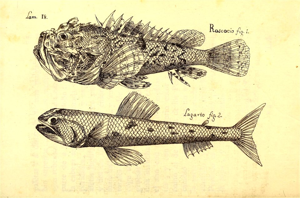
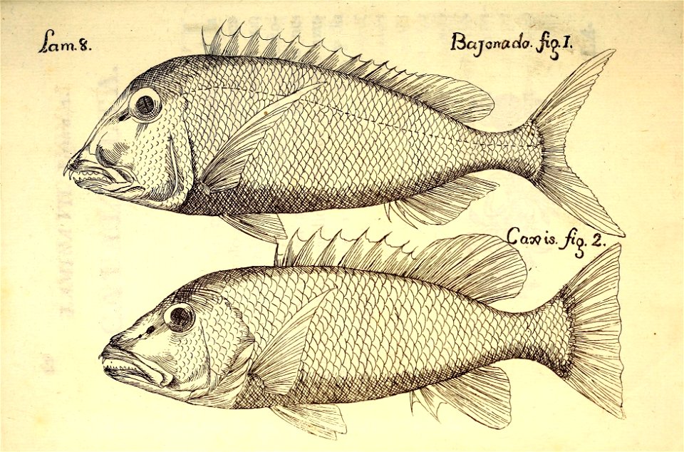
natural history
cuba
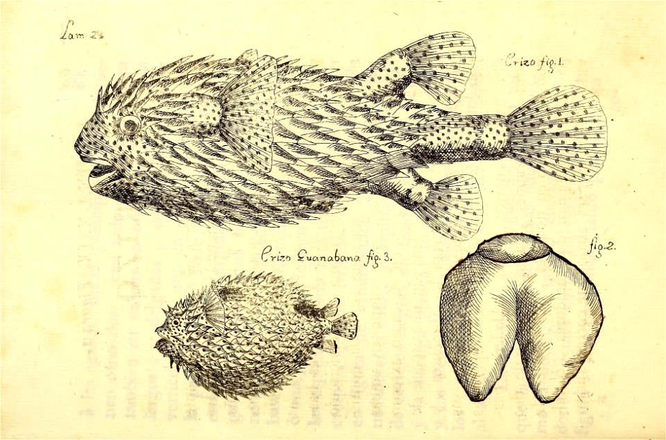
natural history
cuba
natural history
cuba
natural history
cuba
natural history
cuba
natural history
cuba
natural history
cuba
natural history
cuba
natural history
cuba
natural history
cuba
101 - 200 of 405
Next page
/ 5