Log in
All resources
Create a design
8 Free Images of Old Maps Of Westmorland
old county maps of westmorland
westmorland, cumberland, durham, and northumberland (1858)
bibliothèque nationale de france
maps from the earth and its inhabitants, vol. iv
old maps of the lake district
19th-century maps of cumberland
19th-century maps of westmorland
maps made in the 17th century
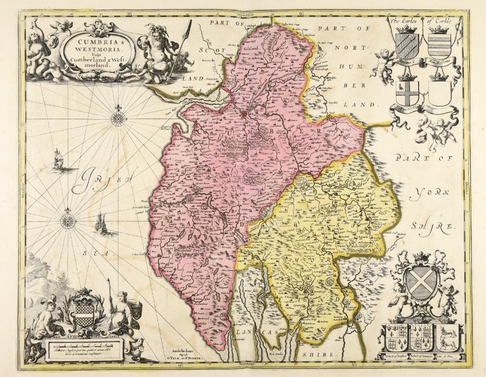
gerard valck
westmorland, cumberland, durham, and northumberland (1858)
old maps of westmorland
chorographia britanniae (1741-1742)
18th-century maps of westmorland
atlas maior, vol 5 (england) - joan blaeu, 1667 - bl 114.h(star).5
17th-century maps of westmorland
westmorland, cumberland, durham, and northumberland (1858)
old maps of westmorland
maps by willem and johannes blaeu
old maps of westmorland
maps from the earth and its inhabitants, vol. iv
old maps of the lake district
maps from the earth and its inhabitants, vol. iv
old maps of the lake district
1 - 8 of 8
/ 1