Log in
All resources
Create a design
36 Free Images of English Language Maps Of The World
bibliothèque nationale de france
pages with maps
cc-zero
france photographs taken on 2015-04-30
quality images by jebulon
quality images missing sdc depicts
quality images
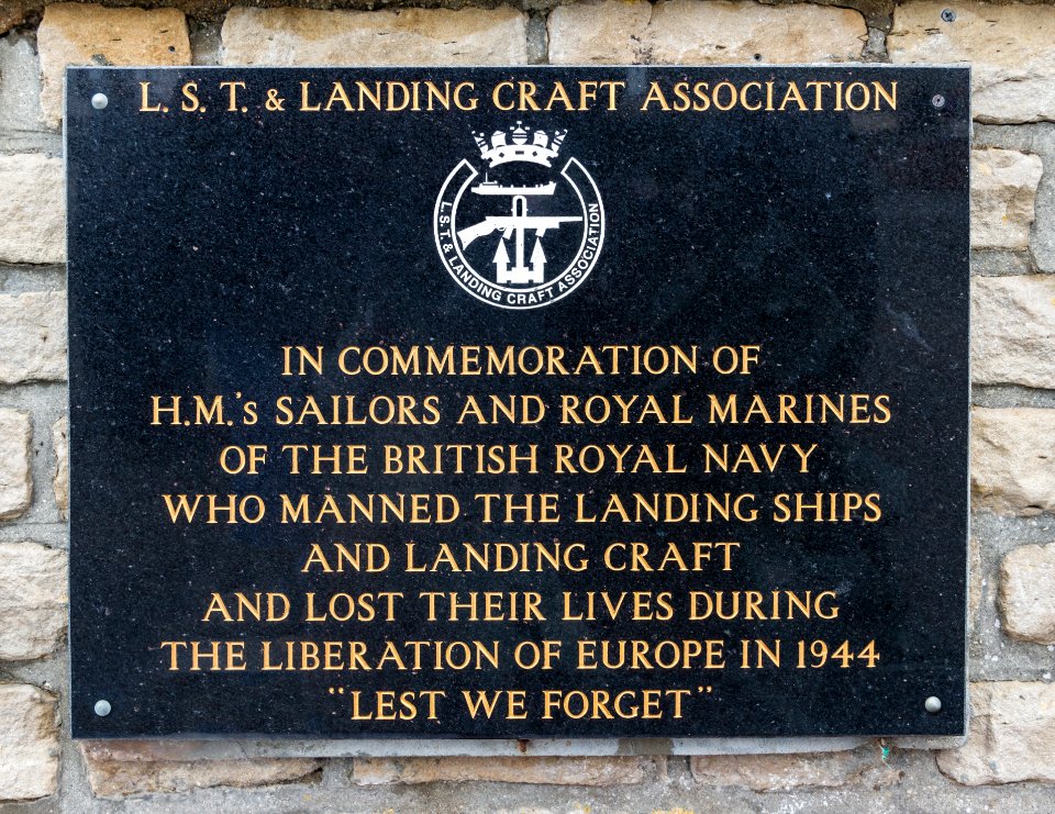
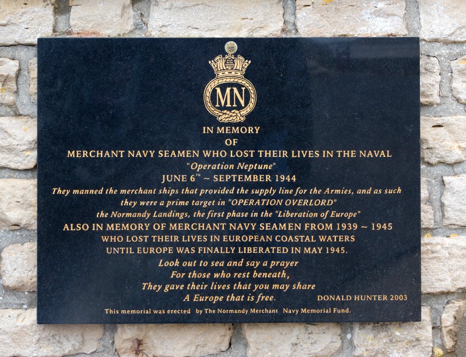
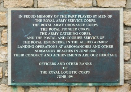
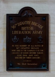
world war ii memorials in calvados
english-language plaques in france
plaques referencing 1944 in calvados
landing craft
letter
self-published work
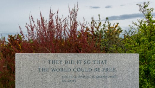
quotation
arromanches-les-bains
self-published work
arromanches-les-bains
royal engineers
south wales borderers
essex regiment
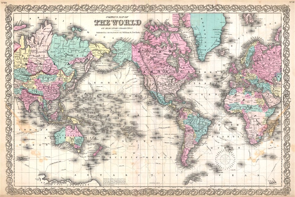
english-language maps
ptolemaic world maps
maps showing 19th-century history
political maps of the world
political maps of the world
1852
english-language maps
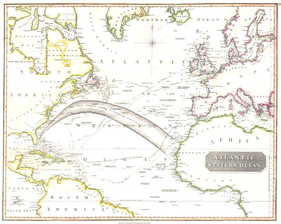
maps of voyages
school
maps
old constellation maps
maps by samuel dunn
character
symbol
maps of the world without antarctica
1820s maps of the world
maps of circumnavigations of the world
1740s maps of the world
1710s maps of the world
maps by edward wright
1850s maps of the americas
maps by john tallis
maps by thomas kitchin
1781 maps of europe
historical
history
maps by emanuel bowen
1740 maps
1750s maps of the caribbean
maps by thomas kitchin
bibliothèque nationale de france
maps by thomas kitchin
1840s maps showing history
maps by thomas starling
geological maps of england
william smith (geologist)
maps by thomas starling
1842 maps
maps of saint paul's journeys
maps by thomas starling
1740s maps of the world
maps by emanuel bowen
1750s maps of north america
solomon bolton
maps by john cary
1799 maps
18th-century double hemisphere world maps
1730s maps of the world
18th-century double hemisphere world maps
1730s maps of the world
maps by peter lesley
maps by james hall
maps of the mexican-american war
maps by joseph warren revere
geocentric model
1730 maps
maps by john cary
1801 maps
1650s maps of the americas
1658 maps
1740s maps of the americas
1747 maps of north america
1 - 36 of 36
/ 1