Log in
All resources
Create a design
1,170 Free Images of Britannia
bibliothèque nationale de france
chorographia britanniae (1741-1742)
historical
history
cc-zero
images from anefo
images from nationaal archief
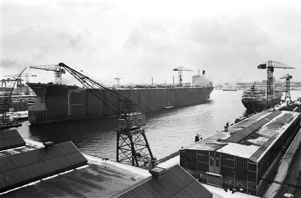
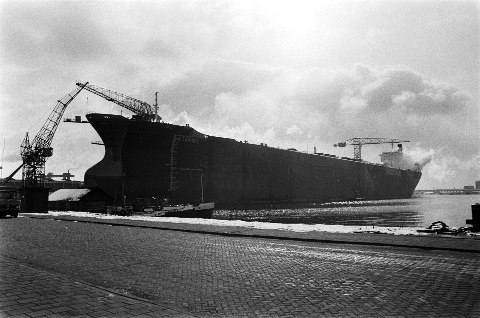
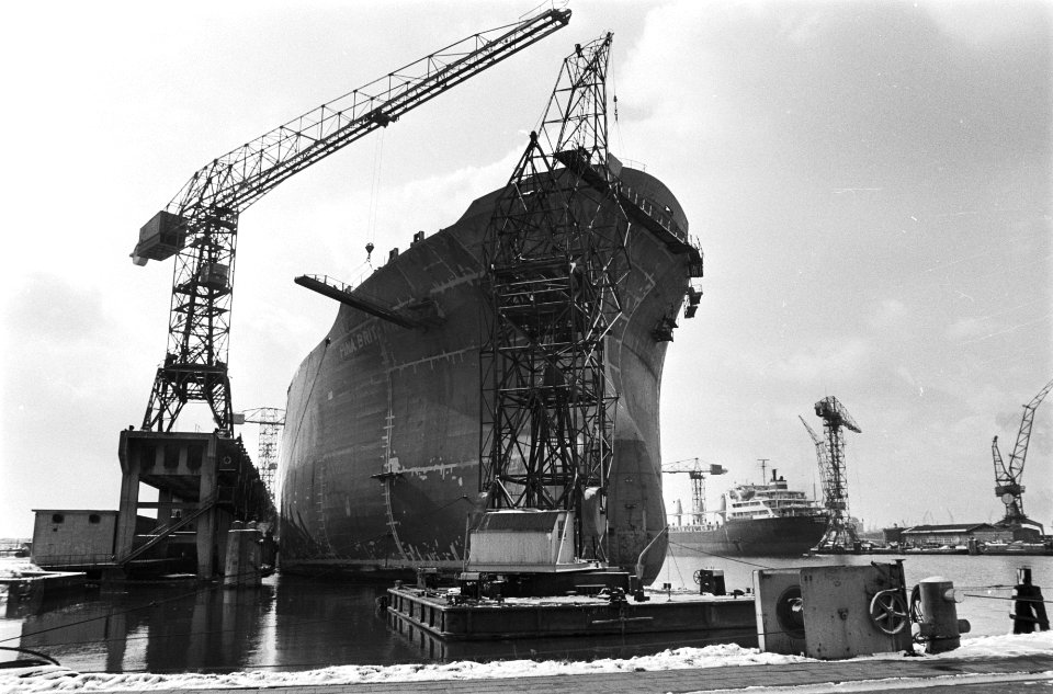
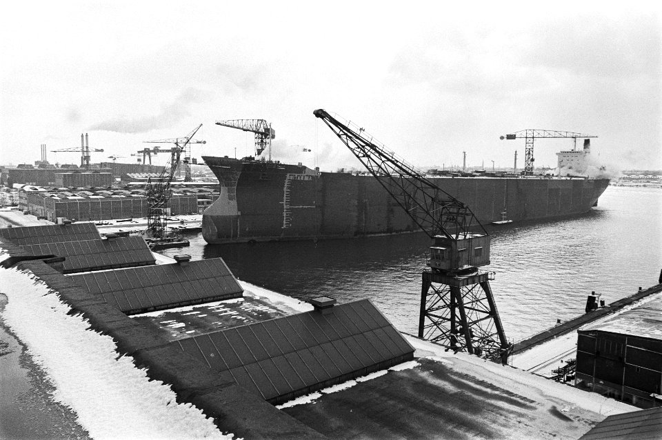
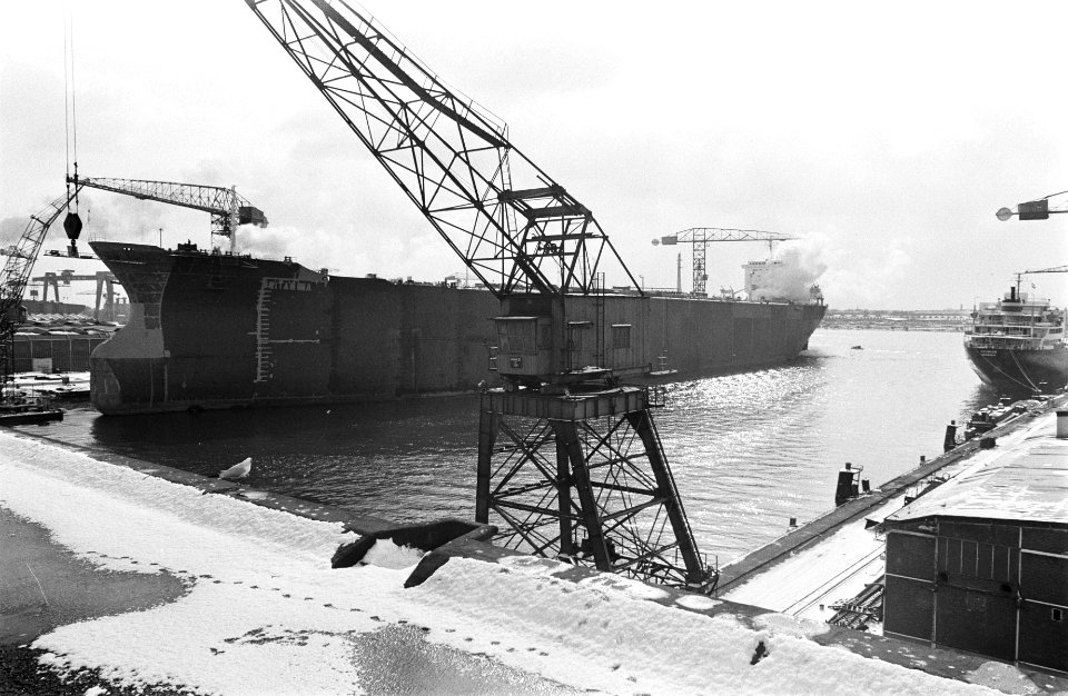
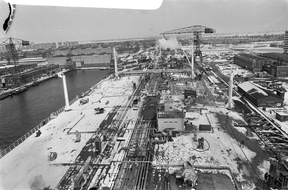
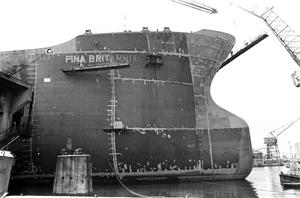
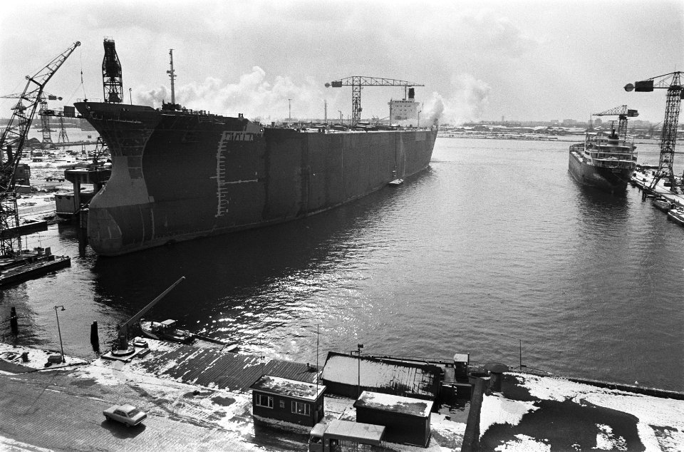
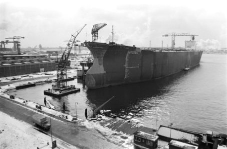
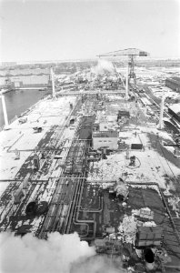
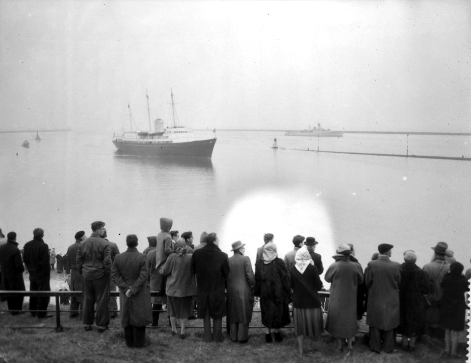
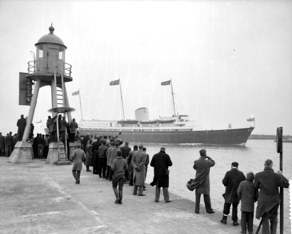
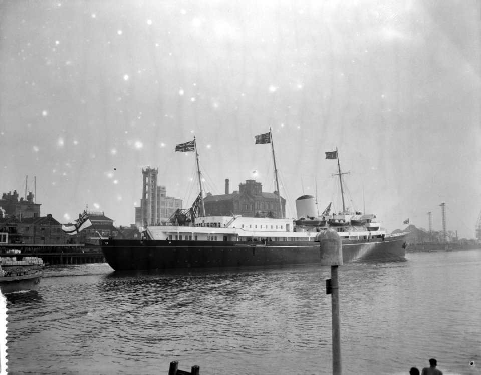
1971 in amsterdam
fina britannia (ship, 1971)
nederlandsche dok en scheepsbouw maatschappij, amsterdam
architecture bl
letitia byrne
landscape
winter
historical
history
historical
history
historical
history
landscape
nature
maps of exeter by braun & hogenberg
hooker (alias vowell) arms
historical
history
historical
history
historical
history
historical
history
hampton court palace
britannia illustrata
chorographia britanniae (1741-1742)
1741 in england
vehicle
car
landscape
grass
historical
history
historical
history
cornelis martinus vermeulen
reinier leers
historical
history
chorographia britanniae (1741-1742)
bibliothèque nationale de france
honoré daumier
realism
cornelis martinus vermeulen
reinier leers
the earth and its inhabitants, vol. iv: europe, vol. iv
britannia bridge
maps in the library of congress
1870 cartoons
prints by william hogarth in the british museum
realism
prints by william hogarth in the british museum
realism
chorographia britanniae (1741-1742)
bibliothèque nationale de france
18th-century maps of england and wales
chorographia britanniae (1741-1742)
cornelis martinus vermeulen
reinier leers
historical
history
medals in the musée carnavalet
pre-raphaelite brotherhood
prints by william hogarth in the british museum
realism
a political concert; the vocal parts by
satirical prints in the british museum
chorographia britanniae (1741-1742)
england in the 1740s
chorographia britanniae (1741-1742)
bibliothèque nationale de france
chorographia britanniae (1741-1742)
18th-century maps of wiltshire
prints by isaac cruikshank in the british museum
satirical prints in the british museum
the earth and its inhabitants, vol. iv: europe, vol. iv
britannia bridge
historical
history
chorographia britanniae (1741-1742)
18th-century maps of essex
chorographia britanniae (1741-1742)
18th-century maps of sussex
icons
travel
prints by robert jacob hamerton in the british museum
chromolithographs in the british museum
chorographia britanniae (1741-1742)
18th-century maps of middlesex
chorographia britanniae (1741-1742)
18th-century maps of monmouthshire
chorographia britanniae (1741-1742)
18th-century maps of cambridgeshire
18th-century maps of england and wales
chorographia britanniae (1741-1742)
chorographia britanniae (1741-1742)
18th-century maps of westmorland
18th-century maps of huntingdonshire
chorographia britanniae (1741-1742)
chorographia britanniae (1741-1742)
18th-century maps of lancashire
chorographia britanniae (1741-1742)
18th-century maps of northumberland
chorographia britanniae (1741-1742)
18th-century maps of cumberland
historical
history
icons
travel
historical
history
historical
history
historical
history
historical
history
chorographia britanniae (1741-1742)
18th-century maps of kent
chorographia britanniae (1741-1742)
18th-century maps of cornwall
1864 cartoons
amédée de noé
realism
aeneas
18th-century maps of nottinghamshire
chorographia britanniae (1741-1742)
chorographia britanniae (1741-1742)
18th-century maps of cheshire
chorographia britanniae (1741-1742)
18th-century maps of worcestershire
chorographia britanniae (1741-1742)
18th-century maps of warwickshire
chorographia britanniae (1741-1742)
18th-century maps of suffolk
chorographia britanniae (1741-1742)
18th-century maps of shropshire
18th-century maps of herefordshire
old county maps of herefordshire
chorographia britanniae (1741-1742)
1740s maps of wales
18th-century maps of norfolk, england
chorographia britanniae (1741-1742)
chorographia britanniae (1741-1742)
18th-century maps of rutland
chorographia britanniae (1741-1742)
18th-century maps of bedfordshire
chorographia britanniae (1741-1742)
18th-century maps of derbyshire
chorographia britanniae (1741-1742)
1740s maps of wales
prints after anthony van dyck in the rijksmuseum amsterdam
baroque painting
chorographia britanniae (1741-1742)
old county maps of county durham
chorographia britanniae (1741-1742)
18th-century maps of lincolnshire
chorographia britanniae (1741-1742)
18th-century maps of dorset
old maps of whole wales (alone)
1670s maps of wales
chorographia britanniae (1741-1742)
18th-century maps of yorkshire
18th-century maps of buckinghamshire
chorographia britanniae (1741-1742)
18th-century maps of gloucestershire
chorographia britanniae (1741-1742)
18th-century maps of northamptonshire
chorographia britanniae (1741-1742)
chorographia britanniae (1741-1742)
18th-century maps of berkshire
chorographia britanniae (1741-1742)
18th-century maps of somerset
amédée de noé
britannia
french paintings in the walters art museum
pierre-nicolas legrand
prints, drawings and watercolours of the royal museums greenwich
1814 in art
medals in the musée carnavalet
pre-raphaelite brotherhood
medals in the musée carnavalet
pre-raphaelite brotherhood
18th-century maps of england and wales
chorographia britanniae (1741-1742)
chorographia britanniae (1741-1742)
18th-century maps of hampshire
chorographia britanniae (1741-1742)
18th-century maps of hertfordshire
chorographia britanniae (1741-1742)
18th-century maps of surrey
chorographia britanniae (1741-1742)
18th-century maps of staffordshire
chorographia britanniae (1741-1742)
18th-century maps of leicestershire
chorographia britanniae (1741-1742)
18th-century maps of devon
18th-century maps of england and wales
chorographia britanniae (1741-1742)
chartae orarum marinarum partim normandiae, partum britanniae, et insularum circa eas sitarum - lucas io(ann)es aurigarius inventor ; ioannes a doetecu. fecit - btv1b531567357
bibliothèque nationale de france
1001 - 1100 of 1,170
Next page
/ 12


![A Table of all the Cross Roads in England and Wales.To follow Plate 4 / [Badeslade]; W.H. Toms sculp., 1741](https://cdn.creazilla.com/illustrations/10001514902/a-table-of-all-the-cross-roads-in-england-and-walesto-follow-plate-4-badeslade-wh-toms-sculp-1741-sm.webp)


![A Table of the High Roads through England and Wales.Tab.1. to follow Plate 3 / [Badeslade]; W.H. Toms sculp., 1741](https://cdn.creazilla.com/illustrations/10000549648/a-table-of-the-high-roads-through-england-and-walestab1-to-follow-plate-3-badeslade-wh-toms-sculp-1741-md.jpg)


![An Alphabetical List of all the Cities, Boroughs, & Market Towns in England & Wales / [Badeslade]; W.H. Toms sculp., 1741](https://cdn.creazilla.com/illustrations/10000199143/an-alphabetical-list-of-all-the-cities-boroughs-market-towns-in-england-wales-badeslade-wh-toms-sculp-1741-md.jpg)
![A Table of the High Roads through England and Wales.Tab.2. to follow Plate 3 / [Badeslade]; W.H. Toms sculp., 1741](https://cdn.creazilla.com/illustrations/10001464220/a-table-of-the-high-roads-through-england-and-walestab2-to-follow-plate-3-badeslade-wh-toms-sculp-1741-sm.webp)


![A Map of South Wales: West from London / T. Badeslade delin[eavit]; W.H. Toms Sculp[sit], 1741](https://cdn.creazilla.com/illustrations/10000319175/a-map-of-south-wales-west-from-london-t-badeslade-delineavit-wh-toms-sculpsit-1741-sm.webp)


![A Map of North Wales: N. West from London / T. Badeslade delin[eavit]; W.H. Toms Sculp[sit], 1741](https://cdn.creazilla.com/illustrations/10001551176/a-map-of-north-wales-n-west-from-london-t-badeslade-delineavit-wh-toms-sculpsit-1741-sm.webp)


![Wallia principatus vulgo Wales: Seren[issi]mo Domino Carolo Magnae Britanniae, etc. Principi [signé] Joh. Blaeu, 1673](https://cdn.creazilla.com/illustrations/10001204343/wallia-principatus-vulgo-wales-serenissimo-domino-carolo-magnae-britanniae-etc-principi-sign-joh-blaeu-1673-sm.webp)


