Log in
All resources
Create a design
328 Free Images of 1896 Maps
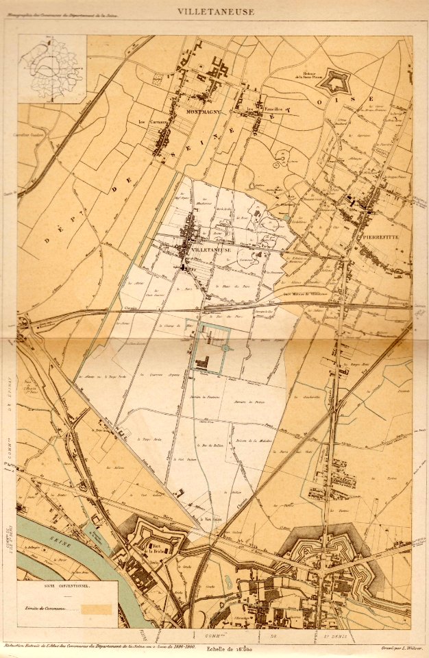
pages with maps
cc-zero
maps in the library of congress
architecture
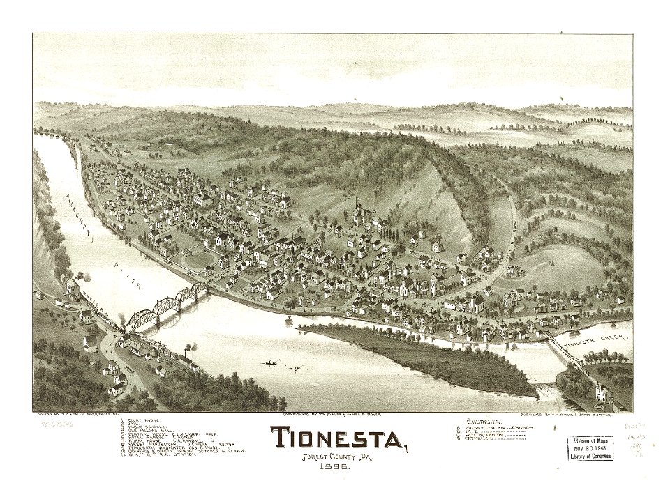
old maps of pennsylvania
national register of historic places with known ids
pennsylvania
village
roof
town
february 2016 denmark photographs
self-published work
architecture
facade
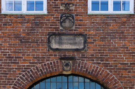
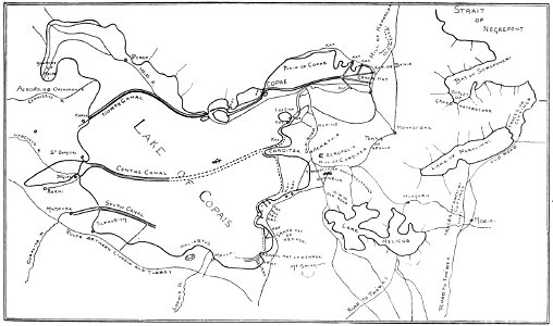
old maps of greece
1896 maps
maps in the library of congress
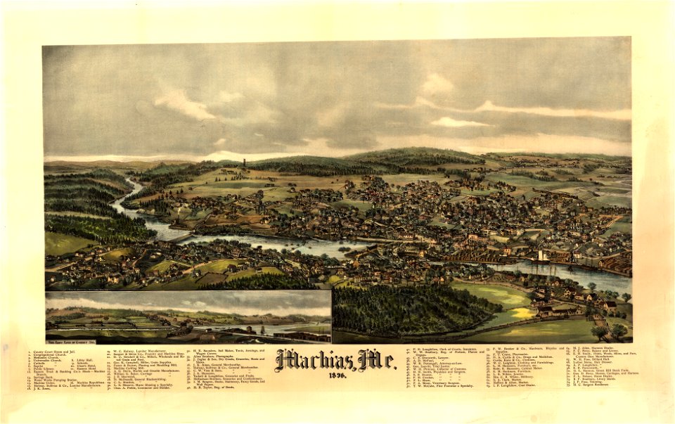
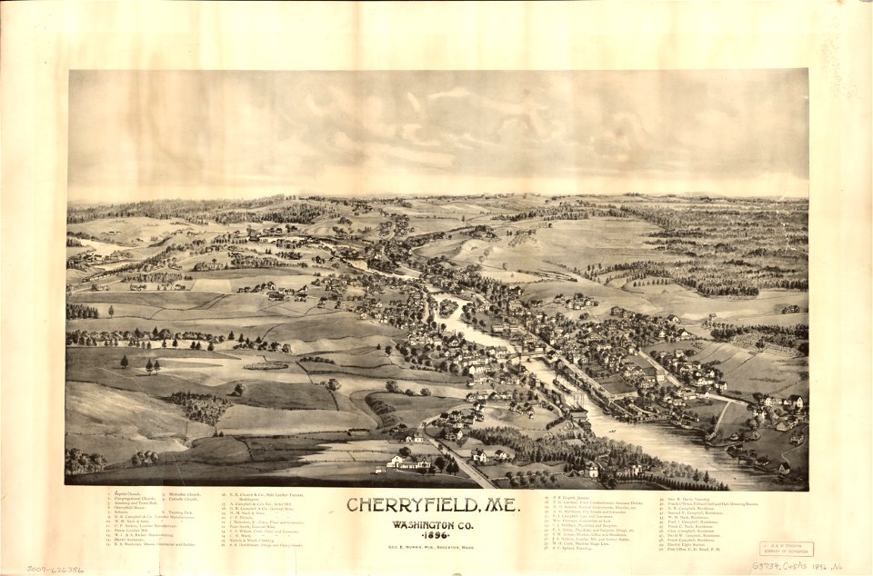
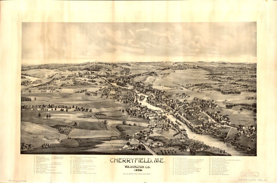
old maps of maine
maps in the library of congress
old maps of maine
maps in the library of congress
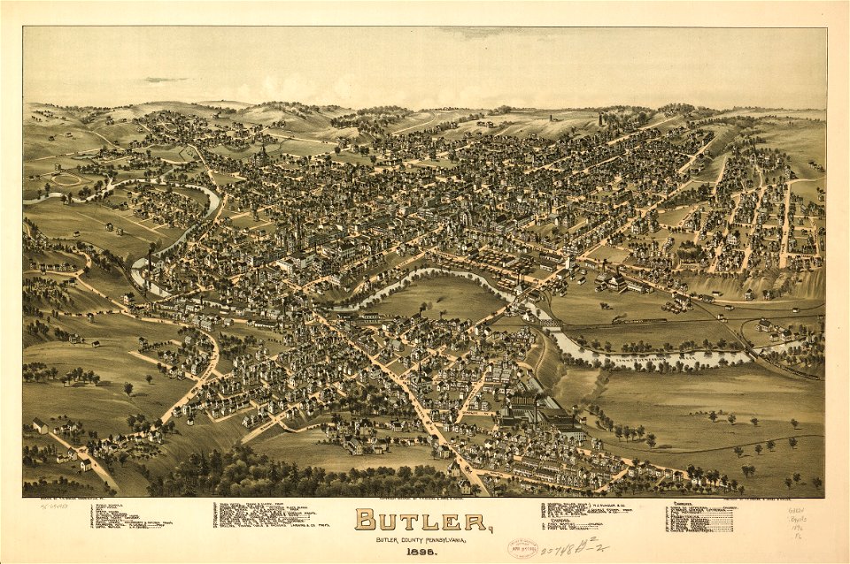
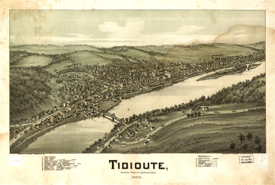
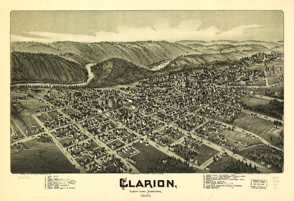
old maps of pennsylvania
maps in the library of congress
old maps of pennsylvania
maps in the library of congress
old maps of pennsylvania
maps in the library of congress
old maps of maine
maps in the library of congress
old maps of pennsylvania
maps in the library of congress
old maps of maine
maps in the library of congress
old maps of pennsylvania
maps in the library of congress
1896 maps
maps in the library of congress
old maps of pennsylvania
maps in the library of congress
1896 maps
maps in the library of congress
old maps of pennsylvania
maps in the library of congress
old maps of pennsylvania
maps in the library of congress
old maps of pennsylvania
maps in the library of congress
old maps of pennsylvania
maps in the library of congress
old maps of pennsylvania
maps in the library of congress
old maps of pennsylvania
maps in the library of congress
old maps of pennsylvania
maps in the library of congress
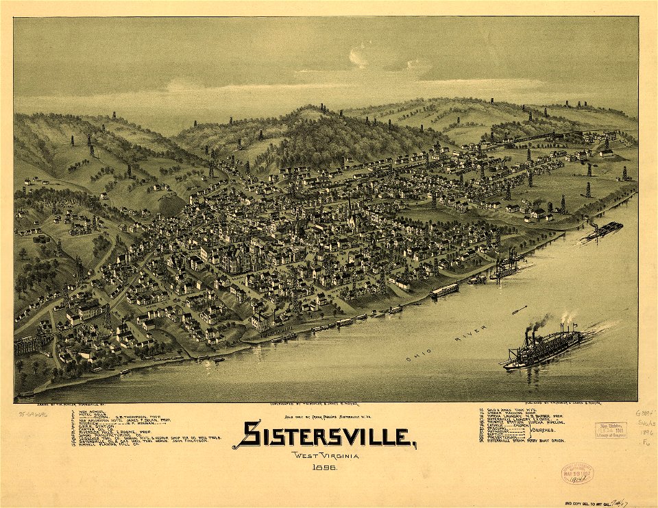
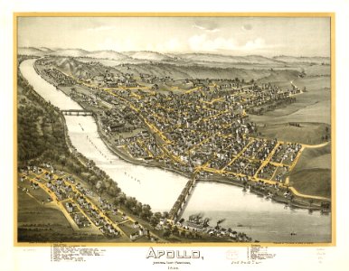
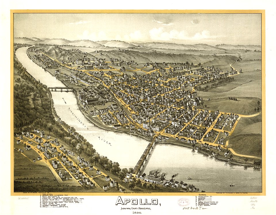
pennsylvania
maps in the library of congress
pennsylvania
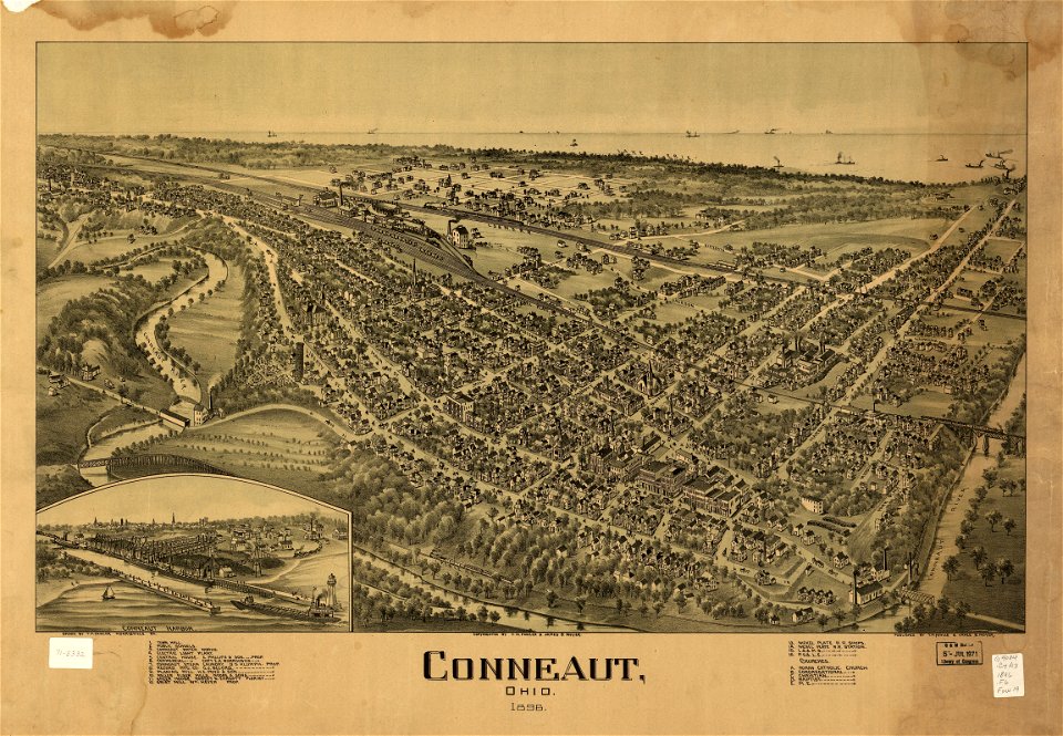
conneaut
ohio
conneaut
ohio
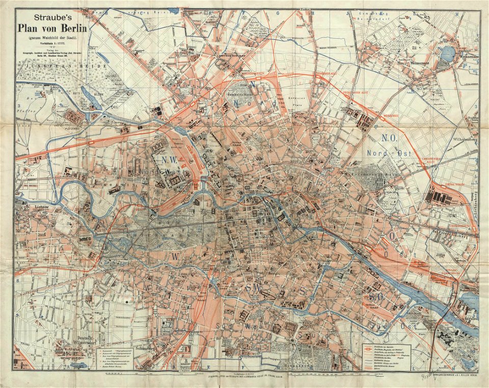
19th-century maps of berlin
1896 maps
ashtabula
ohio
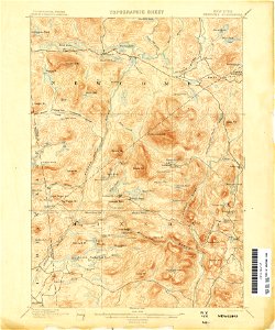
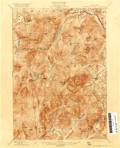
united states geological survey maps
topographic maps of new york (state)
maps in the library of congress
pennsylvania
maps in the library of congress
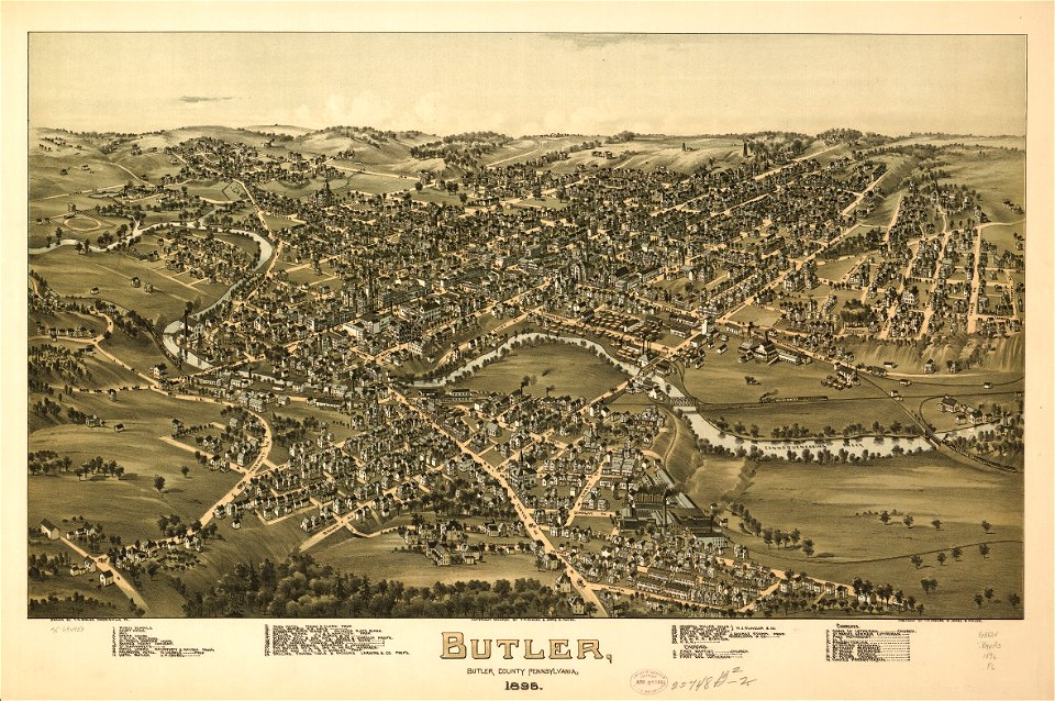
pennsylvania
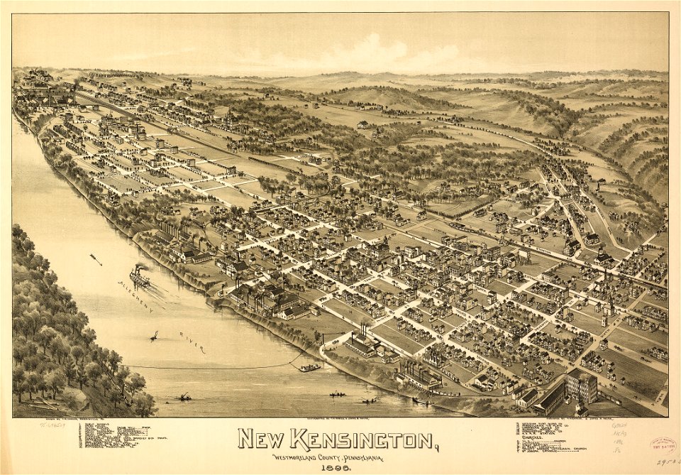
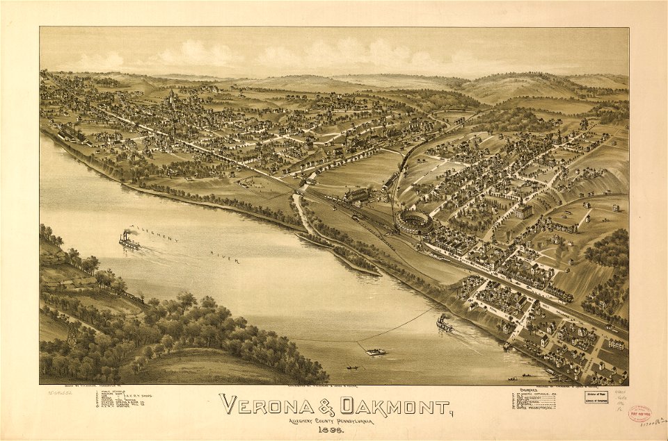
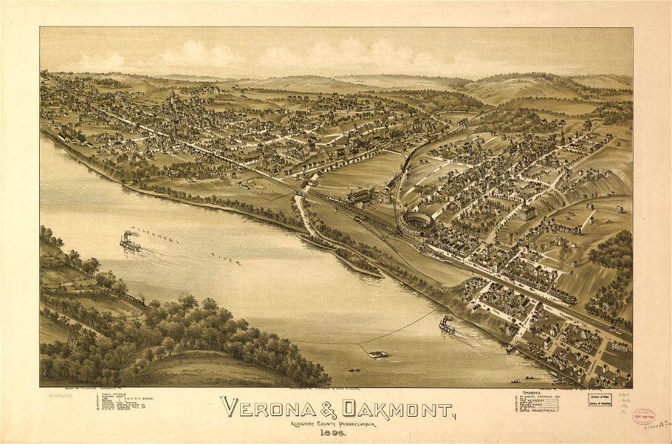
pennsylvania
verona
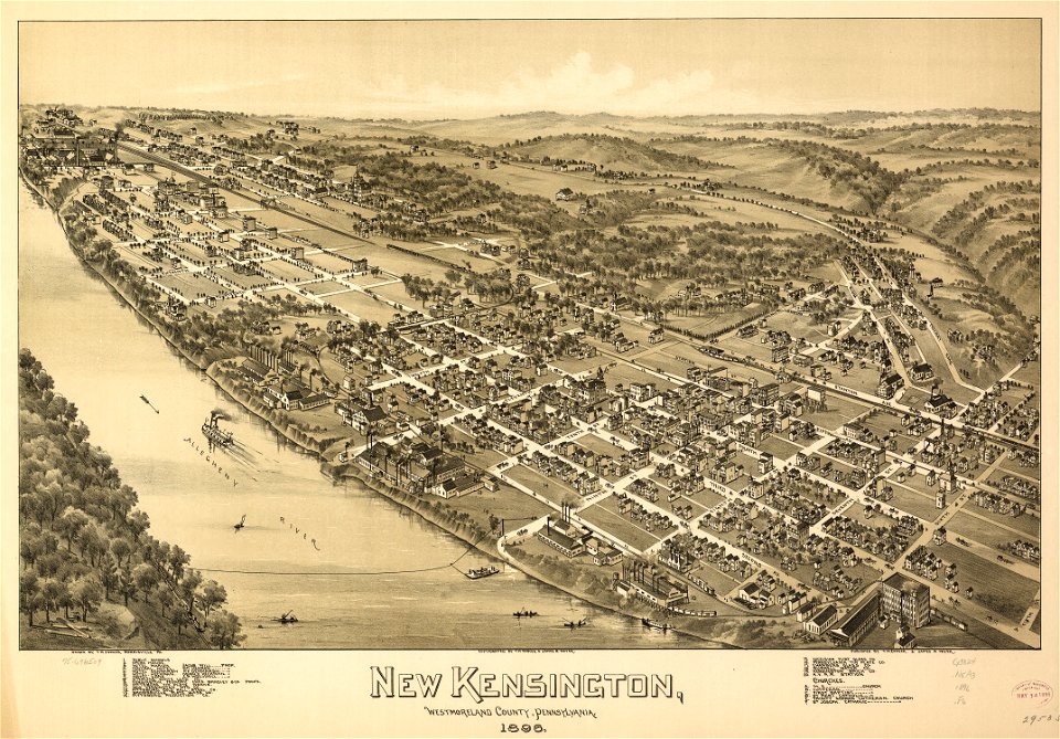
pennsylvania
verona
pennsylvania
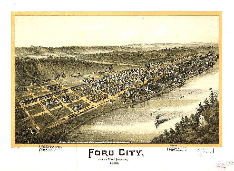
ford city
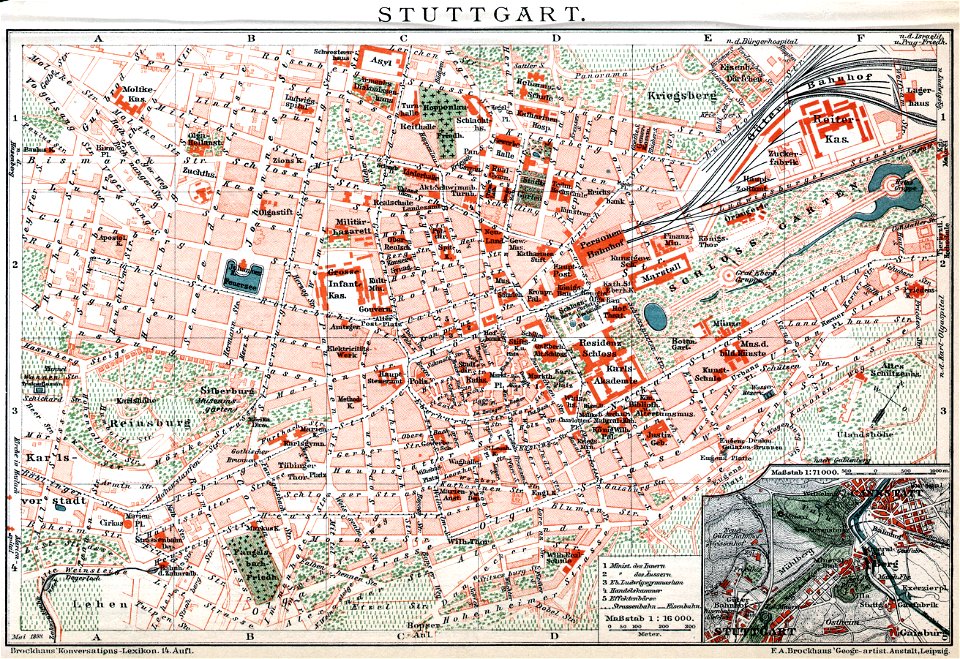
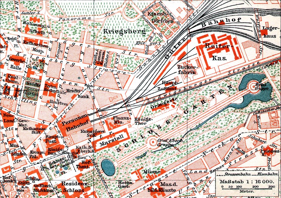
brockhaus' konversations-lexikon (1892)
maps by brockhaus
brockhaus' konversations-lexikon (1892)
maps by brockhaus
united states geological survey maps
old maps of new york (state)
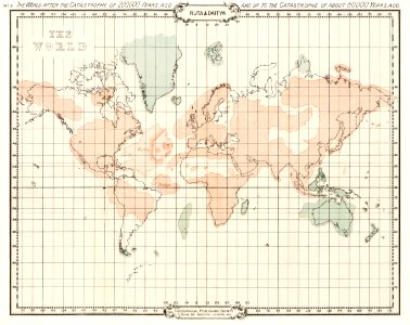
world map
maps
pennsylvania
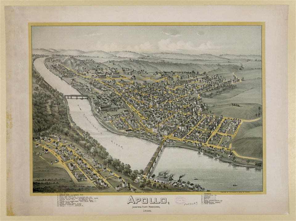
apollo
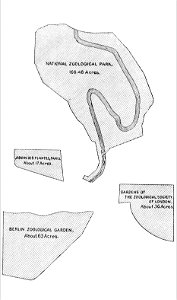
popular science monthly illustrations/volume 48
1896 maps
brockhaus' konversations-lexikon (1892)
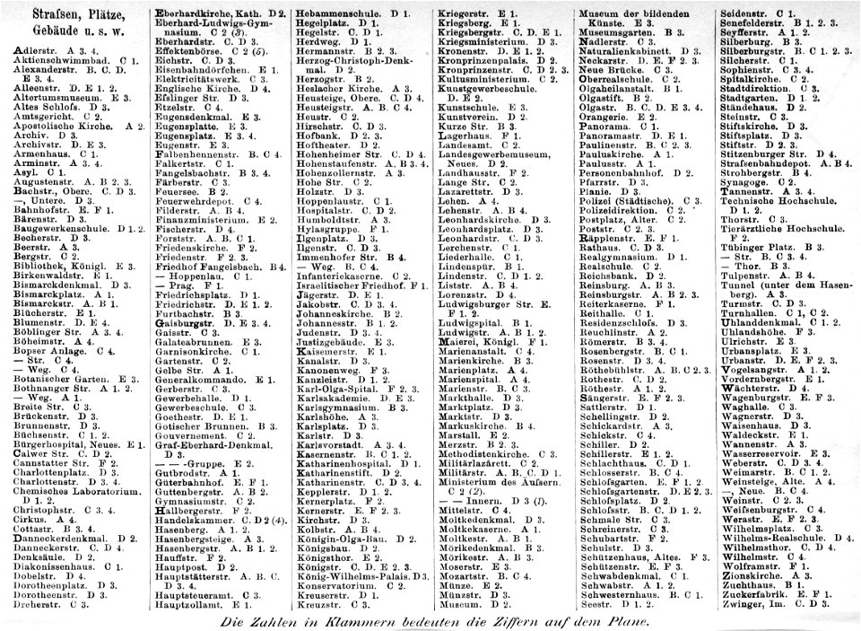
maps of stuttgart
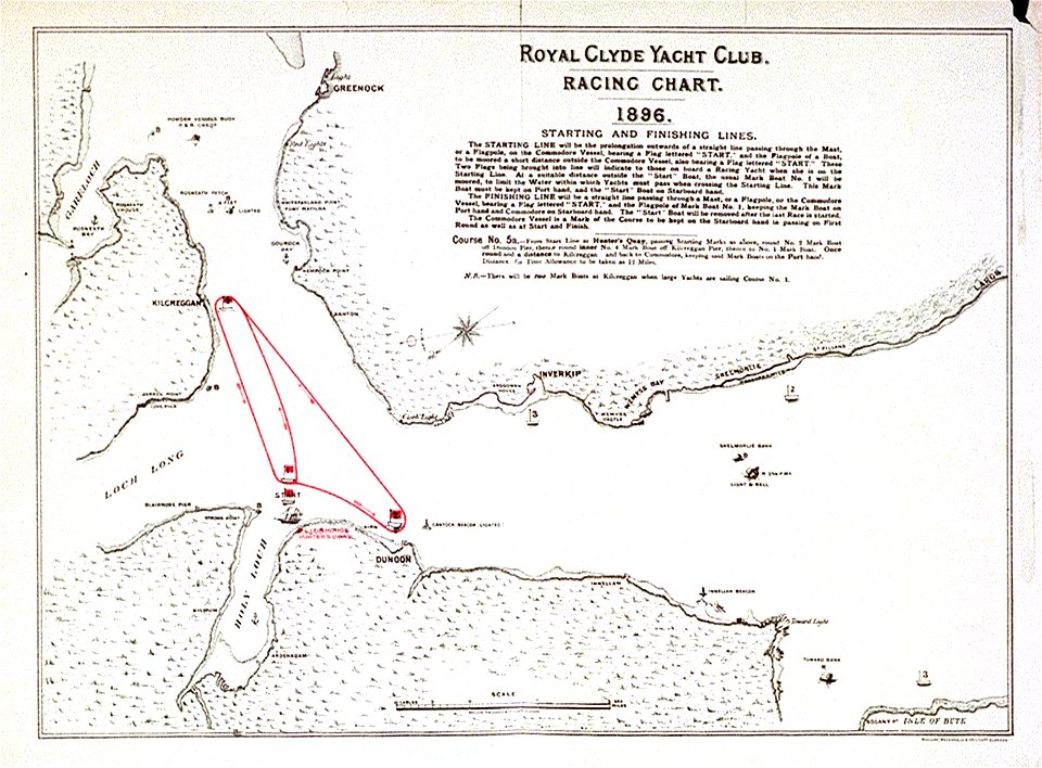
drawings and watercolours of the royal museums greenwich
printing
illustrations from 'robinson crusoe' by walter paget
people with maps in art
popular science monthly illustrations/volume 48
1896 maps
zoos in art
1896 maps
1896 maps of canada
township of malbay
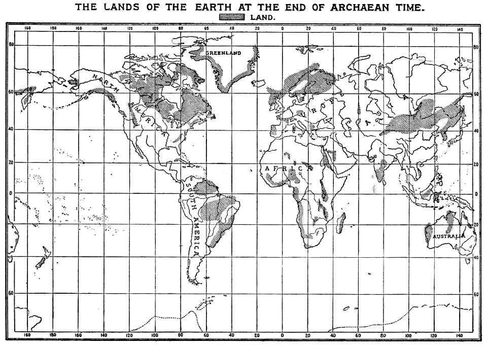
history of geology
1896 maps
sidewalk
pavement
self-published work
color
self-published work
pages with maps
architecture
travel
architecture
color
architecture
lawn
self-published work
town
village
roof
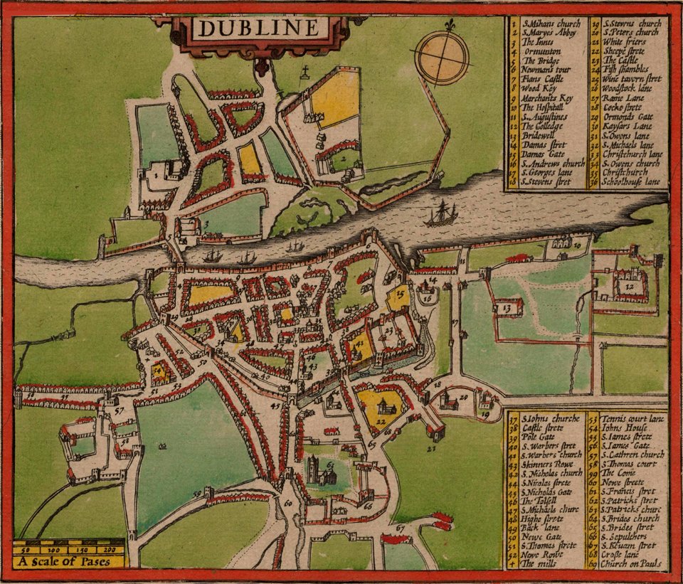
st mary's church
dublin
architecture
village
architecture
city
self-published work
architecture
downtown pittsburgh
self-published work
self-published work
architecture
self-published work
architecture
architecture
city
architecture
city
self-published work
pages with maps
sidewalk
facade
mountain
village
self-published work
town
self-published work
roof
self-published work
pages with maps
architecture
facade
landscape
blue sky
self-published work
village
self-published work
town
bromfield street (boston, massachusetts)
granary burying ground
village
roof
village
roof
architecture
lawn
architecture
town
old maps of svalbard
old maps of iceland
village
roof
nationaldenkmal kaiser wilhelm i (berlin)
berlin und seine bauten
architecture
city
maps from the mechanical curator collection
through the subarctic forest (1896) by pike
self-published work
village
maps from the mechanical curator collection
through the subarctic forest (1896) by pike
fire and sword in the sudan (1896) by slatin
maps from the mechanical curator collection
fire and sword in the sudan (1896) by slatin
maps from the mechanical curator collection
winthrop square (boston)
downtown crossing
eberts villaby
franz šedivý
saltsjöbadens sjukhus
saltsjöbaden, maps
old maps of khartoum
history of omdurman
maps of the mahdist war
1890s maps of sudan
maps of ghent by armand heins
old maps of ghent
1895 sanborn fire insurance map from new orleans, orleans parish, louisiana
maps in the library of congress
topographischer atlas der schweiz
kraftwerk wildegg
offizieller katalog der münchener jahres-ausstellung 1896 im kgl. glaspalast
anna marie wirth
historical
history
historical
history
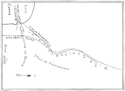
old maps of athens
1896 in athens
1 - 100 of 328
Next page
/ 4