Log in
All resources
Create a design
141 Free Images of 1864 Maps
topographic map of france, 1864
lemercier & cie.
maps in the library of congress
pages with maps
cc-zero
malerischer plan von frankfurt am main und seiner nächsten umgebung
friedrich wilhelm delkeskamp
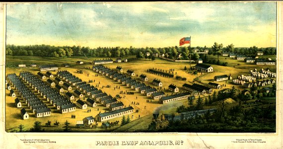
old maps of maryland
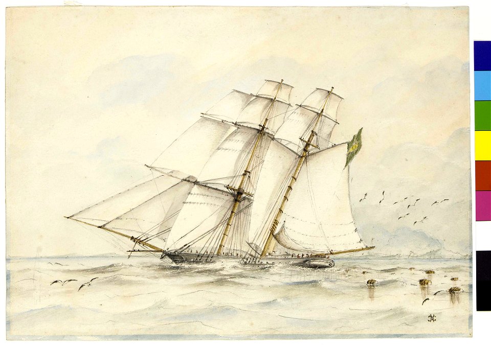
alabama (ship, 1862)
robert knox sneden
paper
maps
laurel wreaths in art
zappeion
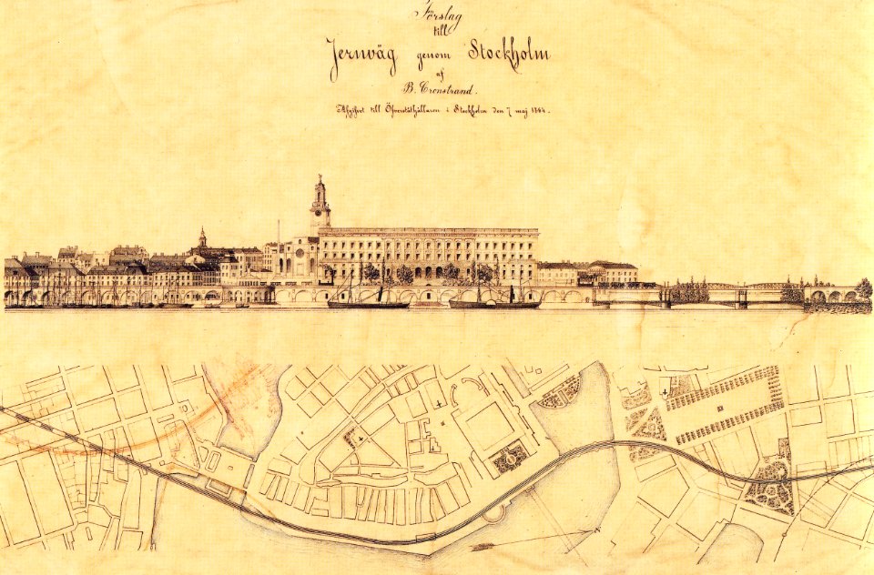
maps of gamla stan
1864 in sweden
maps of melbourne
australia
images from the new york public library
george hayward
maps in the library of congress
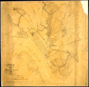
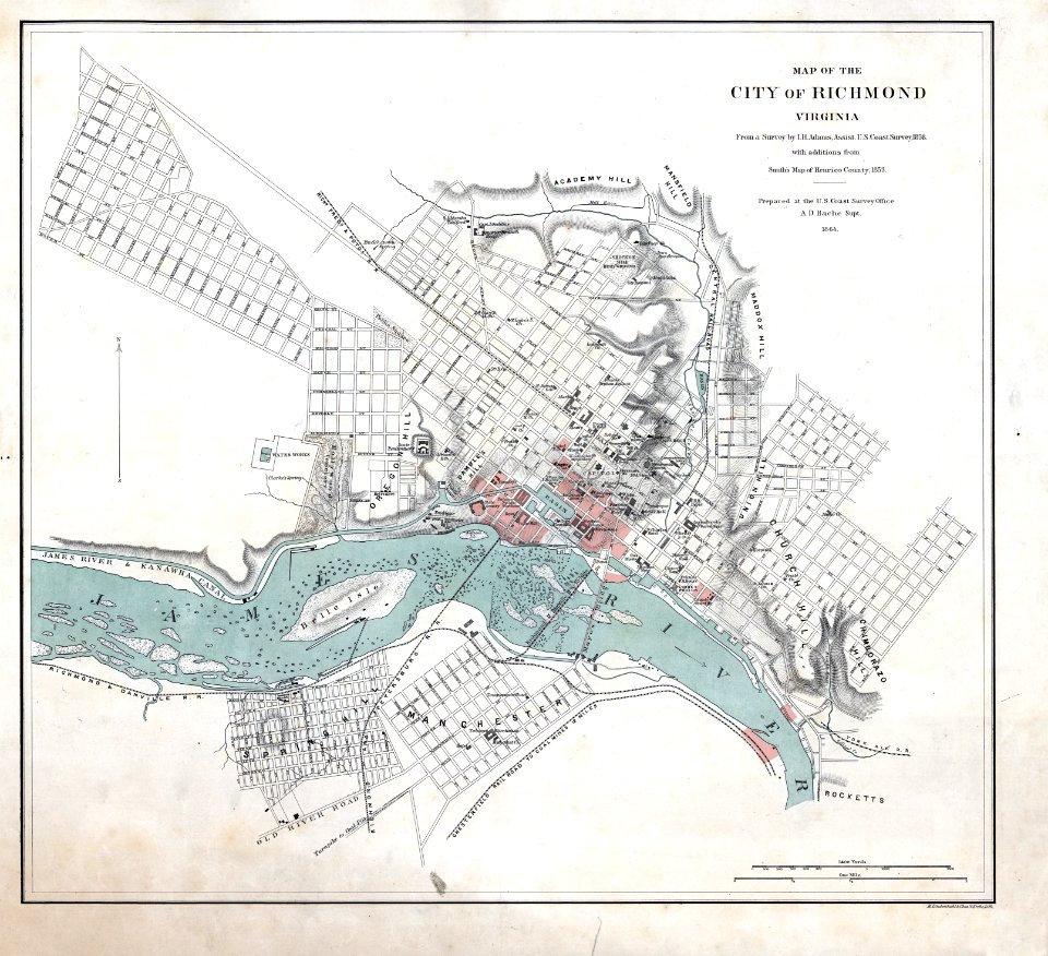
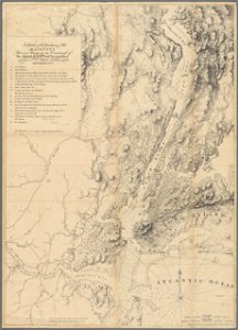
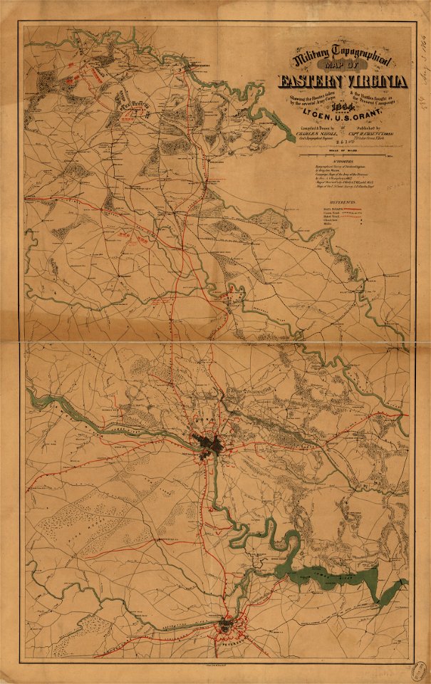
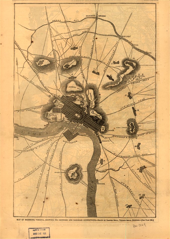
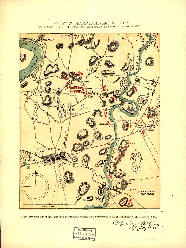
1864 maps of virginia
maps in the library of congress
old maps of maryland
maps in the library of congress
old maps of maryland
maps in the library of congress
1864 maps of virginia
maps in the library of congress
1864 maps of virginia
maps in the library of congress
old maps of maryland
maps in the library of congress
old maps of maryland
maps in the library of congress
old maps of maryland
maps in the library of congress
old maps of maryland
maps in the library of congress
1894 maps
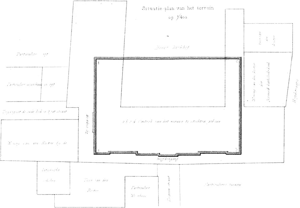
bouwkundige bijdragen
maps of pompeii
egypt
maps
great central fair (philadelphia)
1864 maps of philadelphia
great central fair (philadelphia)
1864 maps of philadelphia
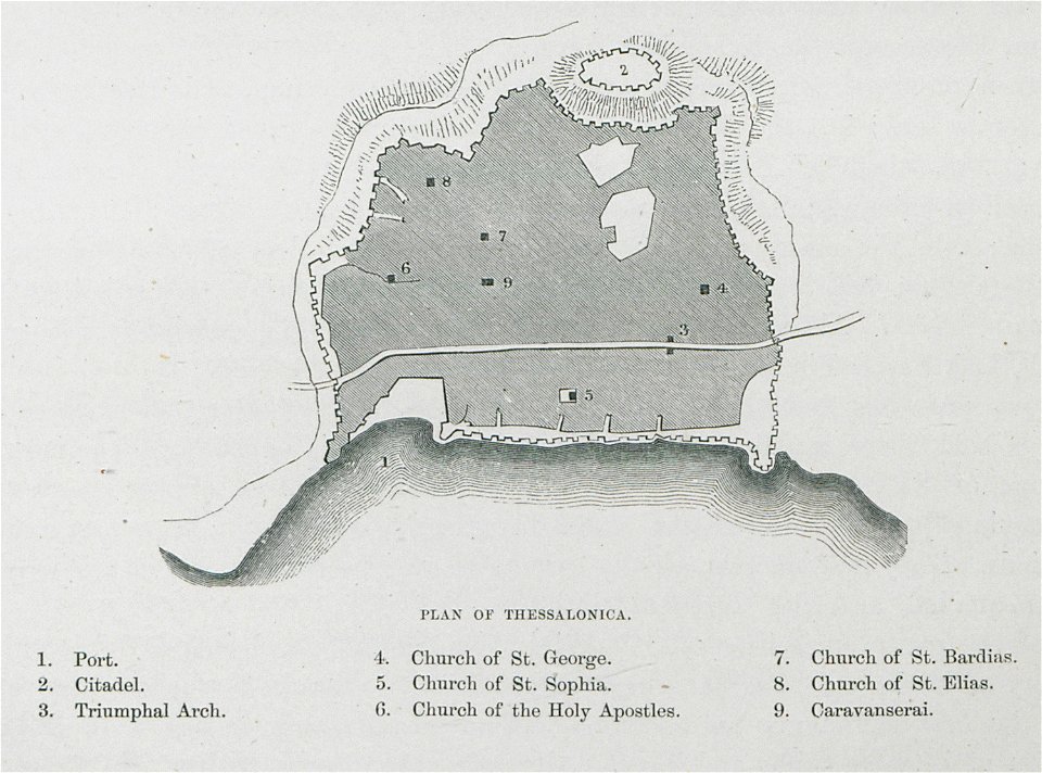
old maps of thessaloniki
day & son
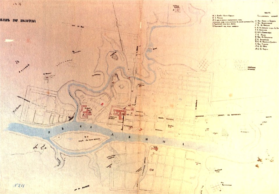
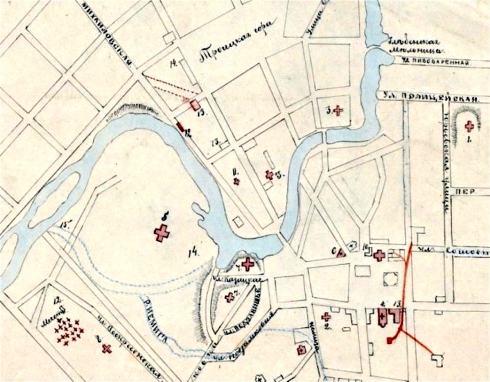
paintings of połacak by dmitry strukov
old maps of polotsk
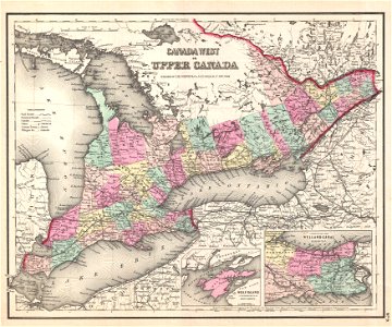
bruce county
ontario
self-published work
pages with maps
1862
1864
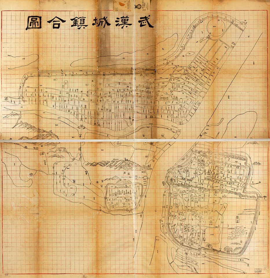
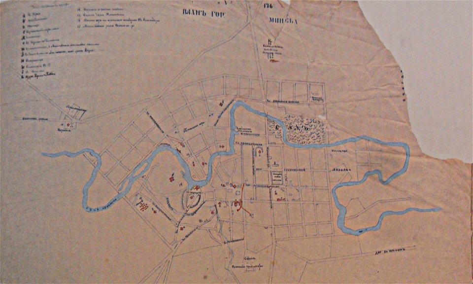
historical images of minsk
minsk in the 19th century
historical images of minsk
minsk in the 19th century
slave ships
printing
demolished buildings in groningen (city)
old maps of groningen (city)
self-published work
town
animals
bird
architecture
rural
self-published work
pages with maps
self-published work
pages with maps
tree
lawn
self-published work
pages with maps
self-published work
pages with maps
self-published work
architecture
1860s maps of new york (state)
maps showing 1776
self-published work
cc-pd-mark
hamburger stadtentwässerung
1864 maps of hamburg
maps in the library of congress
old maps of france
maps in the library of congress
old maps of france
maps of the new york and new jersey campaign
maps showing 1776
old maps of georgia (u.s. state)
maps in the library of congress
maps in the library of congress
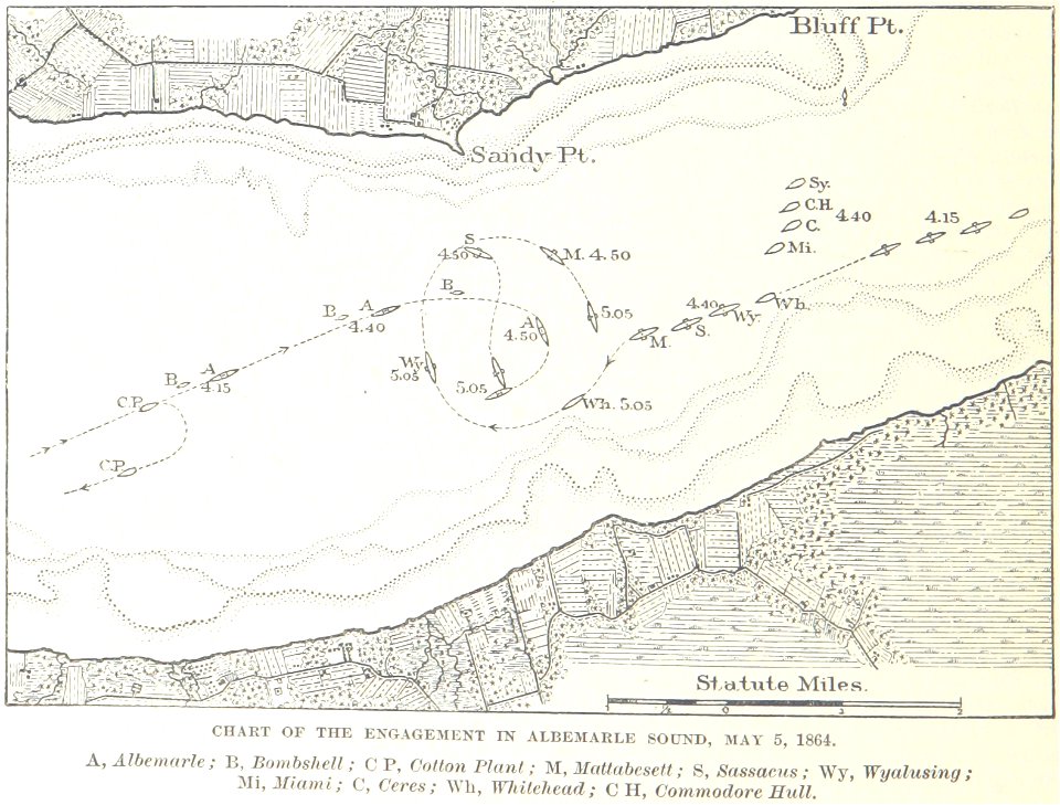
battle of cherbourg (1864)
topographic map of france, 1864
lemercier & cie.
topographic map of france, 1864
lemercier & cie.
topographic map of france, 1864
lemercier & cie.
topographic map of france, 1864
lemercier & cie.
topographic map of france, 1864
lemercier & cie.
topographic map of france, 1864
lemercier & cie.
topographic map of france, 1864
lemercier & cie.
topographic map of france, 1864
lemercier & cie.
topographic map of france, 1864
lemercier & cie.
topographic map of france, 1864
lemercier & cie.
topographic map of france, 1864
lemercier & cie.
topographic map of france, 1864
lemercier & cie.
topographic map of france, 1864
lemercier & cie.
topographic map of france, 1864
lemercier & cie.
topographic map of france, 1864
lemercier & cie.
topographic map of france, 1864
lemercier & cie.
topographic map of france, 1864
lemercier & cie.
topographic map of france, 1864
lemercier & cie.
topographic map of france, 1864
lemercier & cie.
topographic map of france, 1864
lemercier & cie.
topographic map of france, 1864
lemercier & cie.
topographic map of france, 1864
lemercier & cie.
topographic map of france, 1864
lemercier & cie.
topographic map of france, 1864
lemercier & cie.
topographic map of france, 1864
lemercier & cie.
topographic map of france, 1864
lemercier & cie.
topographic map of france, 1864
lemercier & cie.
topographic map of france, 1864
lemercier & cie.
topographic map of france, 1864
lemercier & cie.
topographic map of france, 1864
lemercier & cie.
topographic map of france, 1864
lemercier & cie.
topographic map of france, 1864
lemercier & cie.
old maps of georgia (u.s. state)
maps in the library of congress
historical
history
maps of frankfurt-innenstadt
maps of frankfurt-nordend
maps in the library of congress
andersonville prison
new bern, north carolina
solon m. allis
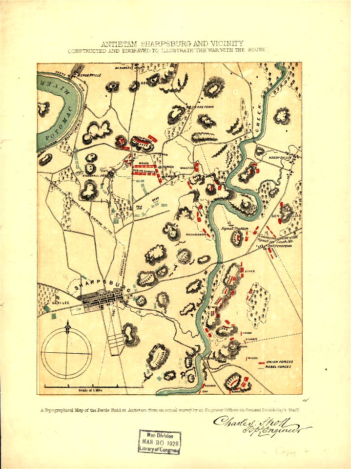
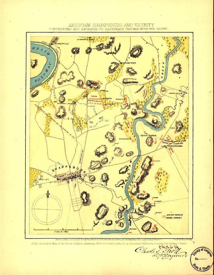
old maps of the american civil war
francis d'avignon
dominikanerkloster (frankfurt)
judengasse (frankfurt)
historical
history
malerischer plan von frankfurt am main und seiner nächsten umgebung
19th-century maps of frankfurt am main
kaiserdom st. bartholomäus in the 19th century
maps of frankfurt-innenstadt
maps in the library of congress
1862 maps of virginia
ligne de strasbourg-ville à saint-dié
frédéric-émile simon
redeeming the republic (1890)
1890s maps showing history
goetheplatz (frankfurt)
an der hauptwache
great central fair (philadelphia)
1864 maps of philadelphia
history
florida
palais rothschild (bockenheimer landstraße)
bockenheimer landstraße (frankfurt am main)
demolished train stations in frankfurt am main
demolished buildings in frankfurt-innenstadt
historical
history
history of naturmuseum senckenberg
eschenheimer tor
neues palais an der grünen burg
maps of grüneburgpark
redeeming the republic (1890)
1890s maps showing history
adolf eltzner, svate mesto jerusalem za casu krista pana, 1864
eran laor cartographic collection
1 - 100 of 141
Next page
/ 2


![Plan of the circle battle between the U.S. ship "Keasarge," Capt. Winslow, and the Confederate cruiser "Alabama," Capt. Raphael Semmes, off the harbor [of] Cherbourg, France: forenoon of Sunday June 19th 1864., 19 June 1864](https://cdn.creazilla.com/illustrations/10000851176/plan-of-the-circle-battle-between-the-us-ship-keasarge-capt-winslow-and-the-confederate-cruiser-alabama-capt-raphael-semmes-off-the-harbor-of-cherbourg-france-forenoon-of-sunday-june-19th-1864-19-june-1864-md.jpg)
![[Map of the defeat of the Confederate ship Alabama by the U.S. steamer Kearsarge on June 19, 1864, off Cherbourg, France].](https://cdn.creazilla.com/illustrations/10001534884/map-of-the-defeat-of-the-confederate-ship-alabama-by-the-us-steamer-kearsarge-on-june-19-1864-off-cherbourg-france-md.jpg)