Log in
All resources
Create a design
377 Free Images of 1800 Maps
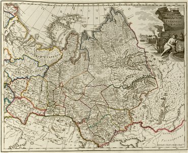
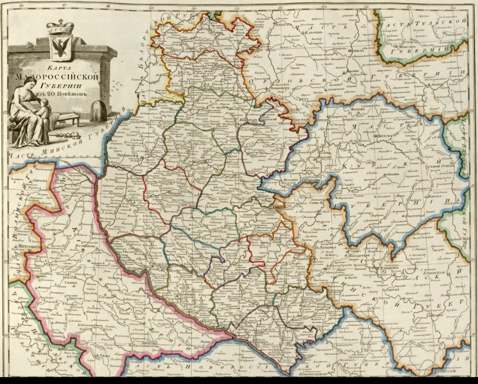
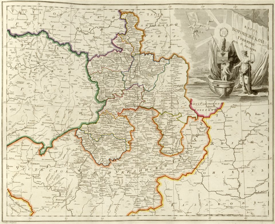
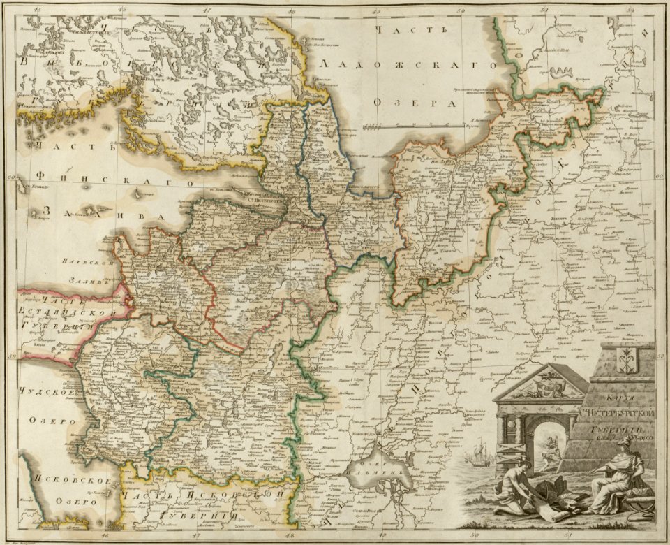
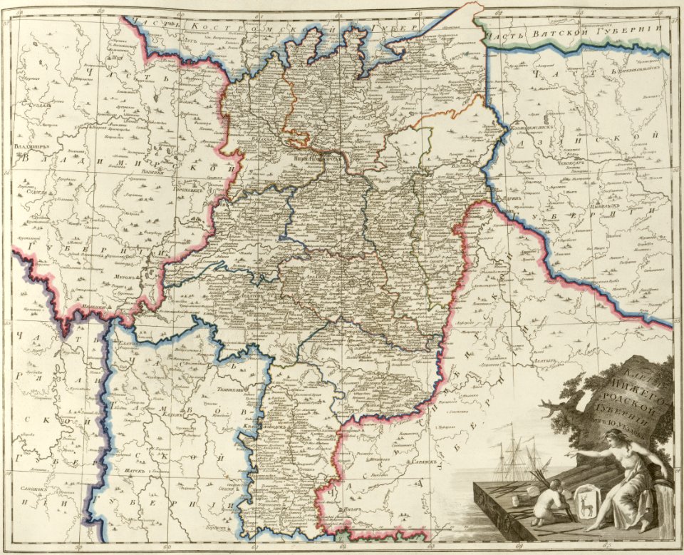
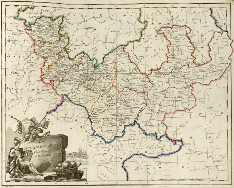
atlas of the russian empire (1800)
1800s public domain
1800s
vintage maps
old map
world map
poster
maps antique
vintage
vintage poster
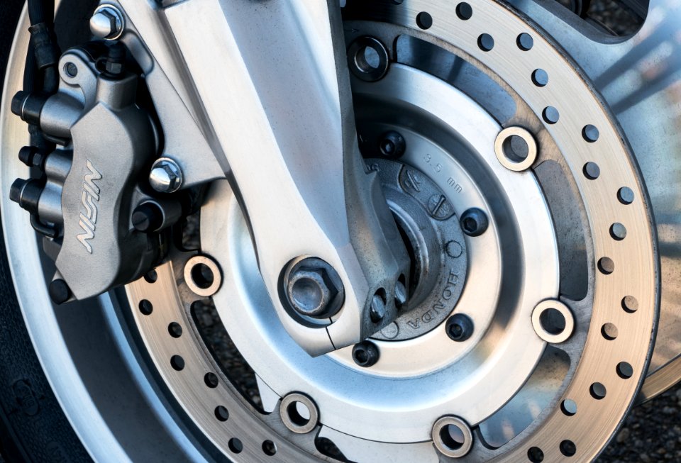
honda vtx 1800 c
car
vehicles in lysekil municipality
honda vtx 1800 c
motorcycle handlebar
honda vtx 1800 c
v-twin motorcycle engines
honda vtx 1800 c
jean-baptiste wicar
neoclassicism
1805 maps of the united states
maps by john cary
vintage
maps
old celestial maps
1800 maps
atlas of the russian empire (1800)
1800 maps of lithuania
antique
maps
old maps of the sea of azov
old maps of crimea
atlas of the russian empire (1800)
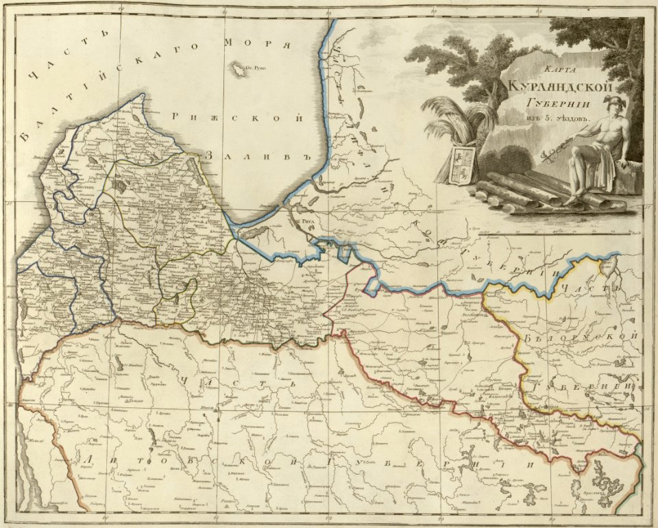
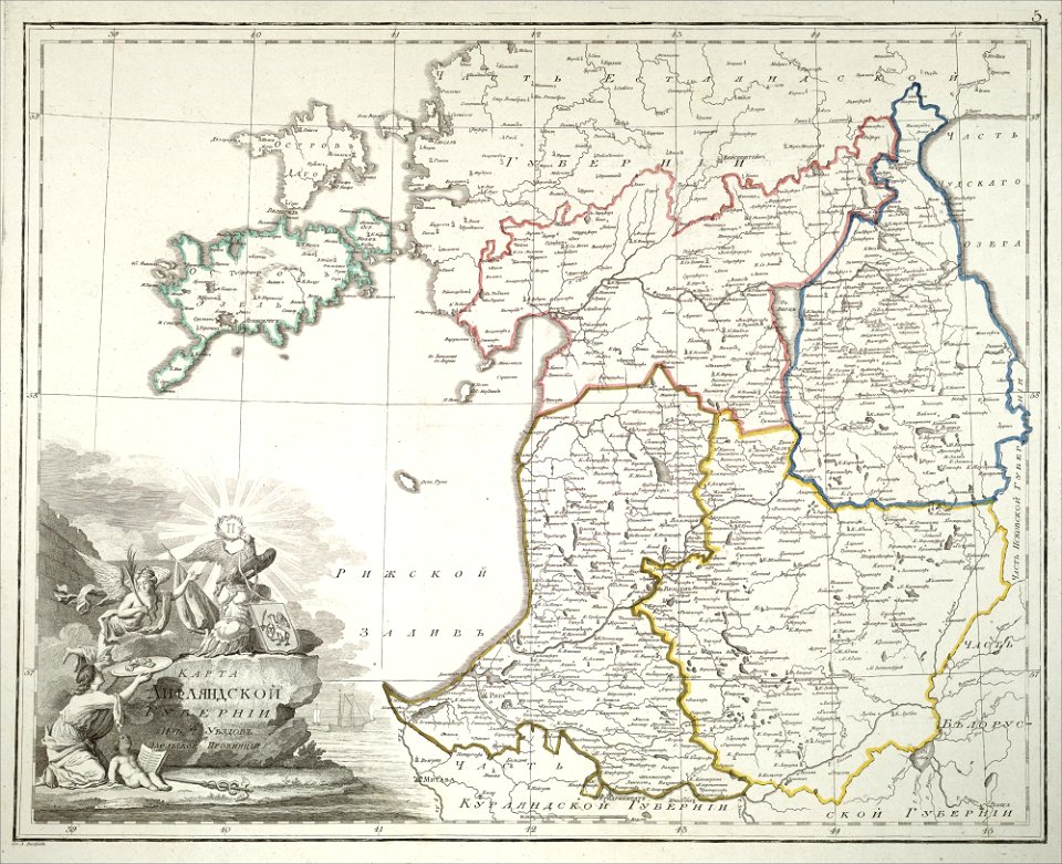
old maps of courland governorate
atlas of the russian empire (1800)
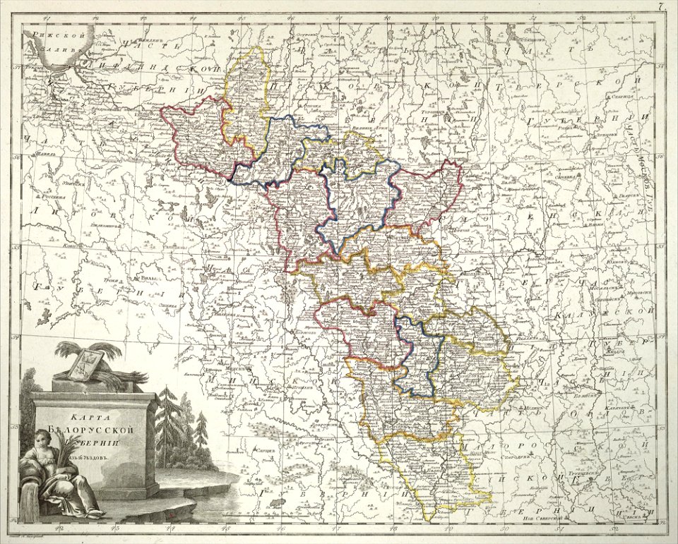
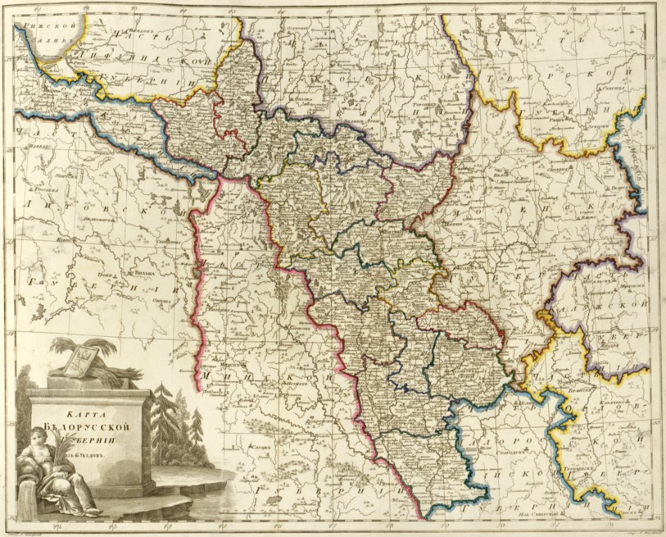
old maps of belarus
australia
maps
atlas of the russian empire (1800)
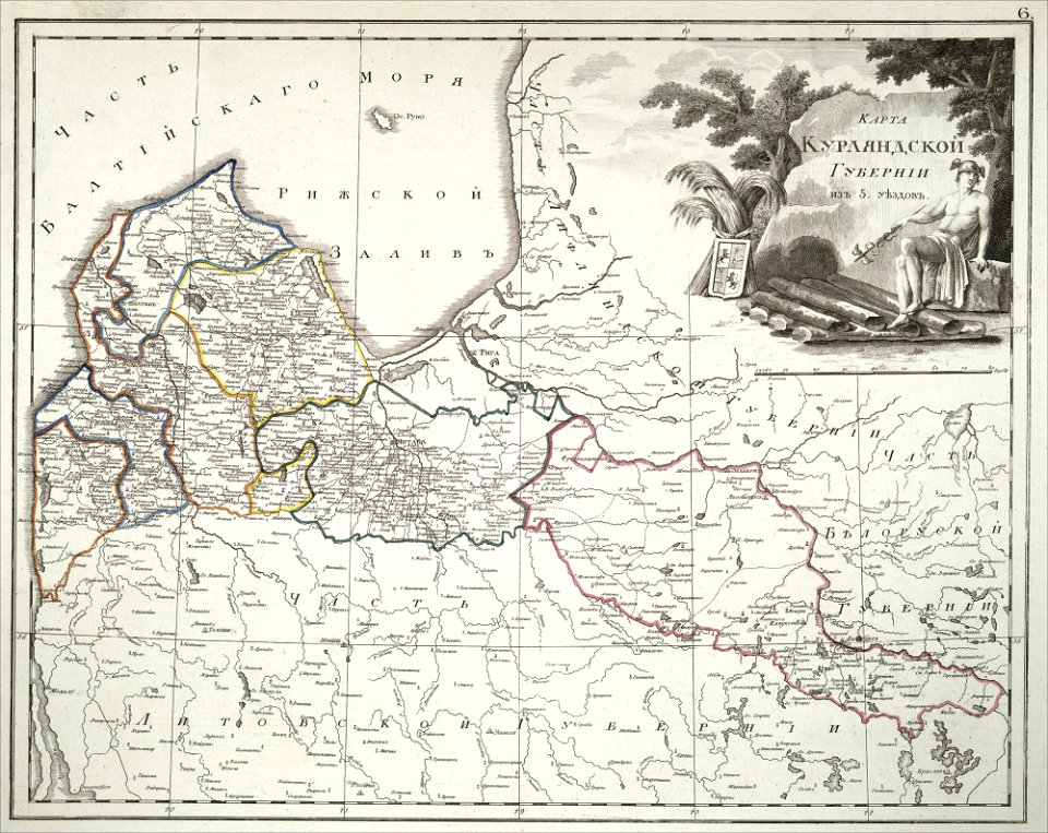
old maps of courland governorate
illustration
maps
vintage
maps
australia
maps
heinrich keller
aussersihl
maps from the mechanical curator collection
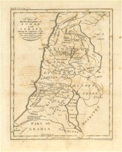
1800s maps of palestine
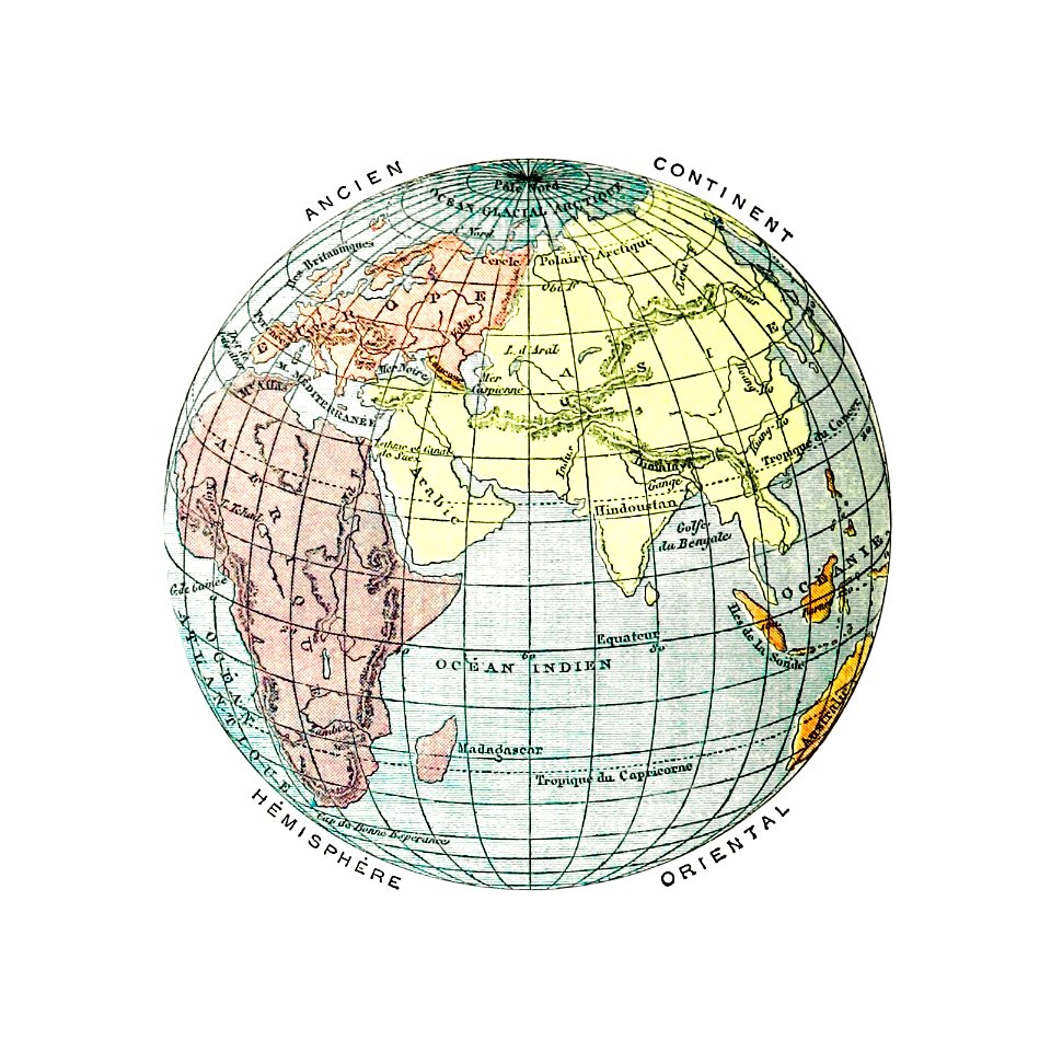
earth
maps
atlas of the russian empire (1800)
maps of astrakhan governorate
australia
maps
earth
maps
maps
land
cartography
maps
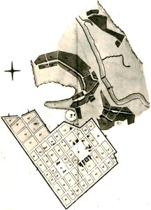
maps of petropavlovsk-kamchatsky
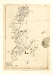
maps of russian america
cartography
maps
cartography
maps
old maps of tbilisi
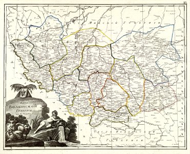
atlas of the russian empire (1800)
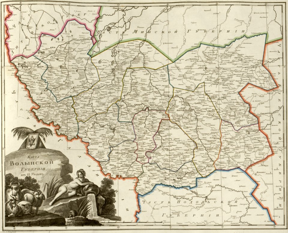
maps of volyn governorate
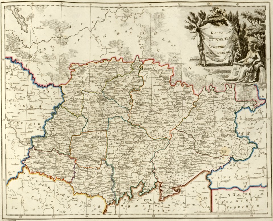
atlas of the russian empire (1800)
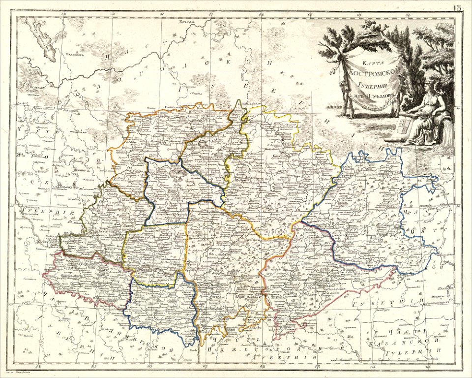
maps of kostroma governorate
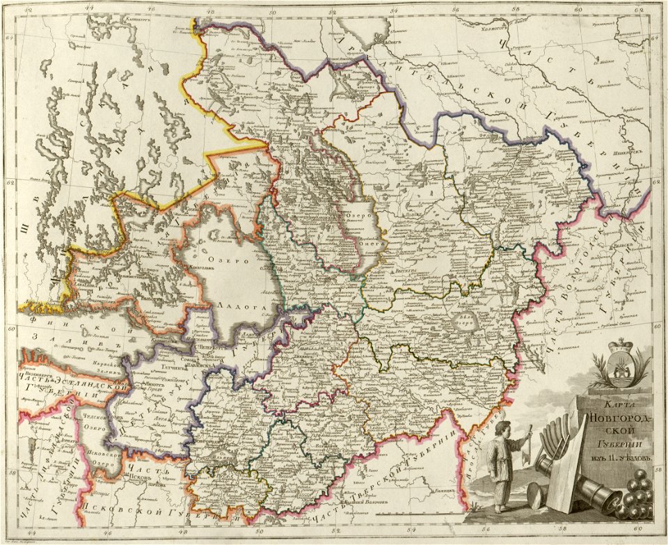
atlas of the russian empire (1800)
maps of novgorod governorate
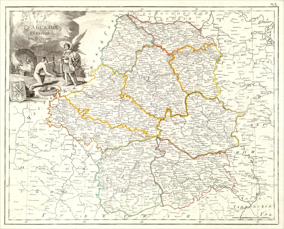
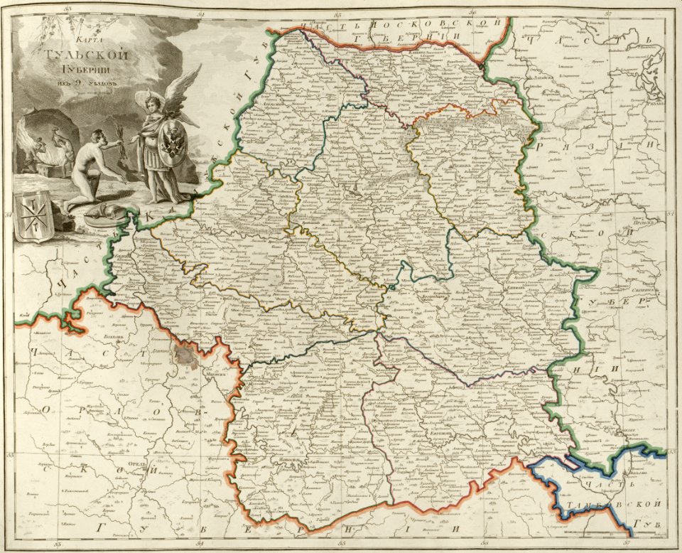
atlas of the russian empire (1800)
maps of tula governorate
atlas of the russian empire (1800)
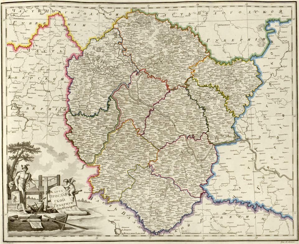
maps of yaroslavl governorate
atlas of the russian empire (1800)
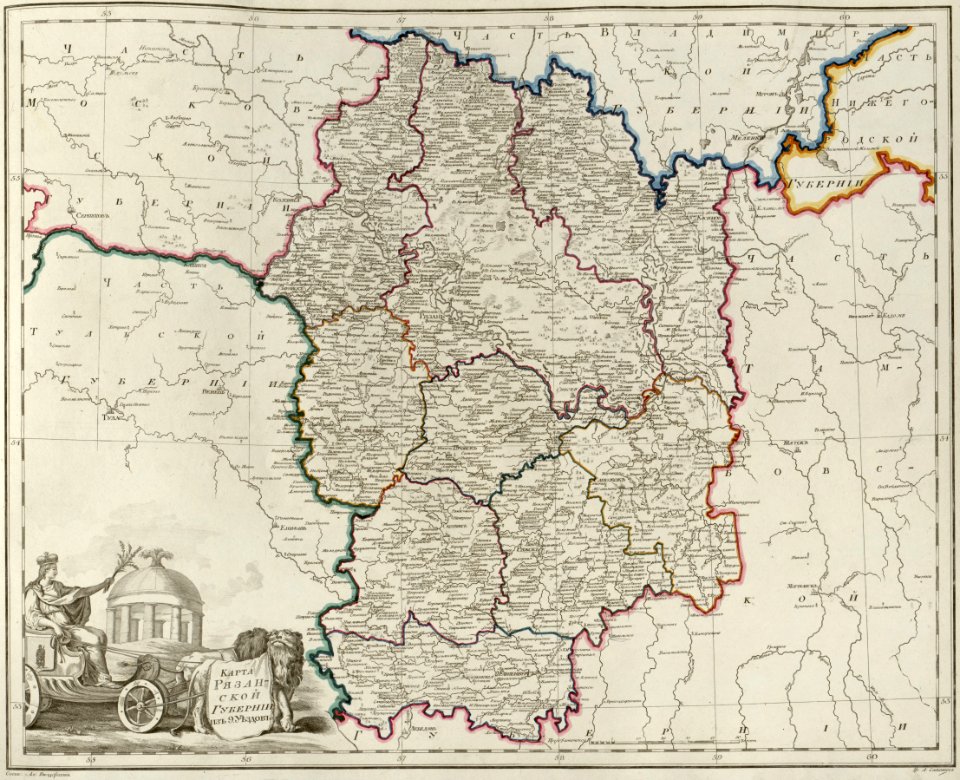
maps of ryazan governorate
atlas of the russian empire (1800)
maps of volyn governorate
atlas of the russian empire (1800)
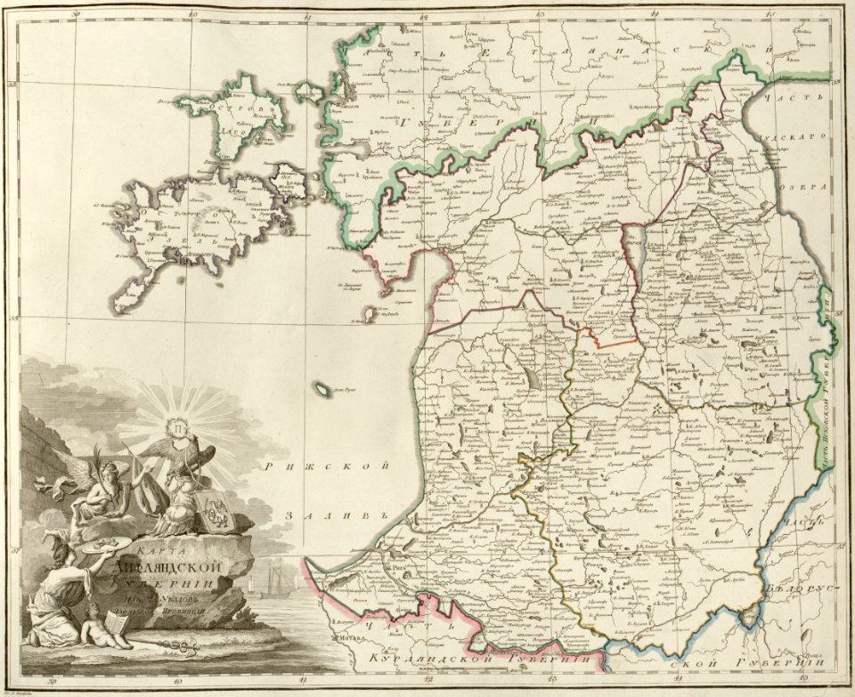
maps of liflandia governorate
atlas of the russian empire (1800)
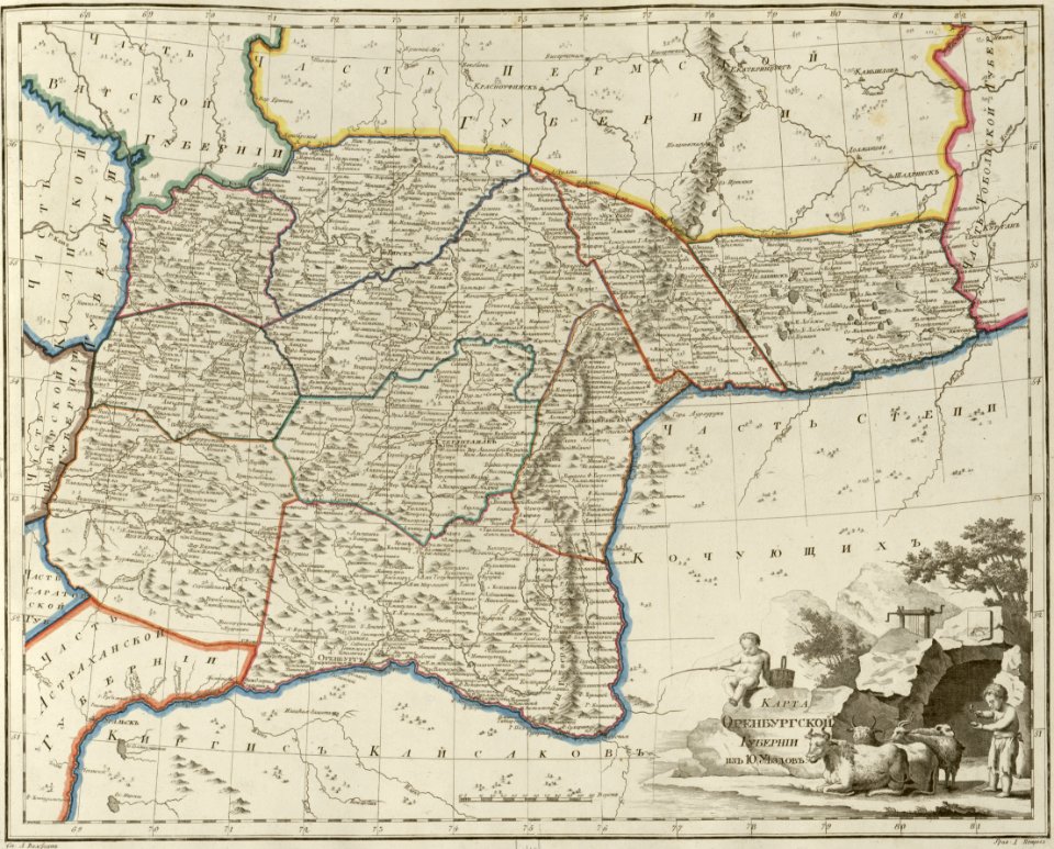
maps of orenburg governorate
atlas of the russian empire (1800)
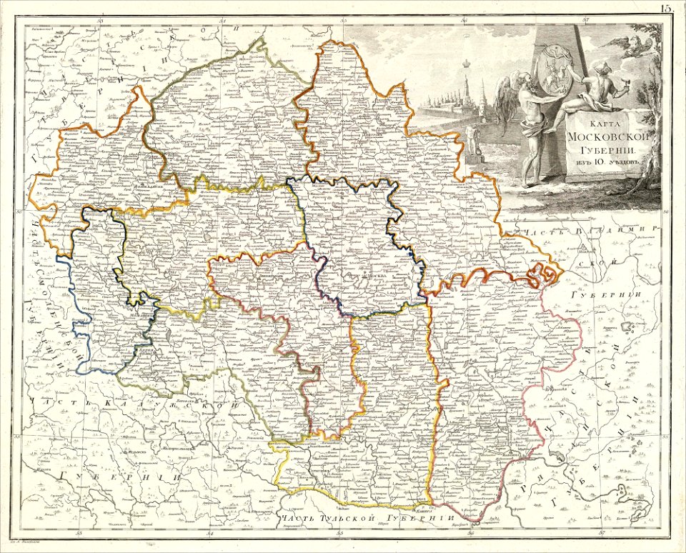
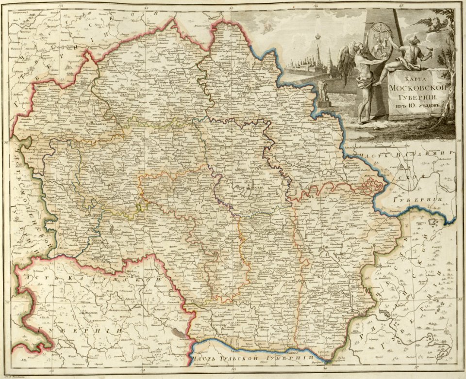
maps of moscow governorate
atlas of the russian empire (1800)
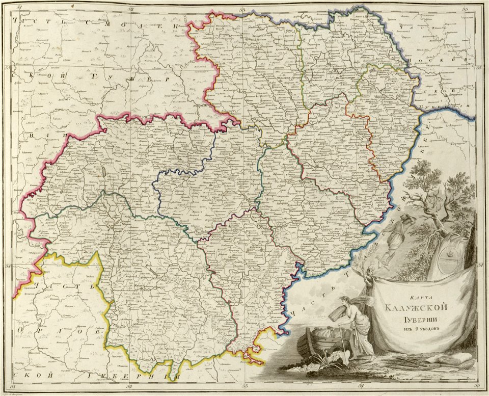
maps of kaluga governorate
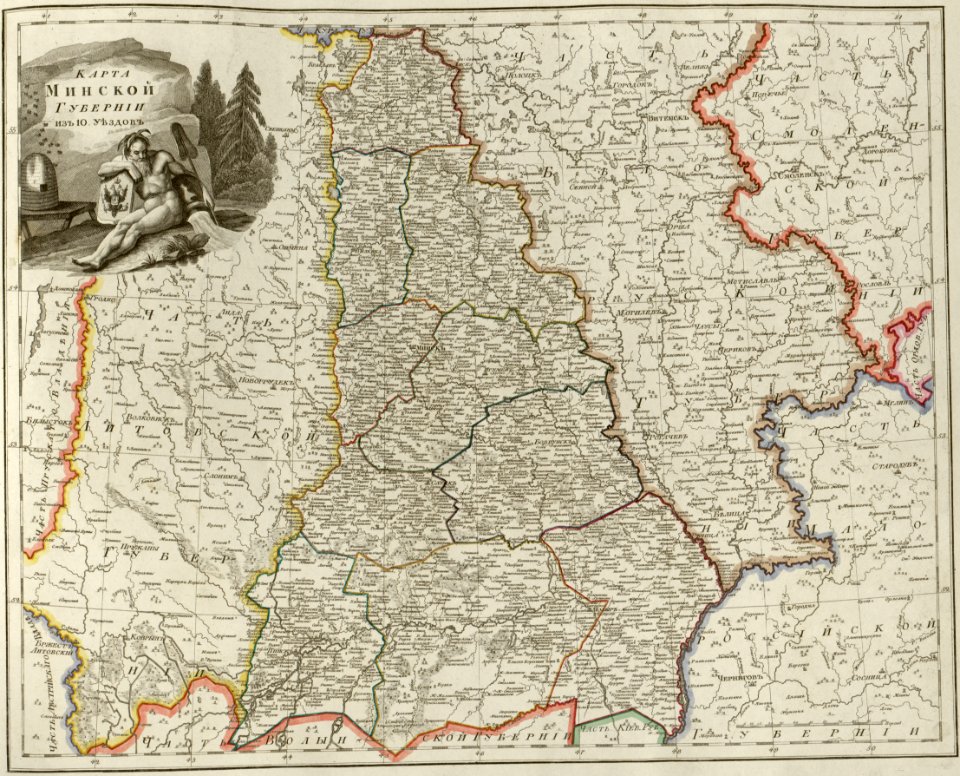
atlas of the russian empire (1800)
maps of minsk governorate
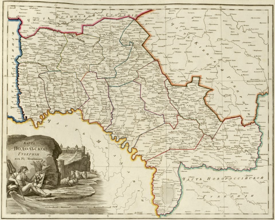
atlas of the russian empire (1800)
maps of podolia governorate
atlas of the russian empire (1800)
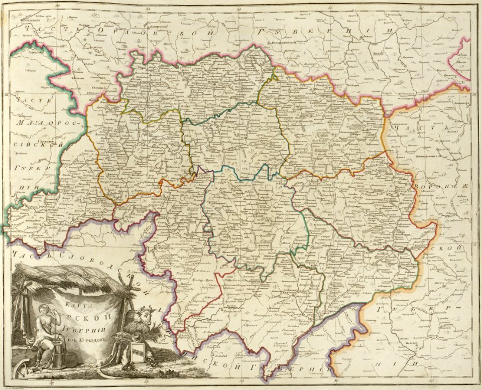
maps of kursk governorate
atlas of the russian empire (1800)
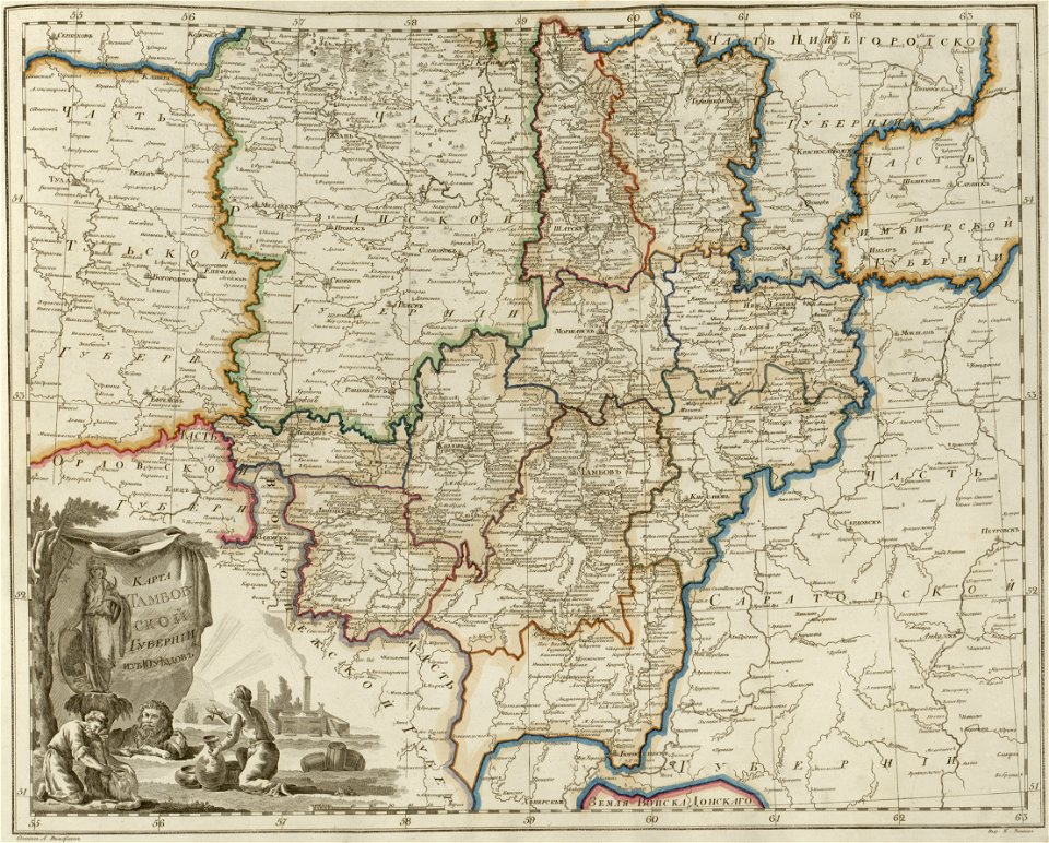
maps of tambov governorate
atlas of the russian empire (1800)
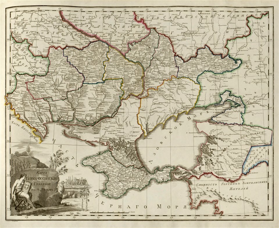
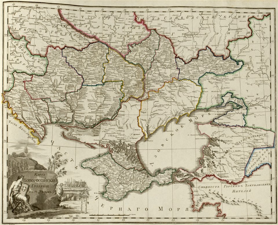
maps of novorossia governorate
atlas of the russian empire (1800)
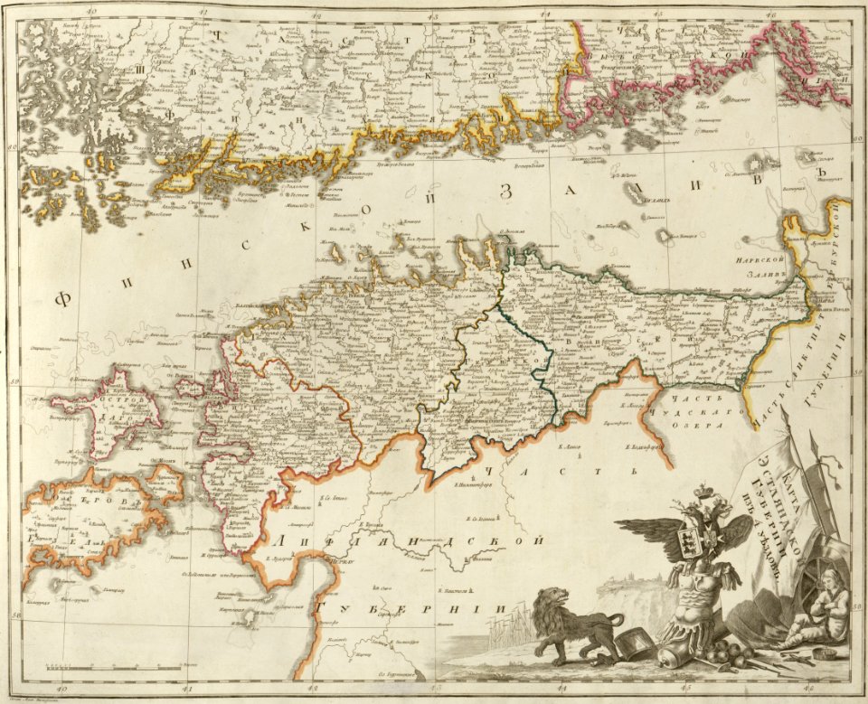
maps of estlandia governorate
atlas of the russian empire (1800)
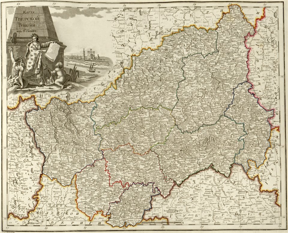
maps of tver governorate
atlas of the russian empire (1800)
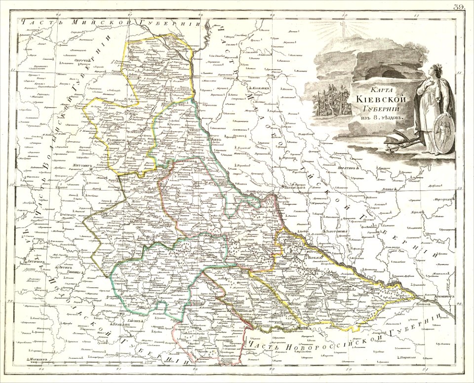
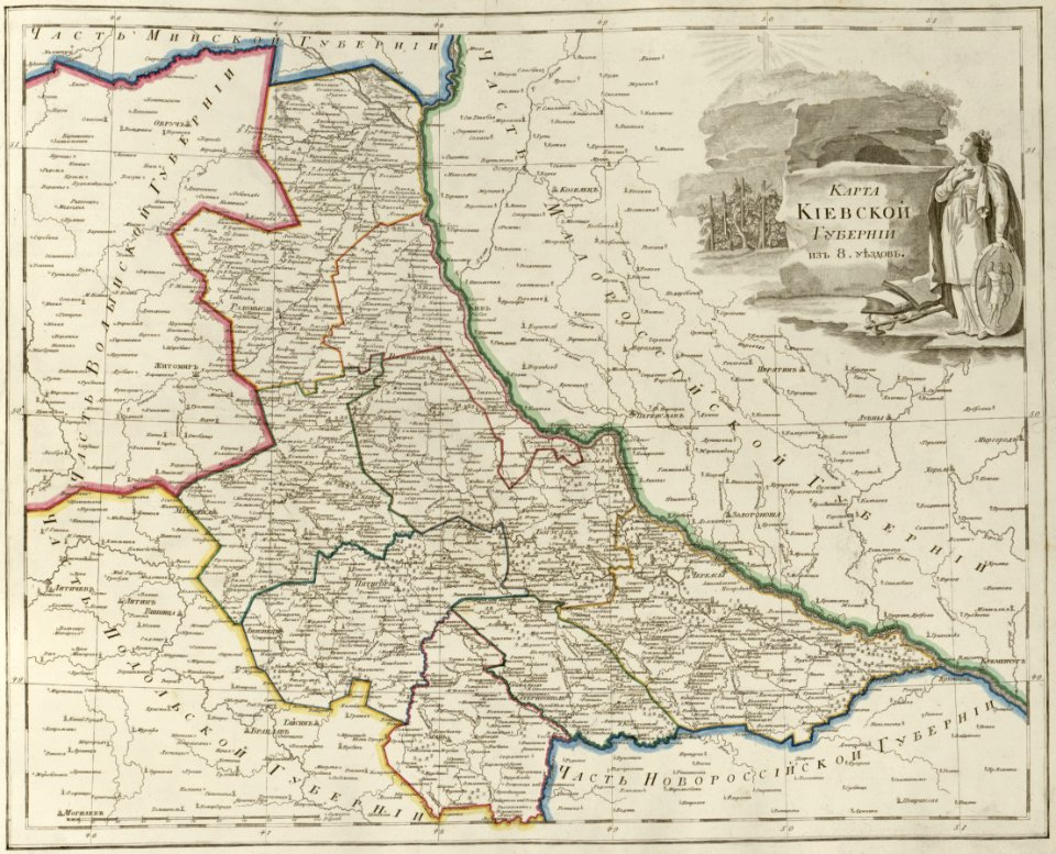
maps of kiev governorate
atlas of the russian empire (1800)
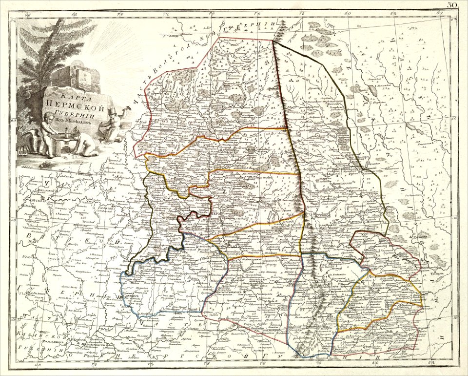
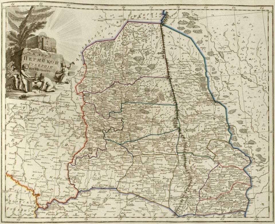
maps of perm governorate
atlas of the russian empire (1800)
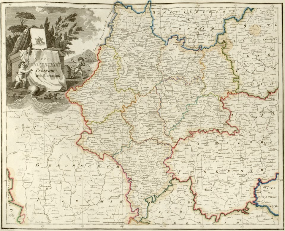
maps of smolensk governorate
atlas of the russian empire (1800)
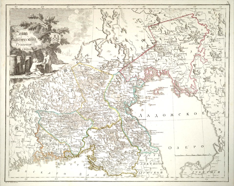
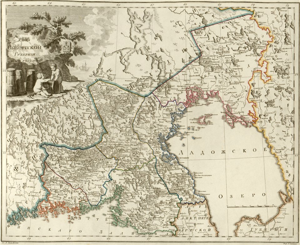
maps of wyborg governorate
atlas of the russian empire (1800)
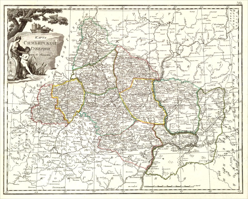
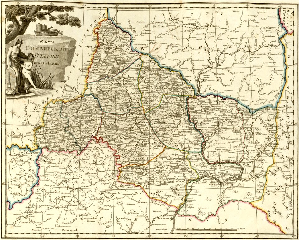
maps of simbirsk governorate
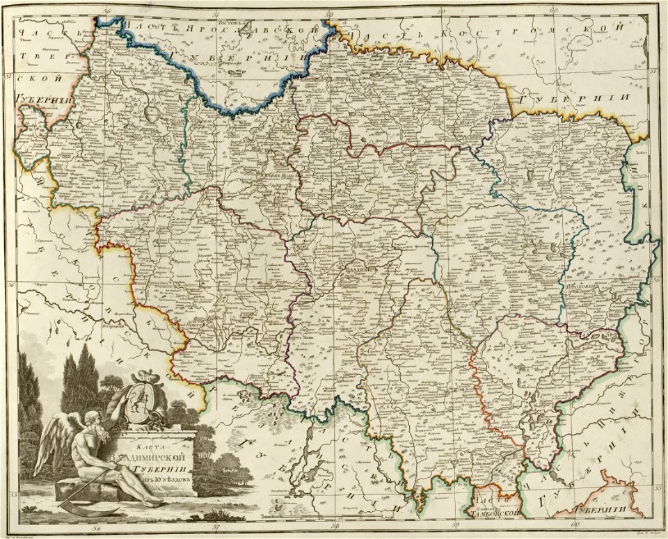
atlas of the russian empire (1800)
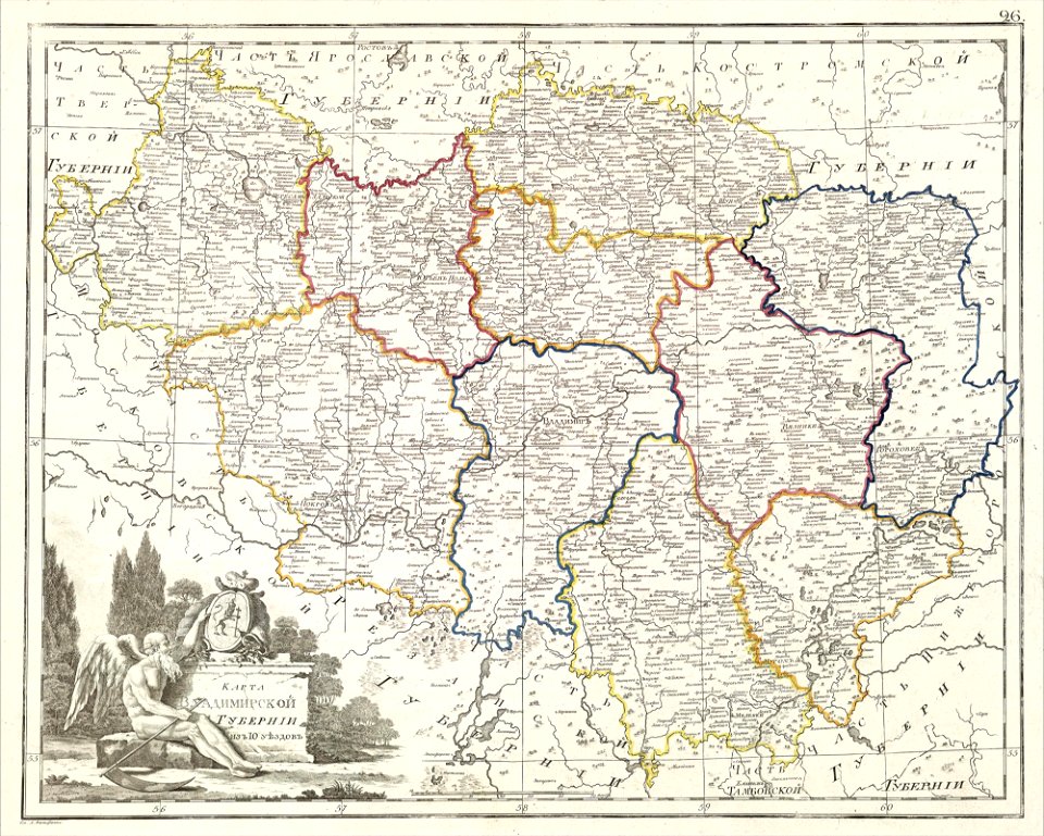
maps of vladimir governorate
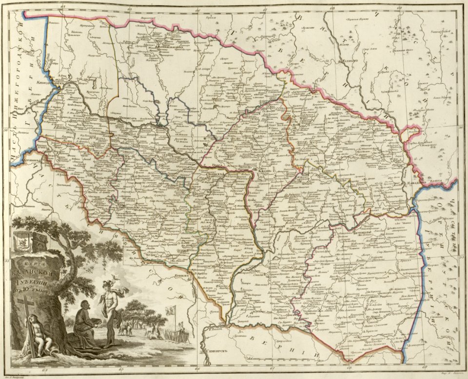
atlas of the russian empire (1800)
maps of kazan governorate
atlas of the russian empire (1800)
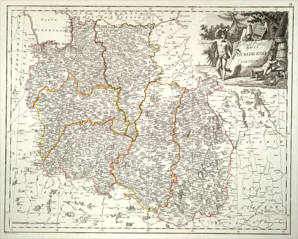
maps of pskov governorate
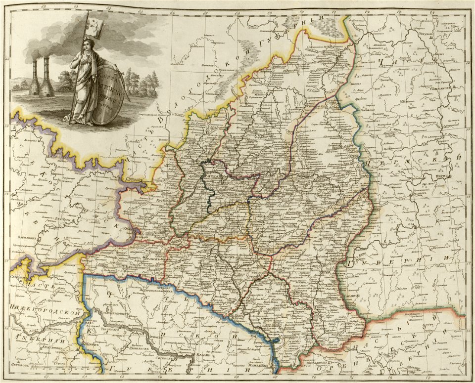
atlas of the russian empire (1800)
maps of vyatka governorate
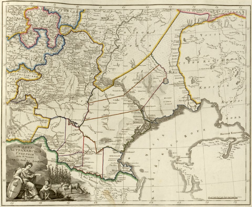
atlas of the russian empire (1800)
maps of astrakhan governorate
atlas of the russian empire (1800)
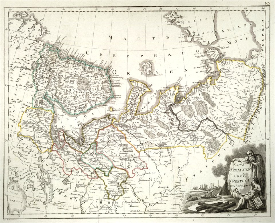
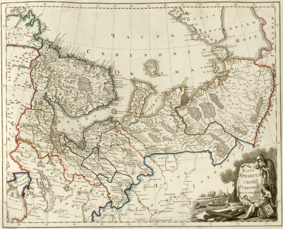
maps of arkhangelsk governorate
atlas of the russian empire (1800)
maps of saratov governorate
atlas of the russian empire (1800)
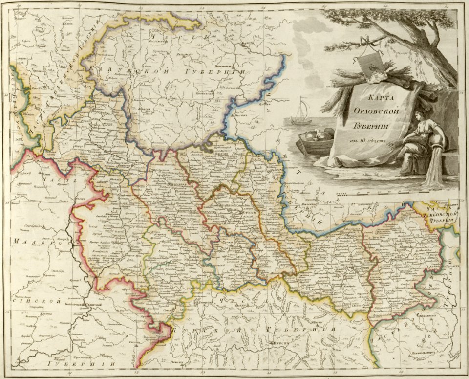
maps of oryol governorate
atlas of the russian empire (1800)
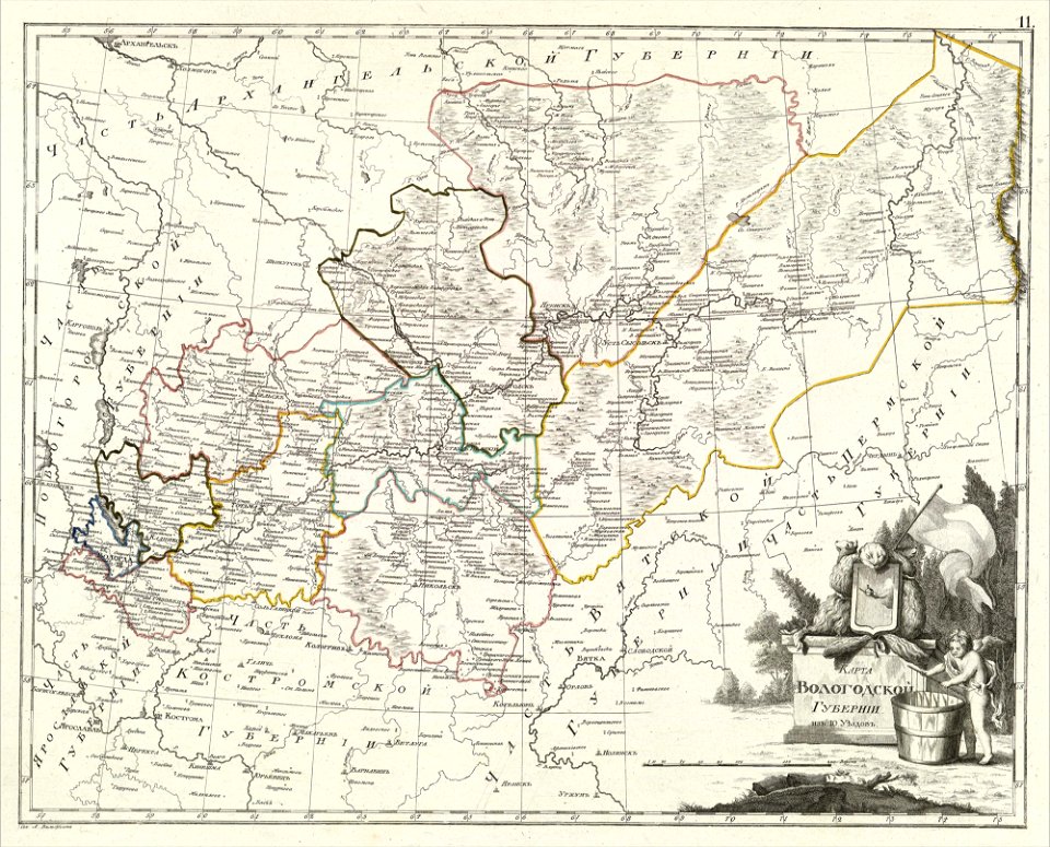
maps of vologda governorate
globe
maps
vintage
maps
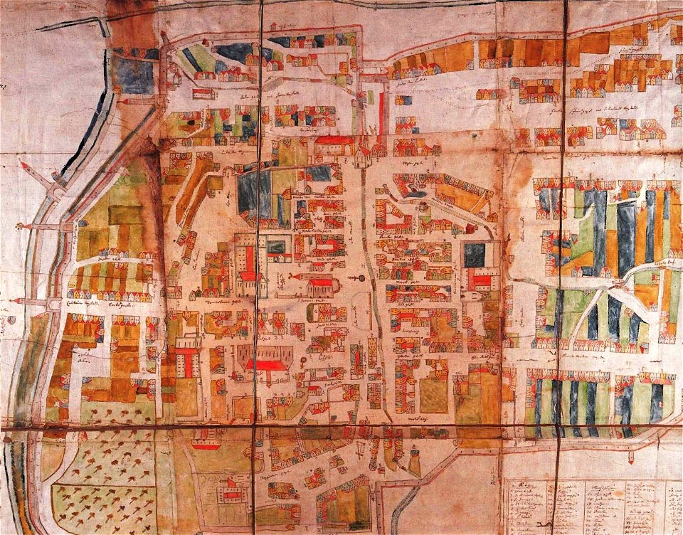
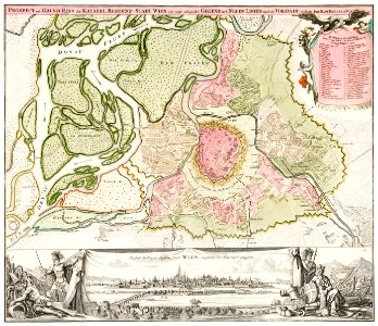
historic views of schwäbisch gmünd
dominikus debler
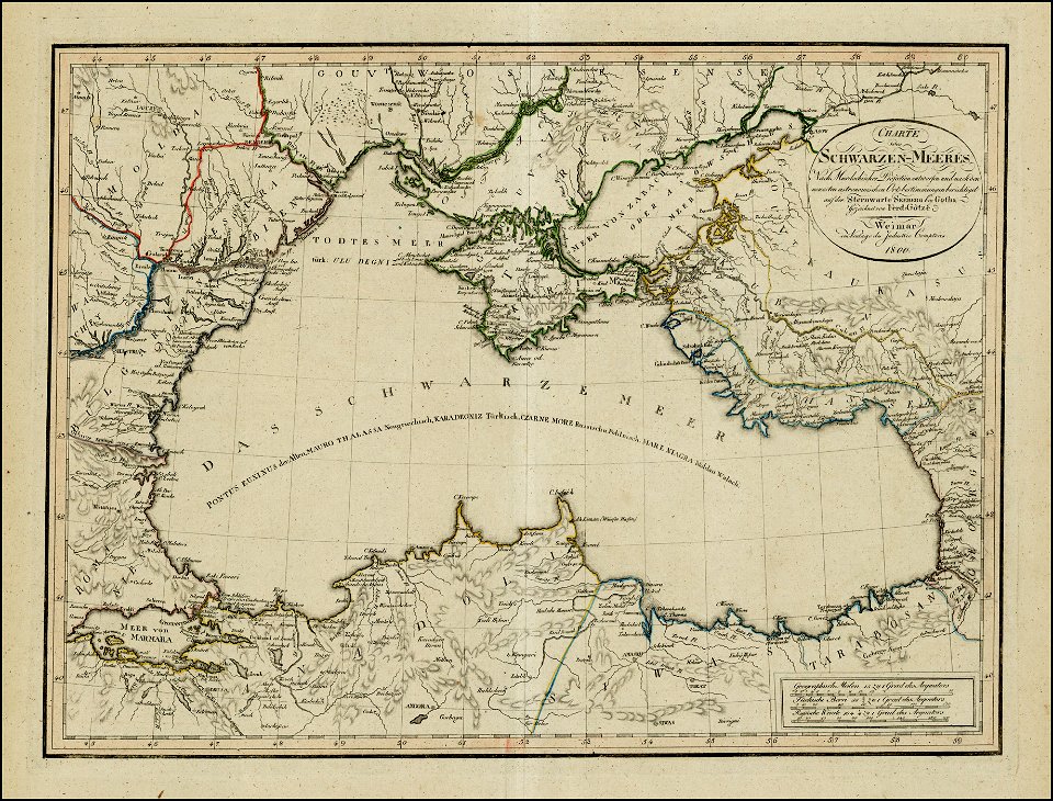
18th-century maps of the black sea
1800 maps of georgia
atlas of the russian empire (1800)
old maps of tobolsk governorate
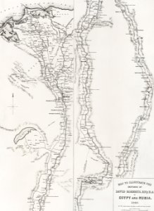
egypt
maps
atlas of the russian empire (1800)
18th-century maps of estonia
old maps of polotsk
england
maps
maps in russian state archives of ancient documents
historical images of viciebsk
old maps of governorates of the russian empire
atlas of the russian empire (1800)
old maps of governorates of the russian empire
atlas of the russian empire (1800)
old maps of governorates of the russian empire
atlas of the russian empire (1800)
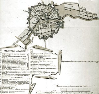
maps of saint petersburg governorate
atlas of the russian empire (1800)
maps of nizhny novgorod governorate
atlas of the russian empire (1800)
old maps of governorates of the russian empire
atlas of the russian empire (1800)
old maps of governorates of the russian empire
atlas of the russian empire (1800)
earth
maps
cartography
maps
vintage
maps
historical images of mscislaŭ
maps of mscislaŭ
maps in skokloster castle
1800 maps
historical images of sluck
maps of sluck
ukiyo-e by unknown artists
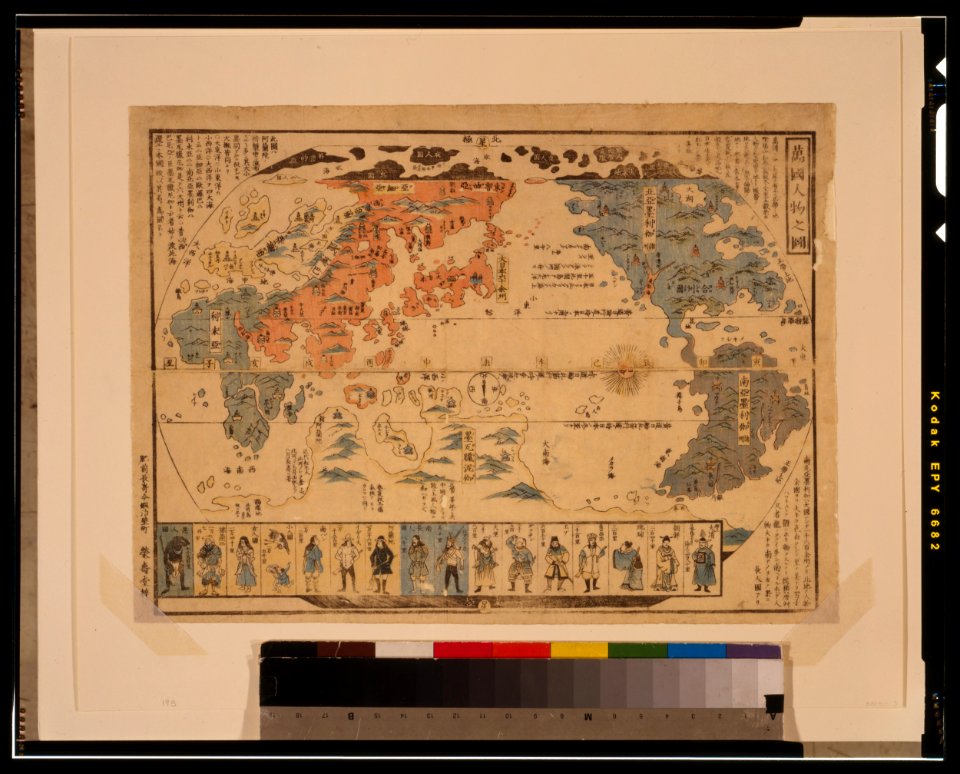
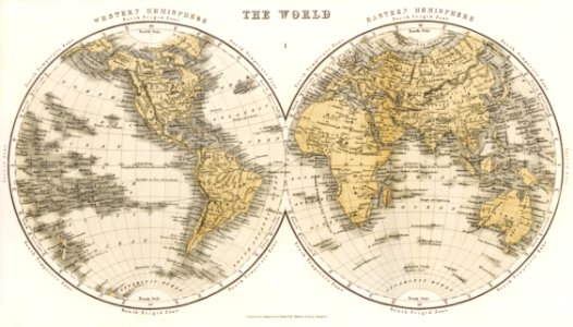
1800s maps of the world
ukiyo-e by unknown artists
1800s maps of the world
atlas of the russian empire (1800)
maps of tula governorate
atlas of the russian empire (1800)
maps of kostroma governorate
atlas of the russian empire (1800)
maps of ryazan governorate
atlas of the russian empire (1800)
maps of moscow governorate
atlas of the russian empire (1800)
maps of kiev governorate
atlas of the russian empire (1800)
maps of arkhangelsk governorate
atlas of the russian empire (1800)
maps of simbirsk governorate
atlas of the russian empire (1800)
maps of perm governorate
atlas of the russian empire (1800)
maps of vologda governorate
atlas of the russian empire (1800)
maps of kazan governorate
atlas of the russian empire (1800)
maps of pskov governorate
atlas of the russian empire (1800)
maps of wyborg governorate
atlas of the russian empire (1800)
maps of vladimir governorate
1 - 100 of 377
Next page
/ 4


![Johnson's Western Hemisphere [and] Johnson's Eastern Hemisphere (1866) by Johnson and Ward.](https://cdn.creazilla.com/illustrations/1955988/johnson-s-western-hemisphere-and-johnson-s-eastern-hemisphere-1866-by-johnson-an-sm.jpeg)


![Map of France, Spain, and Portugal; Switzerland in cantons [inset]; Island of Corsica (1863) by Samuel Augustus Mitchell.](https://cdn.creazilla.com/illustrations/1953186/map-of-france-spain-and-portugal-switzerland-in-cantons-inset-island-of-corsica--sm.jpeg)