Log in
All resources
Create a design
9 Free Images of 17th Century Maps Of Paraguay
17th-century maps of argentina
17th-century maps of bolivia
17th-century maps of uruguay
bibliothèque nationale de france
maps made in the 17th century
old maps of the río de la plata
1668 maps of south america
maps made in the 17th century
gerard valck
17th-century maps of argentina
maps made in the 17th century
maps by willem and johannes blaeu
pantanal
17th-century maps of the strait of magellan
maps by nicolas sanson
17th-century maps of paraguay
1668 maps of south america
1668 maps of south america
maps by guillaume sanson
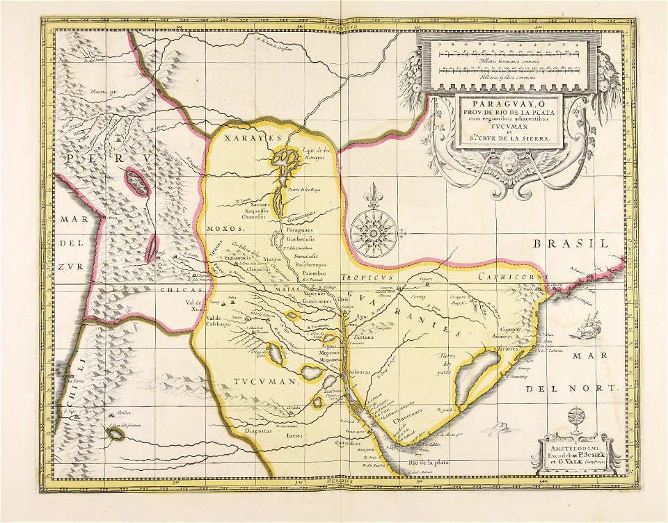
paraguay, o prov. de rio de la plata cum regionibus adiacentibus tucuman et sta cruz de la sierra - (blaeu) - btv1b8596658x
1640s maps of south america
uruguay
maps
atlas ou representation du monde universel t. 2 (1633)
17th-century maps of paraguay
1 - 9 of 9
/ 1


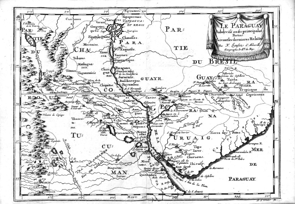
![Paraguay taken from the most recent reports / by G[uillaume] Sanson, 1668](https://cdn.creazilla.com/illustrations/10000773533/paraguay-taken-from-the-most-recent-reports-by-g-uillaume-sanson-1668-md.jpg)

![Paraguay, o prov. de Rio de La Plata cum regionibus adiacentibus Tucuman et Sta Cruz de la Sierra / [Blaeu], 1640s](https://cdn.creazilla.com/illustrations/10001055781/paraguay-o-prov-de-rio-de-la-plata-cum-regionibus-adiacentibus-tucuman-et-sta-cruz-de-la-sierra-blaeu-1640s-md.jpg)
![Gerardi Mercatoris and I. Hondii Atlas or Representation of the Universal World, and of the Parts of It, Made in Tables and Very Ample Descriptions. [t. 2].](https://cdn.creazilla.com/illustrations/10000511702/gerardi-mercatoris-and-i-hondii-atlas-or-representation-of-the-universal-world-and-of-the-parts-of-it-made-in-tables-and-very-ample-descriptions-t-2-sm.webp)