Log in
All resources
Create a design
13 Free Images of 1750s Maps Of The Caribbean
maps by tomas lopez
maps in the library of congress
juan de la cruz cano y olmedilla
bibliothèque nationale de france
1750s maps of central america
1755 maps of north america
spanish-language maps of north america
engraving etching print
university of texas at arlington
maps by richard william seale
maps in the library of congress
1750s maps of central america
1754 maps of the bahamas
1754 maps of florida
juan de la cruz cano y olmedilla
1755 maps of north america
maps in the library of congress
1780s maps of the caribbean
juan de la cruz cano y olmedilla
maps by tomas lopez
juan de la cruz cano y olmedilla
maps by tomas lopez
maps in the library of congress
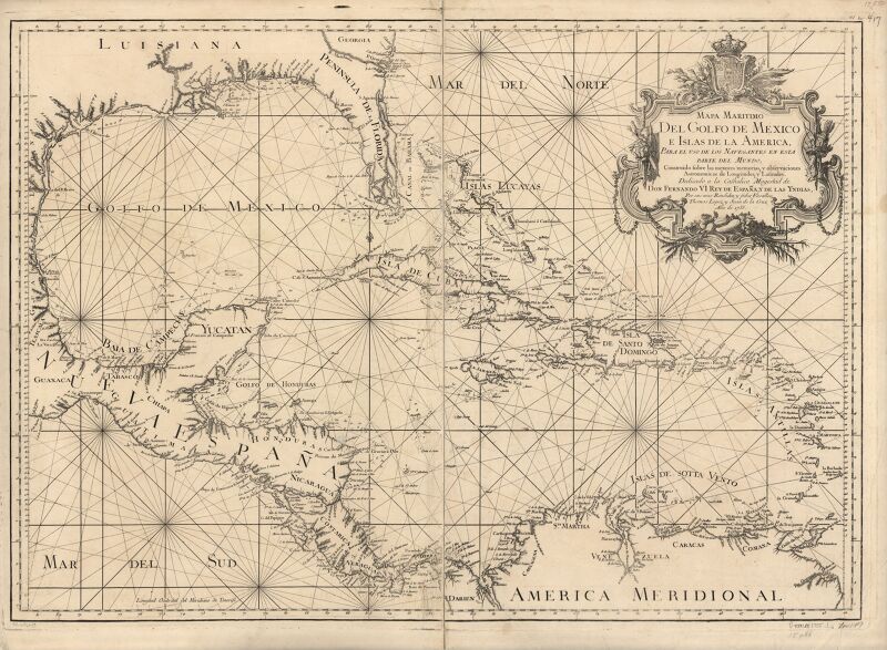
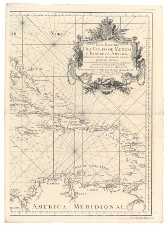
1750s maps of the caribbean
1750s maps of the caribbean
maps by thomas kitchin
1750s maps of central america
maps by tomas lopez
juan de la cruz cano y olmedilla
1750s maps of the caribbean
maps in the library of congress
1763 maps of north america
maps in the library of congress
1752 maps of north america
maps by jean-baptiste bourguignon d'anville
1750s maps of the caribbean
1 - 13 of 13
/ 1