Map of ancient Spain, Alain Manesson Mallet, between 1683 and 1719

Map of ancient Spain, Alain Manesson Mallet, between 1683 and 1719

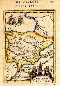
All the maps and views shown here come from different editions (1683-1719) of mallet; some of them are from translations into german and italian, and some from later reissues by others, with or without small modifications. (for reference: *a complete list of mallet maps and views*. ) many of the maps and views shown here have modern hand-coloring. The images come from various offerings by *the honor roll of map sources*. 12:04, 19 june 2017 (utc)12:04, 19 june 2017 (utc)~. Date: between 1683 and 1719.
Edit image
Published by:
Creazilla
Author: Alain Manesson MalletSource: commons.wikimedia.org

Loading...

0 downloads
Loading...
description de l'universe1680s maps of the iberian peninsulaold maps of roman hispaniaalain manesson mallet

MORE LIKE THIS

Creazilla logo
Over 10 million free graphic resources for content creators and designers.
© 2018 - 2025 Creazilla
Our resourcesAll imagesPhotosDigital illustrationsClipartIconsPNG ImagesEmojisSilhouettesTraditional Art3D ModelsVectorsFontsColor namesColor palettesGradientsAudioAnimationVideosTemplates
InformationAbout CreazillaTerms of useTech teamPrivacy policyLicence Information
FeedbackContact Us