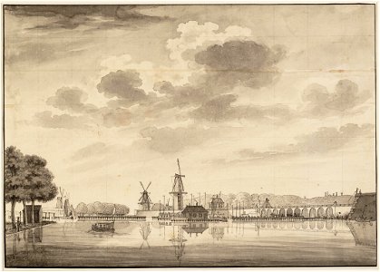
Description the intersection of the amstel and the singelgracht, seen from the singelweg outside the weesperpoort to the southwest
on the left the trees at the beginning of the weesperzijde, the barriers in the amstel, then the de ruyter and de veermolen mills (predecessor of the bouwlust) on the zaagmolensloot, the roo haan and de hoop mills, the westerblokhuis stronghold with the de groen mill, the marina, the hogesluis and a part of the oosterblokhuis stronghold. Document type: drawing
manufacturer: tavenier, hendrik
collection: amsterdam city archives collection: drawings and prints
dating: 1767 ca. Geographical name: singelgracht
amstel
inventories: http://archief. Amsterdam/archief/10097/010097010381
image file: 010097010381. Date: circa 1767.
Loading...