Log in
All resources
Create a design
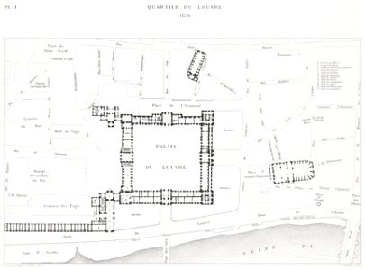
Quartier du Louvre, Theodor Josef Hubert Hoffbauer, between 1875 and 1882
Map showing the louvre in 1836. Date: between 1875 and 1882. Dimensions: 24 x 30 cm. Medium: lithograph. Collection: Brown University Library. Quartier du Louvre, 1836
Download
Edit image
Published by:
Creazilla
Author:
Theodor Josef Hubert Hoffbauer (1839–1922)
Source:
commons.wikimedia.org
Loading...
1 download
Print it
Copy image
Loading...
lithographs of paris
engravings of louvre by theodor hoffbauer
old maps of paris 1er arrondissement
floor plans of paris 1er arrondissement
historical plans of the palais du louvre
plans of the sully wing (louvre)
1836 in paris
place du louvre (paris)
palais du louvre in the 1830s
lithograph
brown university library
theodor josef hubert hoffbauer
MORE LIKE THIS