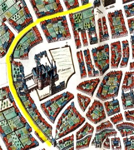
Maastricht, omgeving Vrijthof, detail kaart Joan Blaeu, 1649 (Atlas van Loon, 1652)
Maastricht, the netherlands. Detail of a map of maastricht from the atlas van loon, published by blaeu (amsterdam, 1652?), showing the center of town around vrijthof. The curved line indicates the location of the first medieval city wall.