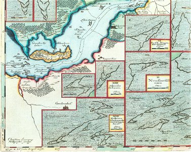
Exact description of the "river" schlei, engraved by christian lorensen rodtgiesser (21 side maps show the herring fences in detail) from the map below left: detail. On behalf of duke friedrich iii of schleswig-holstein-gottorf, mejer had carried out a detailed survey and mapping of all herring fences in the schleijunkern in more than 40 maps (the so-called' schlei atlas'). The reason for this was the dispute between the' schleijunkern' (aristocratic goods on the schlei) and the holmer (schleswiger) fishermen about fishing rights on the schlei. This detail shows the detail around the island of arnis and comes from the map showing the easternmost part of the schlei.
Loading...