Log in
All resources
Create a design
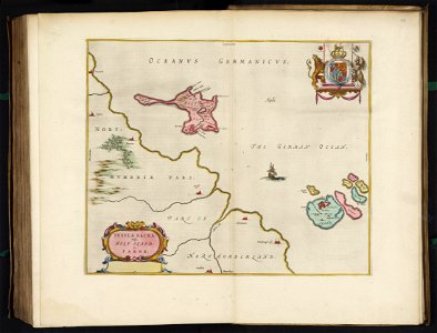
Insula Sacra et Farne by Blaeu, Joan Blaeu, 1665
Map of lindisfarne (formerly holy island) and farne islands off the coast of northumberland, northeast england. Date: 1665.
Download
Edit image
Published by:
Creazilla
Author:
Joan Blaeu
Source:
commons.wikimedia.org
Loading...
0 downloads
Print it
Copy image
Loading...
joan blaeu
old maps of lindisfarne
old maps of the farne islands
1665 maps
david rumsey historical map collection
MORE LIKE THIS