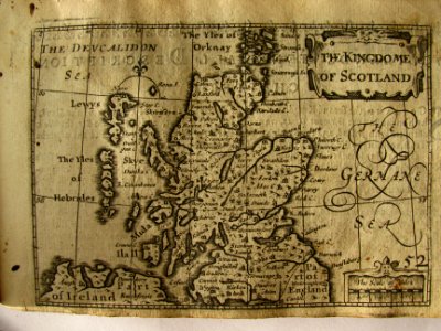
17th Century map of Scotland, Pieter van den Keere, 1627
Map from a 17th century pocket atlas of great britain, drawn by john speed and engraved by peter van den keere (petrus kaerius). Date: 1627.
Loading...