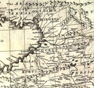
Bowen, Emanuel. Anatolia, Syria. 1747. (C), Emanuel Bowen

Bowen, Emanuel. Anatolia, Syria. 1747. (C), Emanuel Bowen

Of anatolia or asia minor, with syria and such other provinces of the turkish empire as border thereupon. Laid down according to the best authorities, & regulated by astronomical observations. By eman. Bowen. (london: printed for william innys, richard ware, aaron ward, j. And p. Knapton, john clarke, t. Longman and t. Shewell, thomas osborne, henry whitridge. M. Dcc. Xlvii). Date: 1747.
Edit image
Published by:
Creazilla
Author: Emanuel BowenSource: commons.wikimedia.org

Loading...

0 downloads
Loading...
maps by emanuel bowen1740s maps of abkhazia1740s maps of the caucasusold maps of samegreloold maps of guriaold maps of imeretidavid rumsey historical map collectionmaps of lazikaj. and p. knaptondetails of old mapsrichard ware (bookseller)emanuel bowen

MORE LIKE THIS

Creazilla logo
Over 10 million free graphic resources for content creators and designers.
© 2018 - 2025 Creazilla
Our resourcesAll imagesPhotosDigital illustrationsClipartIconsPNG ImagesEmojisSilhouettesTraditional Art3D ModelsVectorsFontsColor namesColor palettesGradientsAudioAnimationVideosTemplates
InformationAbout CreazillaTerms of useTech teamPrivacy policyLicence Information
FeedbackContact Us