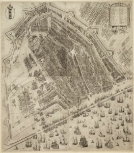
Map of Amsterdam, Pieter Bast, 1597
Object Type: city map. Date: 1597. Place of creation: presumably Amsterdam. Dimensions: height: 92.5 cm (36.4 in) ; width: 81.2 cm (31.9 in). Medium: engraving. Collection: Stadsarchief Amsterdam. Amstelredam by Pieter Bast 1597
Loading...