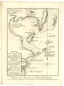
Map of the Bay of Mozambique, Jakob van der Schley, circa 1750
Map of the bay of mozambique. Kaart van de baaije van mosambique. Carte de la baye de moasambique. Date: circa 1750. Dimensions: height: 14 cm (5.5 in); width: 18 cm (7 in). Medium: engraving on paper. Collection: Koninklijke Bibliotheek. AMH-8104-KB Map of the Bay of Mozambique