Map of the southern part of South America, Jakob van der Schley, 1757

Map of the southern part of South America, Jakob van der Schley, 1757

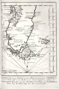
Map of the southern part of south america. Carte réduite de la partie la plus meridionale de l'amerique, par le sr. Bellin ingr. De la marines de la societé royale de londres &a. Gereduceerde kaart van het zuidelykste deel van america, door den hr. Bellin, ingr. Des zee-vaards, &ca. Date: 1757. Dimensions: height: 12 cm (4.7 in); width: 17.5 cm (6.8 in). Medium: engraving on paper. Collection: Koninklijke Bibliotheek. AMH-8031-KB Map of the southern part of South America
Edit image
Published by:
Creazilla
Author: Jakob van der SchleySource: commons.wikimedia.org

Loading...

0 downloads
Loading...
maps of the west-indische compagnie1757 maps of south americamaps by jakob van der schleyengraving on paperkoninklijke bibliotheekjakob van der schley

MORE LIKE THIS

Creazilla logo
Over 10 million free graphic resources for content creators and designers.
© 2018 - 2025 Creazilla
Our resourcesAll imagesPhotosDigital illustrationsClipartIconsPNG ImagesEmojisSilhouettesTraditional Art3D ModelsVectorsFontsColor namesColor palettesGradientsAudioAnimationVideosTemplates
InformationAbout CreazillaTerms of useTech teamPrivacy policyLicence Information
FeedbackContact Us