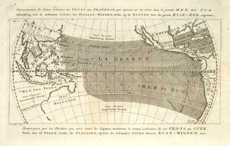
Map of the winds in the Pacific Ocean, Jakob van der Schley, 1768
Map of the prevailing winds in the pacific ocean. Répresentation du cours ordinaire des vents de traverse, qui règnent sur les côtes dans la grande mer du sud. Afbeelding van de ordinaire cours der passaat-winden welke om de kusten van de groote zuid-zee regeeren. Date: 1768. Dimensions: height: 22.5 cm (8.8 in); width: 14.5 cm (5.7 in). Medium: engraving on paper. Collection: Koninklijke Bibliotheek. AMH-8038-KB Map of the winds in the Pacific Ocean