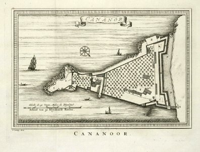
Floor plan of the fort Cananoor, Jakob van der Schley, 1755
Floor plan of the cananoor fort. Cananor. Cananoor. Cf. Scheepvaartmuseum, amsterdam, inv. Nr. Snsm_b0032(109)06[chart042]. The illustration has been copied from 'oud en nieuw oost-indiën' by françois valentyn. Date: 1755. Dimensions: height: 21 cm (8.2 in); width: 16 cm (6.2 in). Medium: engraving on paper. Collection: Koninklijke Bibliotheek. AMH-8014-KB Floor plan of the fort Cananoor