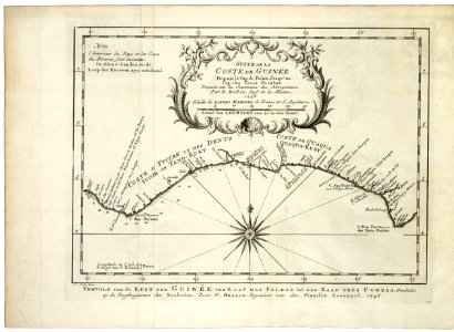
Map of the west african coast, from cape das palmas to cape tres puntas. Vervolg van de kust van guin??e, van kaap das palmas tot aan kaap tres puntas, geschikt op de daghregisters der zeelieden. Door n. Bellin, ingenieur van den fransen zeevaard. 1746. Suite de la coste de guin??e / depuis le cap de palme jusqu'au / cap des trois pointes / dress??e sur les journaux des navigateurs / par n. Bellin ing. R de la marine, 1746. This map is the continuation after p. 53 in the same book. Date: 1747. Dimensions: height: 29 cm (11.4 in); width: 18.5 cm (7.2 in). Medium: engraving on paper. Collection: Koninklijke Bibliotheek. AMH-7943-KB Map of the West African coast, from Cape das Palmas to Cape Tres Puntas
Loading...