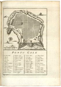
Map of Punto Galle, Jakob van der Schley, circa 1753
Map of punto galle. Punto galle. Key: 1-24. Date: circa 1753. Dimensions: height: 13.5 cm (5.3 in); width: 20 cm (7.8 in). Medium: engraving on paper. Collection: Koninklijke Bibliotheek. AMH-7988-KB Map of Punto Galle