Map of China and Korea, Jakob van der Schley, circa 1749

Map of China and Korea, Jakob van der Schley, circa 1749

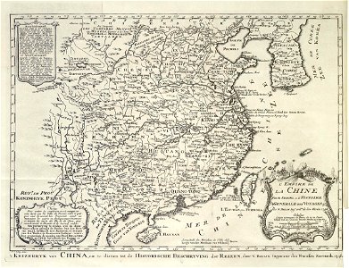
Map of china and korea. 't keizerryk van china, om te dienen tot de historische beschryving der reizen, door n. Bellin, ingenieur des fransen zeevaards 1748. L'empire de la chine pour servir a l'histoire generale des voyages par n. Bellin ing:r ord:re de la marine 1748. Date: circa 1749. Dimensions: height: 29 cm (11.4 in); width: 22 cm (8.6 in). Medium: engraving on paper. Collection: Koninklijke Bibliotheek. AMH-7973-KB Map of China and Korea
Edit image
Published by:
Creazilla
Author: Jacques-Nicolas BellinSource: commons.wikimedia.org

Loading...

0 downloads
Loading...
maps of the dutch east india company - koreamaps of the dutch east india company - china1749 maps of asiamaps by jakob van der schleyengraving on paperkoninklijke bibliotheekjakob van der schley

MORE LIKE THIS

Creazilla logo
Over 10 million free graphic resources for content creators and designers.
© 2018 - 2025 Creazilla
Our resourcesAll imagesPhotosDigital illustrationsClipartIconsPNG ImagesEmojisSilhouettesTraditional Art3D ModelsVectorsFontsColor namesColor palettesGradientsAudioAnimationVideosTemplates
InformationAbout CreazillaTerms of useTech teamPrivacy policyLicence Information
FeedbackContact Us