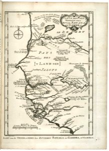
Map of part of the west coast of Africa, near Cape Verde, Jakob van der Schley, 1747
Map of part of the west coast of africa near cape verde. Kaart van de ommelanden der rivieren sanaga en gambra, of gambea. Carte des pays voisins des riv. De sanaga et gambra. Date: 1747. Dimensions: height: 19 cm (7.4 in); width: 26 cm (10.2 in). Medium: engraving on paper. Collection: Koninklijke Bibliotheek. AMH-7892-KB Map of part of the west coast of Africa, near Cape Verde