Map of the Pacific Ocean, from Malacca to Japan, Jakob van der Schley, 1747

Map of the Pacific Ocean, from Malacca to Japan, Jakob van der Schley, 1747

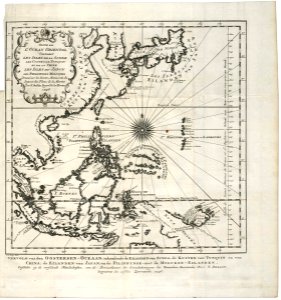
Map of the pacific ocean, from the malaccas to japan. Vervolg van den oostersen-oceaan, inhoudende de eilanden van sunda, de kusten van tunquin en van china, de eilanden van japan, en de filippynse -met de molukse eilanden. Suite de / l'ocean oriental / contenant / les isles de la sonde / les costes de tunquin / et de la chine / les isles du japon / les philippines moluques / dress??e sur les divers manuscrits du / depost des plans de la marine / par n. Bellin ingen:r de la marine / 1746. Date: 1747. Dimensions: height: 37 cm (14.5 in); width: 34.5 cm (13.5 in). Medium: engraving on paper. Collection: Koninklijke Bibliotheek. AMH-7874-KB Map of the Pacific Ocean, from Malacca to Japan
Edit image
Published by:
Creazilla
Author: Jacques-Nicolas BellinSource: commons.wikimedia.org

Loading...

0 downloads
Loading...
old maps of the dutch east india company1747 maps of asia18th-century maps of the pacific oceanmaps by jakob van der schleyengraving on paperkoninklijke bibliotheekjakob van der schley

MORE LIKE THIS

Creazilla logo
Over 10 million free graphic resources for content creators and designers.
© 2018 - 2025 Creazilla
Our resourcesAll imagesPhotosDigital illustrationsClipartIconsPNG ImagesEmojisSilhouettesTraditional Art3D ModelsVectorsFontsColor namesColor palettesGradientsAudioAnimationVideosTemplates
InformationAbout CreazillaTerms of useTech teamPrivacy policyLicence Information
FeedbackContact Us