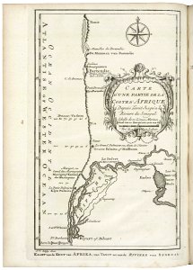
Map of part of the west coast of Africa, near the Senegal river, Jakob van der Schley, 1747
Map of part of the west coast of africa, near the senegal river. Kaart van de kust van afrika, van tanit tot aan de riviere van senegal. Carte d'une partie de la coste d' afrique / depuis tanit jusqu'a la rivier du senegal. Date: 1747. Dimensions: height: 26 cm (10.2 in); width: 19 cm (7.4 in). Medium: engraving on paper. Collection: Koninklijke Bibliotheek. AMH-7893-KB Map of part of the west coast of Africa, near the Senegal river