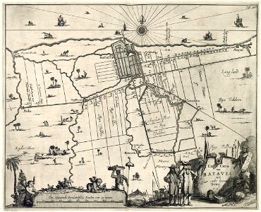
Map of batavia and environs. Landt caerte van batavia met haer onder hoorende forten. This is the black-and-white version of: koninklijke bibliotheek, atlas van der hagen part 4, inv. Nr. 1049b13_020. Adapted copies are: tropenmuseum / kit, inv. Nr. 5681-3, westfries museum, inv. Nr. 15252 and koninklijke bibliotheek, inv. Nr. 2102 a 7, p. 118. Koninklijke biliotheek, inv. Nr. 388 a 9 part ii, p. 298 is not a copy, but has been based on this chart. Date: circa 1682. Dimensions: height: 36.5 cm (14.3 in); width: 29.5 cm (11.6 in). Medium: copperplate printing on paper. Collection: Koninklijke Bibliotheek. AMH-6932-KB Map of Batavia and environs
Loading...