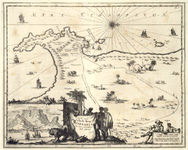
Map of the cape of good hope. Caerte vande cabo de bona esperança / en haer gelegentheyt daer omtrent. The chart also shows various vessels and animals. Bottom left is an insert showing a view of table mountain. This map of the cape of good hope and table mountain is one of the many illustrations accompanying a travel journal by the world traveller from amsterdam, johan nieuhoff. Cf. Koninklijke bibliotheek, atlas van der hagen, part 4, inv. Nr. 1049b13_067. Top right: pag. 7. Date: circa 1682. Dimensions: height: 36.5 cm (14.3 in); width: 29.5 cm (11.6 in). Medium: copperplate printing on paper. Collection: Koninklijke Bibliotheek. AMH-6926-KB Map of the Cape of Good Hope
Loading...