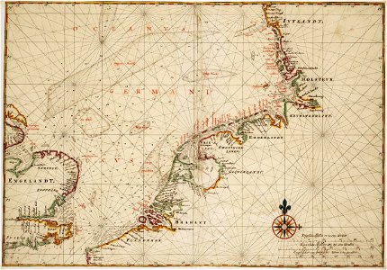
Map of countries around the North Sea, Johannes Vingboons, circa 1665
Title in the leupe catalogue (na): kaart van de noordzee van jutland tot calais en dover met een gedeelte van de oostkust van engeland. Met loodingen. Map of countries on the north sea. Remarks in the leupe catalogue on the scale: wassende. Remarks: the map forms part of the vingboons atlas. Date: circa 1665. Dimensions: height: 69 cm (27.1 in); width: 48 cm (18.8 in). Medium: watercolour on paper. Collection: Nationaal Archief. AMH-6812-NA Map of countries around the North Sea