Map of Venezuela, Jacob van Meurs, circa 1671

Map of Venezuela, Jacob van Meurs, circa 1671

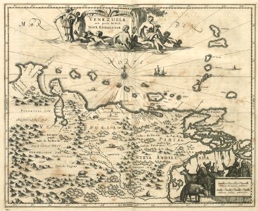
Map of venezuela. Venezuela cum parte australi novae andalusiae. Cf. Koninklijke bibliotheek, den haag, inv. Nr. 36 g 19 after p. 596 and 40 e 6 after p. 608. Date: circa 1671. Dimensions: height: 36.5 cm (14.3 in); width: 30 cm (11.8 in). Medium: engraving on paper. Collection: Koninklijke Bibliotheek. AMH-6829-KB Map of Venezuela
Edit image
Published by:
Creazilla
Author: Jacob van MeursSource: commons.wikimedia.org

Loading...

0 downloads
Loading...
maps of the west-indische compagnie1671maps by jacob van meursengraving on paperkoninklijke bibliotheekjacob van meurs

MORE LIKE THIS

Creazilla logo
Over 10 million free graphic resources for content creators and designers.
© 2018 - 2025 Creazilla
Our resourcesAll imagesPhotosDigital illustrationsClipartIconsPNG ImagesEmojisSilhouettesTraditional Art3D ModelsVectorsFontsColor namesColor palettesGradientsAudioAnimationVideosTemplates
InformationAbout CreazillaTerms of useTech teamPrivacy policyLicence Information
FeedbackContact Us