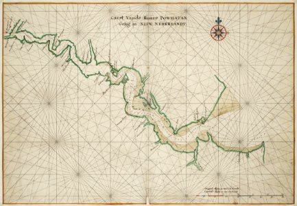
Map of the Powathan River, Johannes Vingboons, circa 1665
Title in the leupe catalogue (na): "caert van de rivier powhatan geleg(en) in nieuw-nederlandt" (de jamesrivier in virginië) van mont ramet tot kaap henry in de chesapeakebaai. Met loodingen. Map of the powhaten river. Caert vande riuier powhaten geleg in niew nederlandt. The map is contained in the vingboons atlas. Date: circa 1665. Dimensions: height: 69 cm (27.1 in); width: 48 cm (18.8 in). Medium: watercolour on paper. Collection: Nationaal Archief. AMH-6791-NA Map of the Powathan River