Log in
All resources
Create a design
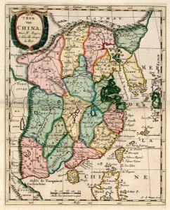
Map of China, Adriaan de Winter, circa 1705
Map of china. 't ryk van china. Date: circa 1705. Dimensions: height: 25.5 cm (10 in); width: 20.5 cm (8 in). Medium: coloured engraving on paper. Collection: Koninklijke Bibliotheek. AMH-6662-KB Map of China
Download
Edit image
Published by:
Creazilla
Author:
Adriaan de Winter
Source:
commons.wikimedia.org
Loading...
1 download
Print it
Copy image
Loading...
maps of the dutch east india company - china
1705 maps of asia
18th-century maps of korea
old maps of taiwan
1700s maps of china
old maps of jiangsu
old maps of shanghai
old maps of guangdong
old maps of shandong
anthonie de winter
maps of the great wall of china
coloured engraving on paper
koninklijke bibliotheek
adriaan de winter
MORE LIKE THIS