Map of a stretch of the West African coast, Jakob van der Schley, 1747

Map of a stretch of the West African coast, Jakob van der Schley, 1747

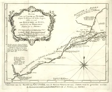
Map of a stretch of the west african coast. Vervolg van de kust van guinée, van de riviere volta tot aan jakin, waarin gevonden worden de koningryken van koto, popo, whidah of juida, en ardra. Suite de la coste de guinée depuis la riviere de volta jusqu'a jakin ou sont les royaumes de koto, de popo, de whidah ou juida, et d'ardra. Date: 1747. Dimensions: height: 20 cm (7.8 in); width: 16.5 cm (6.4 in). Medium: engraving on paper. Collection: Koninklijke Bibliotheek. AMH-6328-KB Map of a stretch of the West African coast
Edit image
Published by:
Creazilla
Author: Jakob van der SchleySource: commons.wikimedia.org

Loading...

0 downloads
Loading...
maps of the west-indische compagnie1747 maps of africamaps by jakob van der schleyold maps of africaengraving on paperkoninklijke bibliotheekjakob van der schley

MORE LIKE THIS

Creazilla logo
Over 10 million free graphic resources for content creators and designers.
© 2018 - 2025 Creazilla
Our resourcesAll imagesPhotosDigital illustrationsClipartIconsPNG ImagesEmojisSilhouettesTraditional Art3D ModelsVectorsFontsColor namesColor palettesGradientsAudioAnimationVideosTemplates
InformationAbout CreazillaTerms of useTech teamPrivacy policyLicence Information
FeedbackContact Us