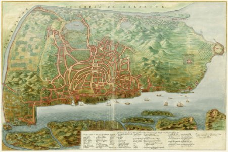
Map of the city of Goa, Johannes Vingboons, circa 1665
Title in the leupe catalogue (na): plattegrond van goa en omgeving. The map is untitled. Key on the chart verclaeringe van sommige portugeesche woorden vande voornaemste plaetsen van stat en 't eylant goa. Date: circa 1665. Dimensions: height: 69 cm (27.1 in); width: 46 cm (18.1 in). Medium: watercolour on paper. Collection: Nationaal Archief. AMH-6152-NA Map of the city of Goa