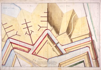
Plan showing part of the castle at Colombo with the Rotterdam and Middelburg ramparts, Carel Frederik Reimer, 1787
Title in the leupe catalogue (na): plan der polygoon van rotterdam en middelburg, met de daarvoor geprojecteerde buitenwerken en bedekten weg enz. Notes on reverse: colombo. Extrait du projet de contregardes relatif aux refutations de mr: reimer. / no. 5 / 535 [in pencil] / 56 [in pencil]. Date: 1787. Dimensions: height: 103.5 cm (40.7 in); width: 72.5 cm (28.5 in). Medium: coloured drawing on paper. Collection: Nationaal Archief. AMH-5559-NA Plan showing part of the castle at Colombo with the Rotterdam and Middelburg ramparts