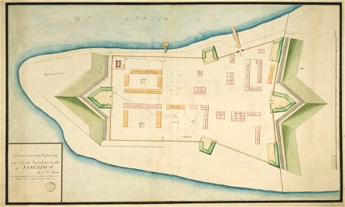
Map of the fort at Tabenjouw, Carel Frederik Reimer, circa 1750
According to the leupe catalogue (na), the original title reads: ontwerp tot eene vergrooting van 't eerste project voor een fort op tabenjouw. Stamped: depot des cart. Pl. Et journ. De la marine. Notes on reverse: no. 15 project van een fort op tabenjauw register 6 deel 1 folio 28 portefeul. / [handwritten on a blue label] / 602 [stamped in bold on a small label]. Date: circa 1750. Dimensions: height: 89.5 cm (35.2 in); width: 56.5 cm (22.2 in). Medium: coloured drawing on paper. Collection: Nationaal Archief. AMH-4608-NA Map of the fort at Tabenjouw