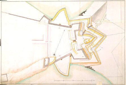
Map of the fort at Trinconomale, Carel Frederik Reimer, circa 1787
According to the leupe catalogue (na), the original title reads: plan de trinquemale, relatif au projet mr. Reimer. Notes on reverse: [blue label odg] nr. :13 plan de trinquemale relatif au projet de mr. Reimer; potloodnr. 4; 64. Date: circa 1787. Dimensions: height: 69 cm (27.1 in); width: 51 cm (20 in). Medium: coloured drawing on paper. Collection: Nationaal Archief. AMH-4507-NA Map of the fort at Trinconomale