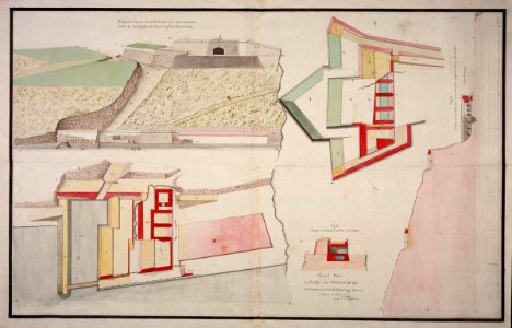
Maps and cross-sections of Fort Oostenburg at Trinkonomale, Carel Frederik Reimer, circa 1787
Title in the leupe catalogue (na): speciaal plans en profils voor oostenburg, ter order van de h. H. Commissarissen-militair enz. Notes on reverse: no: 18. Van oostenburg [twice, in two corners] / 540 [in pencil]. Date: circa 1787. Dimensions: height: 99.5 cm (39.1 in); width: 65 cm (25.5 in). Medium: coloured drawing on paper. Collection: Nationaal Archief. AMH-5572-NA Maps and cross-sections of Fort Oostenburg at Trinkonomale