A map of the British Empire in America with the French and Spanish settlements adjacent thereto, 1733

A map of the British Empire in America with the French and Spanish settlements adjacent thereto, 1733

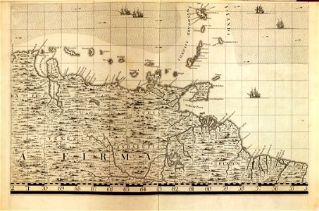
Relief shown pictorially. Depths shown by soundings. Title from plate 17. Originally published as 1 map on 20 sheets. Lc copy bound. Index map bound-in. Phillips. Maps of america, p. 569 sheet of paper (25 x 19 cm. ) listing the numbered plates mounted on preliminary leaf. On title cartouche (plate 17): c. Lempriere inv. & del. , b. Baron, sculp. Available also through the library of congress web site as a raster image. Includes notes, dedication, 4 views, and 17 harbor insets. Margins trimmed on index map. Conserved july 15, 1985. Date: 1733.
Edit image
Published by:
Creazilla
Author: Popple, Henry; Toms, W. H. (William Henry); Seale, Richard William; Lemprière, C. (Clement); Baron, BernardSource: commons.wikimedia.org

Loading...

0 downloads
Loading...
maps in the library of congressa map of the british empire in america with the french and spanish settlements adjacent thereto18th-century maps of barbados

MORE LIKE THIS

Creazilla logo
Over 10 million free graphic resources for content creators and designers.
© 2018 - 2025 Creazilla
Our resourcesAll imagesPhotosDigital illustrationsClipartIconsPNG ImagesEmojisSilhouettesTraditional Art3D ModelsVectorsFontsColor namesColor palettesGradientsAudioAnimationVideosTemplates
InformationAbout CreazillaTerms of useTech teamPrivacy policyLicence Information
FeedbackContact Us