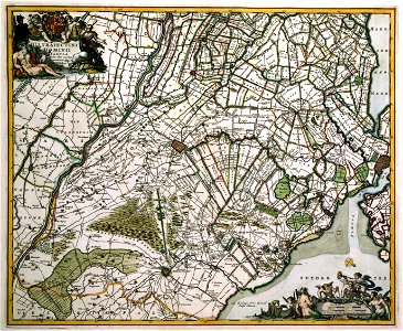
Commissioned by nicolaes visscher ii (1649-1702) the best artists in the netherlands carried out much work for him as engravers and designers for the purpose of new editions. One of them was romeyn de hooghe (1645-1708) from the town of haarlem. He carried out many high quality maps, historical, and garden prints for visscher. This map of the province of utrecht is the result of a successful cooperation between engraver and publisher. According to the title, the map is adapted and corrected and is probable based on a general map of holland and utrecht by balthasar florisz van berckenrode (1591/92-1644) published in 1621 by willem jansz. Blaeu. This wall map was reissued in 1651, 1656 and 1682 by visscher. In 1696, nicolaes visscher ii published a new wall map of utrecht by bernard
de roy, surveyor in utrecht. Object Type: map. Date: after 1681. Place of creation: Amsterdam. Dimensions: 46,5 x 56 cm. Medium: copper engraving print. Collection: Koninklijke Bibliotheek. Atlas Van der Hagen-KW1049B11 096-ULTRAIECTINI DOMINI TABULA Multo aliis auctior et correctior
Loading...